Bagerhat District
| Bagerhat বাগেরহাট জেলা | |
|---|---|
| District | |
|
The historic Sixty Dome Mosque has become the symbol of Bagerhat District | |
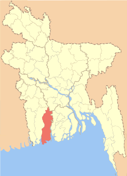 Location of Bagerhat in Bangladesh | |
| Coordinates: BD 22°40′00″N 89°48′00″E / 22.66667°N 89.80000°ECoordinates: BD 22°40′00″N 89°48′00″E / 22.66667°N 89.80000°E | |
| Country |
|
| Division | Khulna Division |
| Capital | Bagerhat |
| Area | |
| • Total | 3,959.11 km2 (1,528.62 sq mi) |
| Elevation | 2 m (7 ft) |
| Population (2011 census) | |
| • Total | 1,476,090 |
| • Density | 370/km2 (970/sq mi) |
| Literacy rate | |
| • Total | 44.3% |
| Time zone | BST (UTC+6) |
| Postal code | 9300 |
| Website |
www |
_002.jpg)
Bagerhat District (Bengali: বাগেরহাট জেলা) is a district in South-western Bangladesh. It is a part of the Khulna Division.[1]
Geography
Bagerhat district has a total area of 3959.11 square kilometres. It is bounded by Gopalganj District and Narail District on the north, The Bay of Bengal on the south, Gopalganj District, Pirojpur District and Barguna District on the east and Khulna District on the west. Main rivers of the district are Panguchi, Daratana, Madhumati River, Pasur River, Haringhata, Mongla River, Baleshwar, Bangra and Goshairkhali.
History
Located at the confluence of two historical rivers, the Brahmaputra River and the Ganges, Bagerghat is also known as the Mosque City for the presence of a large number of mosques in the district. The domed structures of the mosques built with bricks in the 15th century is considered an architectural marvel.[2]
Bagerhat was declared a district in 1984.[1] The district today is the fourth largest district in Bangladesh at the basis of area.
Economy
One of the two main ports of Bangladesh, Port of Mongla is here. Rampal and Fakirhat, two upazilla of Bagerhat is known as Qwait of Bangladesh due to its huge production of shrimp and earning a lot of foreign exchange.(55%)
Points of interest
|
|
- Dohajari Shib Bari, Fakirhat
Subdivisions
Bagerhat is divided into 9 upazilas, 77 union parishads, 1031 villages, 687 mouzas, 3 municipalities, 27 wards and 56 mahallas. The upazilas are:
Administration
Administrator of Zila Porishod: Sheikh Kamruzzaman (Tuku)
Deputy Commissioner (DC): Md. Akram Hossain
Transport
Bagerhat is the terminus of a branch railway from Khulna on the broad gauge system of Bangladesh Railways. The best way to go to Bagerhat from Dhaka is to take a bus which takes five to eight hours. By air you have to go to Jessore airport then take a bus to the city.
Media
- The Daily Star (National)
- Prothom Alo (National)
- The Daily Kaler kantho (National)
- The Daily Jugantar (National)
- The Daily Janakantha (National)
- Daily Purbanchal (Local)
- Daily Inkilab (National)
- Airtel, BTCL, Bangla Link, Teletalk, Grameen Phone etc.
Religion
The district of Bagerhat consists 7815 mosques, 238 temples, 17 churches and seven tombs. The Sixty Pillar Mosque or Shat Gambuj Masjid is famous mosque. Khan Jahan Ali's tomb is the famous tombs.
See also
References
| Wikimedia Commons has media related to Bagerhat District. |
- 1 2 Kamal, HM Khaled (2012). "Bagerhat District". In Islam, Sirajul; Jamal, Ahmed A. Banglapedia: National Encyclopedia of Bangladesh (Second ed.). Asiatic Society of Bangladesh.
- ↑ "Mosque City of Bagerhat - A UNESCO World Heritage Site". BANGLADESH.COM. Retrieved 10 June 2013.
External links
- dcbagerhat.gov.bd, Official website of Bagerhat district administration
- BagerhatPressClub.com, Official website of Bagerhat Press-Club
- MSN Map
- Monglaport : Official Website
| Upazila/Thana: | ||
|---|---|---|
| Barisal Division | 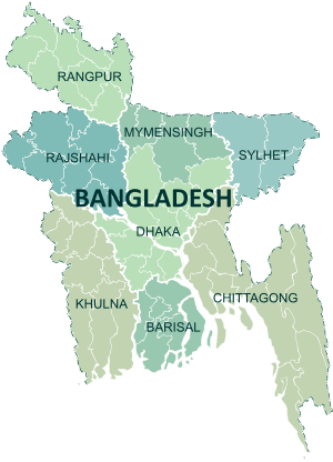 | |
|---|---|---|
| Chittagong Division | ||
| Dhaka Division | ||
| Khulna Division | ||
| Mymensingh Division | ||
| Rajshahi Division | ||
| Rangpur Division | ||
| Sylhet Division | ||