Morgan, Vermont
| Morgan, Vermont | |
|---|---|
| Town | |
 Located in Orleans County, Vermont | |
 Location of Vermont in the United States | |
| Coordinates: 44°54′19″N 71°59′25″W / 44.90528°N 71.99028°WCoordinates: 44°54′19″N 71°59′25″W / 44.90528°N 71.99028°W | |
| Country | United States |
| State | Vermont |
| County | Orleans |
| Chartered | November 6, 1780 |
| Area | |
| • Total | 33.9 sq mi (87.7 km2) |
| • Land | 31.3 sq mi (81.0 km2) |
| • Water | 2.6 sq mi (6.8 km2) |
| Elevation | 1,384 ft (506 m) |
| Population (2000) | |
| • Total | 669 |
| • Density | 21.4/sq mi (8.3/km2) |
| • Households | 247 |
| • Families | 185 |
| Time zone | EST (UTC-5) |
| • Summer (DST) | EDT (UTC-4) |
| ZIP code | 05853 |
| Area code(s) | 802 |
| FIPS code | 50-46450[1] |
| GNIS feature ID | 1462275[2] |
Morgan is the easternmost town in Orleans County, Vermont, United States. The population was 669 at the 2000 census. The town contains two villages: Morgan and Morgan Center.[3]
History
The town was named for John Morgan, a landholder.[4]
The first settler was Nathan Wilcox in 1800.[5]
During the Civil War the town furnished forty-seven enlisted men, thirteen of whom were killed or died from the effects of wounds or disease.[6]
Morgan was one of only two Vermont towns to vote for Mitt Romney over Barack Obama in the 2012 presidential election. [7]
Geography
According to the United States Census Bureau, the town has a total area of 33.9 square miles (87.7 km2), of which 31.3 square miles (81.0 km2) is land and 2.6 square miles (6.8 km2) (7.71%) is water.
Lake Seymour is contained entirely within the town. It covers 1,732 acres (7.01 km2). It is the second largest lake to be contained solely within the state.[8][9]
Demographics
| Historical population | |||
|---|---|---|---|
| Census | Pop. | %± | |
| 1810 | 135 | — | |
| 1820 | 116 | −14.1% | |
| 1830 | 331 | 185.3% | |
| 1840 | 422 | 27.5% | |
| 1850 | 486 | 15.2% | |
| 1860 | 548 | 12.8% | |
| 1870 | 614 | 12.0% | |
| 1880 | 711 | 15.8% | |
| 1890 | 520 | −26.9% | |
| 1900 | 510 | −1.9% | |
| 1910 | 463 | −9.2% | |
| 1920 | 368 | −20.5% | |
| 1930 | 363 | −1.4% | |
| 1940 | 335 | −7.7% | |
| 1950 | 296 | −11.6% | |
| 1960 | 260 | −12.2% | |
| 1970 | 286 | 10.0% | |
| 1980 | 460 | 60.8% | |
| 1990 | 497 | 8.0% | |
| 2000 | 669 | 34.6% | |
| 2010 | 749 | 12.0% | |
| Est. 2014 | 742 | [10] | −0.9% |
As of the census[1] of 2000, there were 669 people, 247 households, and 185 families residing in the town. The population density was 21.4 people per square mile (8.3/km2). There were 672 housing units at an average density of 21.5 per square mile (8.3/km2). The racial makeup of the town was 98.21% White, 0.30% African American, 0.60% Native American, 0.15% Asian, 0.15% from other races, and 0.60% from two or more races. Hispanic or Latino of any race were 0.90% of the population.
There were 247 households out of which 35.6% had children under the age of 18 living with them, 61.9% were married couples living together, 8.9% had a female householder with no husband present, and 25.1% were non-families. 18.2% of all households were made up of individuals and 4.9% had someone living alone who was 65 years of age or older. The average household size was 2.71 and the average family size was 3.03.
In the town the population was spread out with 29.4% under the age of 18, 4.0% from 18 to 24, 27.2% from 25 to 44, 28.1% from 45 to 64, and 11.2% who were 65 years of age or older. The median age was 38 years. For every 100 females there were 108.4 males. For every 100 females age 18 and over, there were 95.0 males.
The median income for a household in the town was $37,292, and the median income for a family was $42,344. Males had a median income of $28,542 versus $18,125 for females. The per capita income for the town was $15,565. About 10.9% of families and 15.0% of the population were below the poverty line, including 20.7% of those under age 18 and 14.9% of those age 65 or over.
Government
Town
- Selectman (2007–2010) - Robie Guyer[13]
- Agent - Jane Malgeri
- Delinquent Tax Collector - Jim Judd
- Auditor - Donna Young
- Lister - Deanna Keenan
- Road Commissioner - Shawn Austin
- Grand Juror - Cyrus Benson
- Grand Juror - Jane Malgeri
- Cemetery Commissioner (2007–2012) - Robert Cargill
- First Constable - Robert Cain
- Second Constable - Greg Wood
Education
The local school district supports the E. Taylor Hatton Elementary School.
- Member, School Board (2007–2010) - Kelly Paul
- Member, North Country School District - Mary Roy
- Budget - $561,000
Politics
Ninety percent of those registered turned out to vote in the 2008 general election, highest in the county.[14]
References
- 1 2 "American FactFinder". United States Census Bureau. Retrieved 2008-01-31.
- ↑ "US Board on Geographic Names". United States Geological Survey. 2007-10-25. Retrieved 2008-01-31.
- ↑ Vermont Villages, Towns, Counties
- ↑ "Profile for Morgan, Vermont". ePodunk. Retrieved 2010-05-09.
- ↑ Catalogue of the Principal Officers of Vermont
- ↑ Gazetteer of Lamoille and Orleans Counties, VT.; 1883-1884, Compiled and Published by Hamilton Child; May 1887
- ↑ "2012 Election Results". US Election Atlas. Retrieved 2014-09-04.
- ↑ The largest is Willoughby Lake
- ↑ Johnson, Charles W. (1984). The Nature of Vermont. University Press of New England.
- ↑ "Annual Estimates of the Resident Population for Incorporated Places: April 1, 2010 to July 1, 2014". Retrieved June 4, 2015.
- ↑ "Census of Population and Housing". Census.gov. Retrieved June 4, 2015.
- ↑ "Vermont History Explorer". Retrieved August 7, 2015.
- ↑ Voter support school budget, keep woodlot, The Chronicle, March 7, 2007, page 25
- ↑ Voter turnout. the Chronicle. November 5, 2008.
Municipalities and communities of Orleans County, Vermont, United States | ||
|---|---|---|
| City | 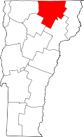 | |
| Towns | ||
| Villages | ||
| CDPs | ||
| Unincorporated community | ||
