Jay, Vermont
| Jay, Vermont | |
|---|---|
| Town | |
 Located in Orleans County, Vermont | |
 Location of Vermont with the U.S.A. | |
| Coordinates: 44°57′54″N 72°27′35″W / 44.96500°N 72.45972°WCoordinates: 44°57′54″N 72°27′35″W / 44.96500°N 72.45972°W | |
| Country | United States |
| State | Vermont |
| County | Orleans |
| Chartered | November 7, 1792 |
| Organized | March 29, 1828 |
| Area | |
| • Total | 34.0 sq mi (88.0 km2) |
| • Land | 33.9 sq mi (87.9 km2) |
| • Water | 0.1 sq mi (0.1 km2) |
| Elevation | 922 ft (469 m) |
| Population (2010) | |
| • Total | 521 |
| • Density | 12.6/sq mi (4.8/km2) |
| • Households | 158 |
| • Families | 115 |
| Time zone | EST (UTC-5) |
| • Summer (DST) | EDT (UTC-4) |
| ZIP code | 05859 |
| Area code(s) | 802 |
| FIPS code | 50-36325[1] |
| GNIS feature ID | 1462127[2] |
Jay is one of the northernmost towns in Orleans County, Vermont, United States, located on the Canada–US border. The population was 521 at the 2010 census. Jay is named for John Jay, one of the Founding Fathers of the United States.[3] The US Census Bureau estimated that the town's population had increased by 13.1% between 2000–2005, the seventh largest increase in the state.[4] Jay is also home to the Jay Challenge, a three-part stage-race, typically held in July.
Geography
According to the United States Census Bureau, the town has a total area of 34.0 square miles (88 km2), of which 33.9 square miles (88 km2) is land and 0.04 square miles (0.10 km2) (0.12%) is water.
The highest point in town is North Jay Peak at 3,438 feet (1,048 m) above sea level. Despite their containing the name "Jay", other peaks with this name lie mostly in adjacent Westfield,[5] including Jay Peak itself and Jay Peak Resort.
The local Jay Branch Brook flows into the Missisquoi River.[6]
History
One November 10, 1943, a Royal Canadian Air Force training plane crashed into the west side of the mountain near the top during a blinding snowfall killing one crew member.[7]
Government
- Selectmen
- Michael Brady (2009)
- Mark Burroughs-Biron (2010)
- Listers
- Arlene Bosco
- Ron Kapeluck
- Fred Cushing
- Tax Collector - Cindy Vincent
- Auditor - Edna Cushing
- Town Agent and Grand Juror - Roger Morin
- School Board
- Sally Rivard (2010)
- Peter Fina (2010)
Demographics
| Historical population | |||
|---|---|---|---|
| Census | Pop. | %± | |
| 1810 | 28 | — | |
| 1820 | 52 | 85.7% | |
| 1830 | 196 | 276.9% | |
| 1840 | 306 | 56.1% | |
| 1850 | 371 | 21.2% | |
| 1860 | 474 | 27.8% | |
| 1870 | 553 | 16.7% | |
| 1880 | 696 | 25.9% | |
| 1890 | 641 | −7.9% | |
| 1900 | 530 | −17.3% | |
| 1910 | 513 | −3.2% | |
| 1920 | 368 | −28.3% | |
| 1930 | 274 | −25.5% | |
| 1940 | 230 | −16.1% | |
| 1950 | 243 | 5.7% | |
| 1960 | 197 | −18.9% | |
| 1970 | 182 | −7.6% | |
| 1980 | 302 | 65.9% | |
| 1990 | 381 | 26.2% | |
| 2000 | 426 | 11.8% | |
| 2010 | 521 | 22.3% | |
| Est. 2014 | 552 | [8] | 6.0% |
As of the census[1] of 2000, there were 426 people, 158 households, and 115 families residing in the town. The population density was 12.6 people per square mile (4.8/km2). There were 417 housing units at an average density of 12.3 per square mile (4.7/km2). The racial makeup of the town was 98.12% White, 0.47% Native American, 0.47% Asian, and 0.94% from two or more races. Hispanic or Latino of any race were 0.94% of the population.
There were 158 households out of which 37.3% had children under the age of 18 living with them, 62.0% were married couples living together, 6.3% had a female householder with no husband present, and 27.2% were non-families. 15.8% of all households were made up of individuals and 3.2% had someone living alone who was 65 years of age or older. The average household size was 2.70 and the average family size was 3.05.
In the town the population was spread out with 27.0% under the age of 18, 7.3% from 18 to 24, 28.9% from 25 to 44, 27.5% from 45 to 64, and 9.4% who were 65 years of age or older. The median age was 39 years. For every 100 females there were 104.8 males. For every 100 females age 18 and over, there were 95.6 males.
The median income for a household in the town was $32,321, and the median income for a family was $34,625. Males had a median income of $21,563 versus $19,286 for females. The per capita income for the town was $13,546. About 9.2% of families and 12.4% of the population were below the poverty line, including 6.9% of those under age 18 and 14.0% of those age 65 or over.
The Jay Challenge
The Jay Challenge is a combination adventure race and triathlon that occurs yearly in and around Jay. It is a three-day event comprising a 26 miles (42 km) kayak trip from the northern to southern end of Lake Memphremagog, a 30.5 miles (49.1 km) run over rough terrain and 65 miles (105 km) of mountain biking. It claims to be "the largest offroad stage race in North America", with 700-1000 racers each year. There is no cash prize and no sponsor. The course record was 19 hours and 20 minutes.
In 2007, the Jay Challenge was reduced to the running portion, and temporarily re-titled "The Ultimate XC Challenge." There were participants from 34 US states and 3 countries.
In 2008, the Ultimate XC Series expanded to three ultra-running races which included Quebec in June, Jay, Vermont in July, and Moab, Utah in November.
The last running of the Jay Challenge was in 2008.
The Vermont edition of this race series is a 33 miles (53 km) "marathon" and an 18 miles (29 km) "half-marathon." The course is almost completely on private property and almost 100% trails. The trails are rugged and muddy and include a variety of brook running, river crossings, steep hills, technical descents, bushwacking, and a sand pit. The race is limited to 400 for the full race and 200 for the half. Most runners who complete the full race take 2-3 times as long as their best times for a road marathon.
References
- 1 2 "American FactFinder". United States Census Bureau. Retrieved 2008-01-31.
- ↑ "US Board on Geographic Names". United States Geological Survey. 2007-10-25. Retrieved 2008-01-31.
- ↑ Gannett, Henry (1905). The Origin of Certain Place Names in the United States. Govt. Print. Off. p. 168.
- ↑ Top 10 Towns/Cities in Vermont by Percent Growth, 2000-2005
- ↑
- ↑ "Jay Peak pays EPA fine for violation". the Chronicle. Barton, Vermont. October 5, 2011. p. 15.
- ↑ Wheeler, Scott (September 2008). "Military Airplane Slams into Jay Peak in 1943". Derb, Vermont: Northland Journal. pp. 26–30.
- ↑ "Annual Estimates of the Resident Population for Incorporated Places: April 1, 2010 to July 1, 2014". Retrieved June 4, 2015.
- ↑ "Census of Population and Housing". Census.gov. Retrieved June 4, 2015.
- ↑ "Vermont History Explorer". Retrieved August 7, 2015.
External links
Municipalities and communities of Orleans County, Vermont, United States | ||
|---|---|---|
| City | 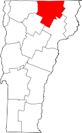 | |
| Towns | ||
| Villages | ||
| CDPs | ||
| Unincorporated community | ||