Lionville, Pennsylvania
| Lionville, Pennsylvania | |
| Census-designated place | |
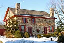 Uwchlan Meetinghouse | |
| Country | United States |
|---|---|
| State | Pennsylvania |
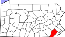
| County | Chester |
| Township | Uwchlan |
| Elevation | 541 ft (164.9 m) |
| Coordinates | 40°03′10″N 75°38′43″W / 40.05278°N 75.64528°WCoordinates: 40°03′10″N 75°38′43″W / 40.05278°N 75.64528°W |
| Area | 2.5 sq mi (6.5 km2) |
| - land | 2.5 sq mi (6 km2) |
| - water | 0.0 sq mi (0 km2), 0% |
| Population | 6,189 (2010) |
| Density | 2,475.6/sq mi (955.8/km2) |
| Timezone | EST (UTC-5) |
| - summer (DST) | EDT (UTC-4) |
| ZIP code | 19353 |
| Area code | 610 and 484 |
 Location in Chester County and the state of Pennsylvania. | |
.svg.png) Location of Pennsylvania in the United States | |
Lionville is a census-designated place (CDP) in Uwchlan Township, Chester County, Pennsylvania, United States. The population was 6,189 at the 2010 census.[1] Prior to 2010 the CDP was recorded as Lionville-Marchwood. "Marchwood", however, refers only to the housing development begun in the early 1960s that is located south of the 100-113 intersection.
Lionville is bisected by two major local highways, PA 100 and PA 113. The area contains residential neighborhoods, hotels, restaurants, and other businesses. The original name of the village was Welsh Pool, but to honor the local Red Lion Inn the name was changed to Lionville, since a borough of Red Lion, Pennsylvania, already existed. The area of Lionville along Village Avenue is a protected historic district. The Friends Meeting House was used as a hospital by the Continental Army during the American Revolutionary War.
Lionville has an independent zip code and post office, but it has never had mail delivery. Many of the long-term residents who picked up mail at the now-closed general store or fire station locations now use a Downingtown address. Because much of the area also falls under the Exton zip code, many Lionville businesses use the Exton name instead, especially if they do not have other locations in the area.
Geography
Lionville-Marchwood is located at 40°3′10″N 75°38′43″W / 40.05278°N 75.64528°W (40.052833, -75.645237).[2]
According to the United States Census Bureau, the CDP has a total area of 2.5 square miles (6.5 km2), all of it land.
Demographics
At the 2000 census,[3] there were 6,298 people, 2,574 households and 1,719 families residing in the CDP. The population density was 2,542.9 per square mile (980.5/km²). There were 2,645 housing units at an average density of 1,068.0/sq mi (411.8/km²). The racial makeup of the CDP was 92.32% White, 2.56% African American, 0.11% Native American, 3.72% Asian, 0.02% Pacific Islander, 0.27% from other races, and 1.02% from two or more races. Hispanic or Latino of any race were 1.21% of the population.
There were 2,574 households of which 32.6% had children under the age of 18 living with them, 55.9% were married couples living together, 8.8% had a female householder with no husband present, and 33.2% were non-families. 26.1% of all households were made up of individuals and 4.4% had someone living alone who was 65 years of age or older. The average household size was 2.45 and the average family size was 3.02.
24.7% of the population were under the age of 18, 6.4% from 18 to 24, 34.6% from 25 to 44, 25.2% from 45 to 64, and 9.1% who were 65 years of age or older. The median age was 36 years. For every 100 females there were 96.3 males. For every 100 females age 18 and over, there were 91.6 males.
The median household income was $63,677 and the median family income was $73,500. Males had a median income of $51,294 compared with $33,199 for females. The per capita income for the CDP was $33,003. About 1.0% of families and 1.9% of the population were below the poverty line, including none of those under age 18 and 6.1% of those age 65 or over.
Education
Lionville is located in the Downingtown Area School District and is home to three schools: Lionville Elementary, Lionville Middle, and Downingtown East High School.
References
- ↑ "Profile of General Population and Housing Characteristics: 2010 Demographic Profile Data (DP-1): Lionville CDP, Pennsylvania". U.S. Census Bureau, American Factfinder. Retrieved August 21, 2012.
- ↑ "US Gazetteer files: 2010, 2000, and 1990". United States Census Bureau. 2011-02-12. Retrieved 2011-04-23.
- ↑ "American FactFinder". United States Census Bureau. Retrieved 2008-01-31.