La Motte-d'Aveillans
| La Motte-d'Aveillans | |
|---|---|
|
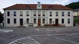
Town hall | |
 La Motte-d'Aveillans | |
|
Location within Auvergne-Rhône-Alpes region  La Motte-d'Aveillans | |
| Coordinates: 44°57′43″N 5°44′45″E / 44.9619°N 5.7458°ECoordinates: 44°57′43″N 5°44′45″E / 44.9619°N 5.7458°E | |
| Country | France |
| Region | Auvergne-Rhône-Alpes |
| Department | Isère |
| Arrondissement | Grenoble |
| Canton | La Mure |
| Intercommunality | La Matheysine |
| Government | |
| • Mayor (2014–2020) | Serge Beschi |
| Area1 | 10 km2 (4 sq mi) |
| Population (2011)2 | 1,778 |
| • Density | 180/km2 (460/sq mi) |
| Time zone | CET (UTC+1) |
| • Summer (DST) | CEST (UTC+2) |
| INSEE/Postal code | 38265 / 38770 |
| Elevation |
637–1,617 m (2,090–5,305 ft) (avg. 872 m or 2,861 ft) |
|
1 French Land Register data, which excludes lakes, ponds, glaciers > 1 km² (0.386 sq mi or 247 acres) and river estuaries. 2 Population without double counting: residents of multiple communes (e.g., students and military personnel) only counted once. | |
La Motte-d'Aveillans is a commune in the Isère department in southeastern France.
Population
| Historical population | ||
|---|---|---|
| Year | Pop. | ±% |
| 1793 | 630 | — |
| 1806 | 681 | +8.1% |
| 1821 | 793 | +16.4% |
| 1831 | 850 | +7.2% |
| 1841 | 1,021 | +20.1% |
| 1851 | 1,322 | +29.5% |
| 1861 | 1,533 | +16.0% |
| 1872 | 1,766 | +15.2% |
| 1881 | 1,829 | +3.6% |
| 1891 | 2,110 | +15.4% |
| 1901 | 3,035 | +43.8% |
| 1911 | 3,642 | +20.0% |
| 1921 | 3,205 | −12.0% |
| 1931 | 3,025 | −5.6% |
| 1946 | 2,832 | −6.4% |
| 1954 | 2,824 | −0.3% |
| 1962 | 2,821 | −0.1% |
| 1968 | 2,410 | −14.6% |
| 1975 | 1,778 | −26.2% |
| 1982 | 1,677 | −5.7% |
| 1990 | 1,591 | −5.1% |
| 1999 | 1,523 | −4.3% |
| 2006 | 1,752 | +15.0% |
| 2011 | 1,778 | +1.5% |
See also
References
| Wikimedia Commons has media related to La Motte-d'Aveillans. |
This article is issued from Wikipedia - version of the 10/28/2016. The text is available under the Creative Commons Attribution/Share Alike but additional terms may apply for the media files.
