Charnècles
| Charnècles | |
|---|---|
 | |
 Charnècles | |
|
Location within Auvergne-Rhône-Alpes region  Charnècles | |
| Coordinates: 45°20′39″N 5°31′43″E / 45.3442°N 5.5286°ECoordinates: 45°20′39″N 5°31′43″E / 45.3442°N 5.5286°E | |
| Country | France |
| Region | Auvergne-Rhône-Alpes |
| Department | Isère |
| Arrondissement | Grenoble |
| Canton | Rives |
| Intercommunality | Pays Voironnais |
| Government | |
| • Mayor (2014–2020) | Marie-Ange Chêne |
| Area1 | 5.23 km2 (2.02 sq mi) |
| Population (2011)2 | 1,489 |
| • Density | 280/km2 (740/sq mi) |
| Time zone | CET (UTC+1) |
| • Summer (DST) | CEST (UTC+2) |
| INSEE/Postal code | 38084 / 38140 |
| Elevation |
260–405 m (853–1,329 ft) (avg. 375 m or 1,230 ft) |
|
1 French Land Register data, which excludes lakes, ponds, glaciers > 1 km² (0.386 sq mi or 247 acres) and river estuaries. 2 Population without double counting: residents of multiple communes (e.g., students and military personnel) only counted once. | |
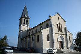
Charnècles is a commune in the Isère department in southeastern France.
Population
| Historical population | ||
|---|---|---|
| Year | Pop. | ±% |
| 1793 | 907 | — |
| 1800 | 814 | −10.3% |
| 1821 | 1,200 | +47.4% |
| 1831 | 1,344 | +12.0% |
| 1841 | 1,342 | −0.1% |
| 1851 | 1,328 | −1.0% |
| 1861 | 1,187 | −10.6% |
| 1872 | 1,022 | −13.9% |
| 1881 | 988 | −3.3% |
| 1891 | 898 | −9.1% |
| 1901 | 798 | −11.1% |
| 1911 | 679 | −14.9% |
| 1921 | 615 | −9.4% |
| 1931 | 635 | +3.3% |
| 1946 | 582 | −8.3% |
| 1954 | 607 | +4.3% |
| 1962 | 566 | −6.8% |
| 1968 | 579 | +2.3% |
| 1975 | 644 | +11.2% |
| 1982 | 868 | +34.8% |
| 1990 | 1,044 | +20.3% |
| 1999 | 1,363 | +30.6% |
| 2011 | 1,489 | +9.2% |
See also
References
| Wikimedia Commons has media related to Charnècles. |
This article is issued from Wikipedia - version of the 10/28/2016. The text is available under the Creative Commons Attribution/Share Alike but additional terms may apply for the media files.