Ponsonnas
| Ponsonnas | |
|---|---|
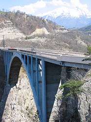 | |
 Ponsonnas | |
|
Location within Auvergne-Rhône-Alpes region  Ponsonnas | |
| Coordinates: 44°53′24″N 5°47′51″E / 44.89°N 5.7975°ECoordinates: 44°53′24″N 5°47′51″E / 44.89°N 5.7975°E | |
| Country | France |
| Region | Auvergne-Rhône-Alpes |
| Department | Isère |
| Arrondissement | Grenoble |
| Canton | La Mure |
| Government | |
| • Mayor (2014–2020) | Jean-Marc Laneyrie |
| Area1 | 3 km2 (1 sq mi) |
| Population (2011)2 | 269 |
| • Density | 90/km2 (230/sq mi) |
| Time zone | CET (UTC+1) |
| • Summer (DST) | CEST (UTC+2) |
| INSEE/Postal code | 38313 / 38350 |
| Elevation | 496–870 m (1,627–2,854 ft) |
|
1 French Land Register data, which excludes lakes, ponds, glaciers > 1 km² (0.386 sq mi or 247 acres) and river estuaries. 2 Population without double counting: residents of multiple communes (e.g., students and military personnel) only counted once. | |
Ponsonnas is a commune in the Isère department in southeastern France.
Population
| Historical population | ||
|---|---|---|
| Year | Pop. | ±% |
| 1793 | 142 | — |
| 1806 | 143 | +0.7% |
| 1821 | 156 | +9.1% |
| 1831 | 172 | +10.3% |
| 1841 | 162 | −5.8% |
| 1851 | 145 | −10.5% |
| 1861 | 187 | +29.0% |
| 1872 | 162 | −13.4% |
| 1881 | 152 | −6.2% |
| 1891 | 134 | −11.8% |
| 1901 | 117 | −12.7% |
| 1911 | 145 | +23.9% |
| 1921 | 130 | −10.3% |
| 1931 | 114 | −12.3% |
| 1946 | 132 | +15.8% |
| 1954 | 186 | +40.9% |
| 1962 | 139 | −25.3% |
| 1968 | 115 | −17.3% |
| 1975 | 104 | −9.6% |
| 1982 | 155 | +49.0% |
| 1990 | 185 | +19.4% |
| 1999 | 226 | +22.2% |
| 2006 | 255 | +12.8% |
| 2011 | 269 | +5.5% |
See also
References
| Wikimedia Commons has media related to Ponsonnas. |
This article is issued from Wikipedia - version of the 10/28/2016. The text is available under the Creative Commons Attribution/Share Alike but additional terms may apply for the media files.