Beauvoir-en-Royans
| Beauvoir-en-Royans | |
|---|---|
|
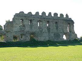
Ruins of the Chateau of Beauvoir | |
 Beauvoir-en-Royans | |
|
Location within Auvergne-Rhône-Alpes region  Beauvoir-en-Royans | |
| Coordinates: 45°07′18″N 5°20′20″E / 45.1217°N 5.3389°ECoordinates: 45°07′18″N 5°20′20″E / 45.1217°N 5.3389°E | |
| Country | France |
| Region | Auvergne-Rhône-Alpes |
| Department | Isère |
| Arrondissement | Grenoble |
| Canton | Pont en Royans |
| Intercommunality | Bourne à l'Isère |
| Government | |
| • Mayor (2001–2008) | Jacques Bourgeat |
| Area1 | 2.1 km2 (0.8 sq mi) |
| Population (2009)2 | 71 |
| • Density | 34/km2 (88/sq mi) |
| Time zone | CET (UTC+1) |
| • Summer (DST) | CEST (UTC+2) |
| INSEE/Postal code | 38036 / 38160 |
| Elevation |
160–606 m (525–1,988 ft) (avg. 281 m or 922 ft) |
|
1 French Land Register data, which excludes lakes, ponds, glaciers > 1 km² (0.386 sq mi or 247 acres) and river estuaries. 2 Population without double counting: residents of multiple communes (e.g., students and military personnel) only counted once. | |
Beauvoir-en-Royans is a commune in the Isère department in southeastern France.
Population
| Historical population | ||
|---|---|---|
| Year | Pop. | ±% |
| 1962 | 52 | — |
| 1968 | 63 | +21.2% |
| 1975 | 43 | −31.7% |
| 1982 | 66 | +53.5% |
| 1990 | 59 | −10.6% |
| 1999 | 70 | +18.6% |
| 2009 | 71 | +1.4% |
See also
References
| Wikimedia Commons has media related to Beauvoir-en-Royans. |
This article is issued from Wikipedia - version of the 10/28/2016. The text is available under the Creative Commons Attribution/Share Alike but additional terms may apply for the media files.