Khagaria district
| Khagaria district खगडिया जिला خھگریا ضلع | |
|---|---|
| District of Bihar | |
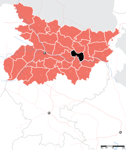 Location of Khagaria district in Bihar | |
| Country | India |
| State | Bihar |
| Administrative division | Munger |
| Headquarters | Khagaria |
| Government | |
| • Lok Sabha constituencies | Khagaria |
| Area | |
| • Total | 1,485 km2 (573 sq mi) |
| Population (2011) | |
| • Total | 1,657,599 |
| • Density | 1,100/km2 (2,900/sq mi) |
| Demographics | |
| • Literacy | 60.87 per cent |
| • Sex ratio | 883 |
| Major highways | NH 31, NH 107 |
| Average annual precipitation | 1182 mm |
| Website | Official website |
Khagaria district is an administrative district in the state of Bihar in India. The district headquarters are located at Khagaria. Khagaria district is a part of Munger Division.
The district occupies an area of 1486 km² and has a population of 1,276,677 (as of census 2001).
History
Also known as Farakiya in local region. There is an interesting story behind it. Five centuries ago Akbar, then the king of Mughal empire directed his revenue minister Todarmal to map his entire empire. But he could not map this region now known as Khagaria due to difficult terrain, rivers and dense forests. So, he named it Farakiya (Farak in Hindi means separate). Now there is even a weekly newspaper- 'Farkiyanchal Times' (albeit published arbitrarily) and Farakiya times (Weekly news paper)
Geography
Khagaria district occupies an area of 1,486 square kilometres (574 sq mi),[1] comparatively equivalent to Greenland's Nares Land.[2] The district is surrounded by seven rivers namely Ganges, Kamla Balan, Koshi, Budhi Gandak, Kareh, Kali Koshi and Bagmati. These rivers cause floods every year which causes great loss of life and property including lifestock.
Sub-Divisions
Khagaria district comprises the following Sub-Divisions:
- Khagaria
- Gogari
Economy
In 2006 the Ministry of Panchayati Raj named Khagaria one of the country's 250 most backward districts (out of a total of 640).[3] It is one of the 36 districts in Bihar currently receiving funds from the Backward Regions Grant Fund Programme (BRGF).[3]
Transport
Khagaria is small town with a major railway junction on the Barauni Guwahati section of the Indian Railways. National Highway No.31, which connects rest of India to North Eastern region passes through this town. It is also connected to other regions of north Bihar by another rail line to Saharsa and Samastipur. Building of a major rail bridge across river Ganges at Munger is underway to connect it to south Bihar and Jharkhand directly.
Demographics
According to the 2011 census Khagaria district has a population of 1,657,599,[4] roughly equal to the nation of Guinea-Bissau[5] or the US state of Idaho.[6] This gives it a ranking of 300th in India (out of a total of 640).[4] The district has a population density of 1,115 inhabitants per square kilometre (2,890/sq mi) .[4] Its population growth rate over the decade 2001-2011 was 29.46%.[4] Khagaria has a sex ratio of 883 females for every 1000 males,[4] and a literacy rate of 60.87%.[4]
References
- ↑ Srivastava, Dayawanti et al. (ed.) (2010). "States and Union Territories: Bihar: Government". India 2010: A Reference Annual (54th ed.). New Delhi, India: Additional Director General, Publications Division, Ministry of Information and Broadcasting (India), Government of India. pp. 1118–1119. ISBN 978-81-230-1617-7.
- ↑ "Island Directory Tables: Islands by Land Area". United Nations Environment Program. 1998-02-18. Retrieved 2011-10-11.
Nares Land 1,466km2
- 1 2 Ministry of Panchayati Raj (September 8, 2009). "A Note on the Backward Regions Grant Fund Programme" (PDF). National Institute of Rural Development. Retrieved September 27, 2011.
- 1 2 3 4 5 6 "District Census 2011". Census2011.co.in. 2011. Retrieved 2011-09-30.
- ↑ US Directorate of Intelligence. "Country Comparison:Population". Retrieved 2011-10-01.
Guinea-Bissau 1,596,677 July 2011 est.
- ↑ "2010 Resident Population Data". U. S. Census Bureau. Retrieved 2011-09-30.
Idaho 1,567,582
External links
 |
Samastipur district | Saharsa district | | |
| Begusarai district | |
Madhepura district | ||
| ||||
| | ||||
| Munger district | Bhagalpur district |
Coordinates: 25°30′00″N 86°28′12″E / 25.50000°N 86.47000°E