Hoyt Lakes, Minnesota
| Hoyt Lakes, Minnesota | |
|---|---|
| City | |
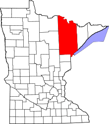
 Location of the city of Hoyt Lakes within Saint Louis County, Minnesota | |
| Coordinates: 47°31′17″N 92°8′14″W / 47.52139°N 92.13722°W | |
| Country | United States |
| State | Minnesota |
| County | Saint Louis |
| Area[1] | |
| • Total | 58.09 sq mi (150.45 km2) |
| • Land | 56.44 sq mi (146.18 km2) |
| • Water | 1.65 sq mi (4.27 km2) |
| Elevation | 1,473 ft (449 m) |
| Population (2010)[2] | |
| • Total | 2,017 |
| • Estimate (2012[3]) | 2,005 |
| • Density | 35.7/sq mi (13.8/km2) |
| Time zone | Central (CST) (UTC-6) |
| • Summer (DST) | CDT (UTC-5) |
| ZIP codes | 55750 |
| Area code(s) | 218 |
| FIPS code | 27-30302[4] |
| GNIS feature ID | 0661511[5] |
| Website | HoytLakes.com |
Hoyt Lakes is a city in Saint Louis County, Minnesota, United States. The population was 2,017 at the 2010 census.[6]
Saint Louis County Highway 110 (CR 110) serves as a main route in Hoyt Lakes.
Geography
According to the United States Census Bureau, the city has a total area of 58.09 square miles (150.45 km2); 56.44 square miles (146.18 km2) is land and 1.65 square miles (4.27 km2) is water.[1]
Demographics
| Historical population | |||
|---|---|---|---|
| Census | Pop. | %± | |
| 1960 | 3,186 | — | |
| 1970 | 3,634 | 14.1% | |
| 1980 | 3,186 | −12.3% | |
| 1990 | 2,348 | −26.3% | |
| 2000 | 2,082 | −11.3% | |
| 2010 | 2,017 | −3.1% | |
| Est. 2015 | 2,004 | [7] | −0.6% |
2010 census
As of the census[2] of 2010, there were 2,017 people, 885 households, and 602 families residing in the city. The population density was 35.7 inhabitants per square mile (13.8/km2). There were 1,016 housing units at an average density of 18.0 per square mile (6.9/km2). The racial makeup of the city was 98.2% White, 0.5% Native American, and 1.3% from two or more races. Hispanic or Latino of any race were 0.3% of the population.
There were 885 households of which 23.5% had children under the age of 18 living with them, 55.5% were married couples living together, 7.6% had a female householder with no husband present, 5.0% had a male householder with no wife present, and 32.0% were non-families. 26.8% of all households were made up of individuals and 13.2% had someone living alone who was 65 years of age or older. The average household size was 2.27 and the average family size was 2.71.
The median age in the city was 49.3 years. 20.2% of residents were under the age of 18; 4% were between the ages of 18 and 24; 21.5% were from 25 to 44; 29.4% were from 45 to 64; and 25.1% were 65 years of age or older. The gender makeup of the city was 49.6% male and 50.4% female.
2000 census
As of the census of 2000,[4] there were 2,082 people, 916 households, and 649 families residing in the city. The population density was 37.1 people per square mile (14.3/km²). There were 995 housing units at an average density of 17.8 per square mile (6.9/km²). The racial makeup of the city was 99.14% White, 0.29% African American, 0.19% Native American, 0.10% Asian, 0.05% from other races, and 0.24% from two or more races. Hispanic or Latino of any race were 0.19% of the population. 22.4% were of Norwegian, 18.6% German, 14.3% Finnish, 7.2% Irish, 6.1% Swedish and 5.2% English ancestry.
There were 916 households out of which 24.1% had children under the age of 18 living with them, 61.6% were married couples living together, 7.3% had a female householder with no husband present, and 29.1% were non-families. 26.3% of all households were made up of individuals and 13.3% had someone living alone who was 65 years of age or older. The average household size was 2.27 and the average family size was 2.71.
In the city the population was spread out with 19.8% under the age of 18, 6.6% from 18 to 24, 22.6% from 25 to 44, 29.6% from 45 to 64, and 21.3% who were 65 years of age or older. The median age was 46 years. For every 100 females there were 99.6 males. For every 100 females age 18 and over, there were 96.4 males.
The median income for a household in the city was $39,493, and the median income for a family was $45,603. Males had a median income of $42,000 versus $24,052 for females. The per capita income for the city was $18,882. About 6.6% of families and 8.9% of the population were below the poverty line, including 19.5% of those under age 18 and 5.7% of those age 65 or over.
References
- 1 2 "US Gazetteer files 2010". United States Census Bureau. Retrieved 2012-11-13.
- 1 2 "American FactFinder". United States Census Bureau. Retrieved 2012-11-13.
- ↑ "Population Estimates". United States Census Bureau. Retrieved 2013-05-28.
- 1 2 "American FactFinder". United States Census Bureau. Retrieved 2008-01-31.
- ↑ "US Board on Geographic Names". United States Geological Survey. 2007-10-25. Retrieved 2008-01-31.
- ↑ "2010 Census Redistricting Data (Public Law 94-171) Summary File". American FactFinder. U.S. Census Bureau, 2010 Census. Retrieved 23 April 2011.
- ↑ "Annual Estimates of the Resident Population for Incorporated Places: April 1, 2010 to July 1, 2015". Retrieved July 2, 2016.
- ↑ "Census of Population and Housing". Census.gov. Retrieved June 4, 2015.
External links
Coordinates: 47°31′11″N 92°08′19″W / 47.51972°N 92.13861°W