Munger, Minnesota
| Munger, Minnesota | |
|---|---|
| Unincorporated community | |
 Munger, Minnesota  Munger, Minnesota Location of the community of Munger | |
| Coordinates: 46°48′03″N 92°20′38″W / 46.80083°N 92.34389°WCoordinates: 46°48′03″N 92°20′38″W / 46.80083°N 92.34389°W | |
| Country | United States |
| State | Minnesota |
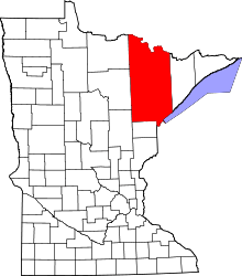
| County | Saint Louis |
| Township | Solway Township |
| Elevation | 1,365 ft (416 m) |
| Population | |
| • Total | 30 |
| Time zone | Central (CST) (UTC-6) |
| • Summer (DST) | CDT (UTC-5) |
| ZIP code | 55720 |
| Area code(s) | 218 |
| GNIS feature ID | 662009[1] |
Munger is an unincorporated community in Solway Township, Saint Louis County, Minnesota, United States.
The community is located 11 miles west of the city of Duluth at the junction of U.S. Highway 2 and County Road 223 (Munger Shaw Road). Munger is located 7 miles west of the city of Proctor.
History
A post office called Munger was established in 1903, and remained in operation until 1931.[2] The community was named for Roger S. Munger, a businessperson in the mining industry.[3]
Community
The unincorporated community of Munger is located within Solway Township (population 1,944).
Most of Munger is located in Saint Louis County, however the mailing address for most of Munger is Cloquet, MN, which is in adjacent Carlton County.
Local business establishments include the Munger Tavern and Grill.
Munger also includes a handful of churches, including Hope Lutheran Church (LCMS).
Nearby places
Nearby cities and communities
References
- ↑ "Munger, Minnesota". Geographic Names Information System. United States Geological Survey.
- ↑ "St. Louis County". Jim Forte Postal History. Retrieved 7 August 2015.
- ↑ Upham, Warren (1920). Minnesota Geographic Names: Their Origin and Historic Significance. Minnesota Historical Society. p. 486.