Grade I listed buildings in Bridgend County Borough
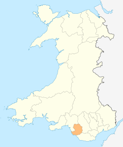
Bridgend County Borough shown within Wales
In the United Kingdom, the term listed building refers to a building or other structure officially designated as being of special architectural, historical, or cultural significance; Grade I structures are those considered to be "buildings of exceptional interest".[1] Listing was begun by a provision in the Town and Country Planning Act 1947. Once listed, strict limitations are imposed on the modifications allowed to a building's structure or fittings. In Wales,[2] the authority for listing under the Planning (Listed Buildings and Conservation Areas) Act 1990[3] rests with Cadw.
Buildings
| Name | Location | Date Listed | Grid Ref.[note 1] Geo-coordinates |
Function | Notes | HB No[note 2] | Image |
|---|---|---|---|---|---|---|---|
| St John the Baptist Church, Porthcawl | Porthcawl | 5 January 1951 | SS8365977477 51°29′03″N 3°40′37″W / 51.484261959826°N 3.6768986936161°W |
Church | In the centre of the old village of Newton with two sides of the rectangular churchyard fronting the village green; main access at WSW. | 11214 | 
|
| Sker Farmhouse | Cynffig | 6 June 1952 | SS7952979838 51°30′17″N 3°44′14″W / 51.504614613995°N 3.7371553105134°W |
Gentry house | Located on a limestone promontory jutting west into Swansea Bay, approximately 4.2 kilometres N of Porthcawl, and reached by a long farm road leading W from the minor road from Porthcawl to Kenfig. | 11217 | 
|
| St James's Church | Pyle | 26 July 1963 | SS8255882645 51°31′50″N 3°41′40″W / 51.530481366083°N 3.6944702327737°W |
Church | The parish church of St James, Pyle, stands in its own churchyard N of the village centre, on the road to Margam. | 11227 | 
|
| St David's Church | Laleston | 26 July 1963 | SS8753979854 51°30′23″N 3°37′18″W / 51.50641251508°N 3.6218030658076°W |
Church | In the centre of the village, on a slight rise above the High Street. Church stands in a roughly circular churchyard surrounded by rubble wall with wrought iron gates S and E. | 11246 | 
|
| St Crallo's Church | Coychurch Lower | 26 July 1963 | SS9396279693 51°30′22″N 3°31′45″W / 51.506209605701°N 3.5292447020245°W |
Church | Situated in the heart of Coychurch village. | 11252 | 
|
| Coity Castle | Coity Higher | 26 July 1963 | SS9231081503 51°31′20″N 3°33′13″W / 51.522165097819°N 3.5535917201206°W |
Castle | Located immediately SW of Coity Church and prominently sited above Heol West Plas. | 11254 | 
|
| St Mary's Church | Coity Higher | 26 July 1963 | SS9239181548 51°31′21″N 3°33′09″W / 51.522585031683°N 3.5524384431041°W |
Church | Located on NE side of Coity village in a large churchyard with open fields to N and Coity Castle to SW. | 11255 | .jpg)
|
| St David's Church | Bettws | 30 July 1997 | SS8990386765 51°34′08″N 3°35′24″W / 51.56899453435°N 3.5899190281024°W |
Church | Situated on the hilltop at the centre of the village which became the core of a post-war estate development. | 18626 |  |
Notes
- ↑ Sometimes known as OSGB36, the grid reference is based on the British national grid reference system used by the Ordnance Survey.
- ↑ The "HB Number" is a unique number assigned to each listed building by Cadw.
See also
References
- ↑ "Buildings & Conservation Areas". Cadw. Retrieved 18 June 2013.
- ↑ "Coflein". online database of RCAHMW. Royal Commission on the Ancient and Historical Monuments of Wales. Retrieved 28 November 2016.
- ↑ "Planning (Listed Buildings and Conservation Areas) Act 1990". The National Archives. Retrieved 18 June 2013.
External links
![]() Media related to Grade I listed buildings in Bridgend County Borough at Wikimedia Commons
Media related to Grade I listed buildings in Bridgend County Borough at Wikimedia Commons
| Communities | | |
|---|---|---|
| Towns and villages |
| |
| Castles | ||
| Rivers | ||
| Topics | ||
This article is issued from Wikipedia - version of the 11/28/2016. The text is available under the Creative Commons Attribution/Share Alike but additional terms may apply for the media files.