Gouézec
| Gouézec Gouezeg | |
|---|---|
|
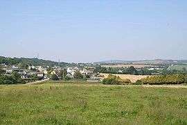
A general view of Gouézec | |
 Gouézec | |
|
Location within Brittany region  Gouézec | |
| Coordinates: 48°10′12″N 3°58′15″W / 48.1700°N 3.9708°WCoordinates: 48°10′12″N 3°58′15″W / 48.1700°N 3.9708°W | |
| Country | France |
| Region | Brittany |
| Department | Finistère |
| Arrondissement | Châteaulin |
| Canton | Pleyben |
| Intercommunality | Région de Pleyben |
| Government | |
| • Mayor (2014–2020) | Cécile Nay |
| Area1 | 30.94 km2 (11.95 sq mi) |
| Population (2008)2 | 1,089 |
| • Density | 35/km2 (91/sq mi) |
| Time zone | CET (UTC+1) |
| • Summer (DST) | CEST (UTC+2) |
| INSEE/Postal code | 29062 / 29190 |
| Elevation | 19–270 m (62–886 ft) |
|
1 French Land Register data, which excludes lakes, ponds, glaciers > 1 km² (0.386 sq mi or 247 acres) and river estuaries. 2 Population without double counting: residents of multiple communes (e.g., students and military personnel) only counted once. | |
Gouézec (Breton: Gouezeg) is a commune in the Finistère department of Brittany in north-western France.
Population
Inhabitants of Gouézec are called in French Gouézécois.
| Historical population | ||
|---|---|---|
| Year | Pop. | ±% |
| 1793 | 1,154 | — |
| 1800 | 1,291 | +11.9% |
| 1806 | 1,306 | +1.2% |
| 1821 | 1,362 | +4.3% |
| 1831 | 1,561 | +14.6% |
| 1836 | 1,614 | +3.4% |
| 1841 | 1,620 | +0.4% |
| 1846 | 1,800 | +11.1% |
| 1851 | 1,911 | +6.2% |
| 1856 | 1,907 | −0.2% |
| 1861 | 1,927 | +1.0% |
| 1866 | 2,075 | +7.7% |
| 1872 | 2,110 | +1.7% |
| 1876 | 2,170 | +2.8% |
| 1881 | 2,247 | +3.5% |
| 1886 | 2,264 | +0.8% |
| 1891 | 2,278 | +0.6% |
| 1896 | 2,284 | +0.3% |
| 1901 | 2,322 | +1.7% |
| 1906 | 2,290 | −1.4% |
| 1911 | 2,335 | +2.0% |
| 1921 | 2,150 | −7.9% |
| 1926 | 2,159 | +0.4% |
| 1931 | 2,042 | −5.4% |
| 1936 | 1,865 | −8.7% |
| 1946 | 1,954 | +4.8% |
| 1954 | 1,520 | −22.2% |
| 1962 | 1,356 | −10.8% |
| 1968 | 1,212 | −10.6% |
| 1975 | 1,062 | −12.4% |
| 1982 | 1,070 | +0.8% |
| 1990 | 1,076 | +0.6% |
| 1999 | 984 | −8.6% |
| 2008 | 1,089 | +10.7% |
See also
References
- Mayors of Finistère Association (French);
External links
| Wikimedia Commons has media related to Gouézec. |
This article is issued from Wikipedia - version of the 2/23/2015. The text is available under the Creative Commons Attribution/Share Alike but additional terms may apply for the media files.