Plouider
| Plouider Plouider | ||
|---|---|---|
|
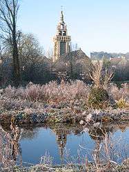
The Chapel of Saint-Fiacre at Pont-du-Châtel, in Plouider | ||
| ||
 Plouider | ||
|
Location within Brittany region  Plouider | ||
| Coordinates: 48°36′32″N 4°17′48″W / 48.6089°N 4.2967°WCoordinates: 48°36′32″N 4°17′48″W / 48.6089°N 4.2967°W | ||
| Country | France | |
| Region | Brittany | |
| Department | Finistère | |
| Arrondissement | Brest | |
| Canton | Lesneven | |
| Intercommunality | Pays de Lesneven et de la Côte des Légendes | |
| Government | ||
| • Mayor (2014–2020) | René Paugam | |
| Area1 | 23.63 km2 (9.12 sq mi) | |
| Population (2008)2 | 1,908 | |
| • Density | 81/km2 (210/sq mi) | |
| Time zone | CET (UTC+1) | |
| • Summer (DST) | CEST (UTC+2) | |
| INSEE/Postal code | 29198 / 29260 | |
| Elevation | 2–86 m (6.6–282.2 ft) | |
|
1 French Land Register data, which excludes lakes, ponds, glaciers > 1 km² (0.386 sq mi or 247 acres) and river estuaries. 2 Population without double counting: residents of multiple communes (e.g., students and military personnel) only counted once. | ||
.svg.png)
Plouider (Breton: Plouider) is a commune in the Finistère department of Brittany in north-western France.
Population
Inhabitants of Plouider are called in French Plouidérois.
See also
References
- Mayors of Finistère Association (French)
External links
| Wikimedia Commons has media related to Plouider. |
- Official website (French)
This article is issued from Wikipedia - version of the 6/21/2015. The text is available under the Creative Commons Attribution/Share Alike but additional terms may apply for the media files.