East Quantoxhead
| East Quantoxhead | |
 East Quantoxhead Church |
|
 Cliff Face East Quantoxhead |
|
 East Quantoxhead |
|
| Population | 104 (2011)[1] |
|---|---|
| OS grid reference | ST134434 |
| District | West Somerset |
| Shire county | Somerset |
| Region | South West |
| Country | England |
| Sovereign state | United Kingdom |
| Post town | BRIDGWATER |
| Postcode district | TA5 |
| Dialling code | 01278 |
| Police | Avon and Somerset |
| Fire | Devon and Somerset |
| Ambulance | South Western |
| EU Parliament | South West England |
| UK Parliament | Bridgwater and West Somerset |
Coordinates: 51°11′02″N 3°14′22″W / 51.1838°N 3.2395°W
East Quantoxhead is a village in West Somerset, 3 miles (5 km) from West Quantoxhead, 4 miles (6 km) east of Williton, and 13 miles (21 km) west of Bridgwater, within the Quantock Hills Area of Outstanding Natural Beauty in Somerset, England.
History
Above the village at Black Ball Camp are an Iron Age hill fort and evidence of Bronze Age burials.[2]
The parish of East Quantoxhead was part of the Williton and Freemanners Hundred.[3]
The village has a manor house, thatched cottages, medieval tithe barn,[4] its own duck pond and mill house dating from 1725.[5][6] The manor house known, as Court House, has a medieval tower and other parts of the building which date from the 17th century. It has been designated as a grade I listed building.[7] The manor was granted to Ralph Pagnall after the Norman Conquest passing down through generations to the Luttrells.[2] No part of the estate has been sold since its grant around 1070 and is still owned by the descendants of the Paganel and Luttrell families. This required a special act of parliament in the 1920s to enable council houses to be built on land which was not freehold, contrary to the rules in the rest of the country.[8]
The village used to have a small harbour which brought in limestone for local limekilns and exported alabaster. It is thought that it was also used for smuggling.[9]
At some time before 1725 Perry Hill was the site of a copper mine.[10]
Governance
The parish council has responsibility for local issues, including setting an annual precept (local rate) to cover the council’s operating costs and producing annual accounts for public scrutiny. The parish council evaluates local planning applications and works with the local police, district council officers, and neighbourhood watch groups on matters of crime, security, and traffic. The parish council's role also includes initiating projects for the maintenance and repair of parish facilities, as well as consulting with the district council on the maintenance, repair, and improvement of highways, drainage, footpaths, public transport, and street cleaning. Conservation matters (including trees and listed buildings) and environmental issues are also the responsibility of the council.
The village falls within the Non-metropolitan district of West Somerset, which was formed on 1 April 1974 under the Local Government Act 1972, having previously been part of Williton Rural District.[11] The district council is responsible for local planning and building control, local roads, council housing, environmental health, markets and fairs, refuse collection and recycling, cemeteries and crematoria, leisure services, parks, and tourism.
Somerset County Council is responsible for running the largest and most expensive local services such as education, social services, libraries, main roads, public transport, policing and fire services, trading standards, waste disposal and strategic planning.
It is also part of the Bridgwater and West Somerset county constituency represented in the House of Commons of the Parliament of the United Kingdom. It elects one Member of Parliament (MP) by the first past the post system of election, and part of the South West England constituency of the European Parliament which elects seven MEPs using the d'Hondt method of party-list proportional representation.
Religious sites
The church is dedicated to St Mary, and parts date back to the 14th century. There is a canonical sundial on the south wall. The wooden pulpit dates from 1633. The church has been designated by English Heritage as a Grade II* listed building.[12]
Notable inhabitants
The village was the birthplace of Sarah Biffen (October 1784 – 2 October 1850), a Victorian English painter born with no arms. She was 37 inches (94 cm) tall.[13] The village was also home to Walter Luttrell a local landowner and veteran of World War II who donated Dunster Castle to the National Trust and was appointed Lord Lieutenant of Somerset.[14]
 East Quantoxhead cliffs
 Scratch dial at church gate
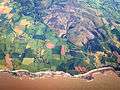 Aerial view of area around East Quantoxhead, which is just left of centre.
References
| Wikimedia Commons has media related to East Quantoxhead. |
- ↑ "Civil Parish population 2011". Retrieved 25 October 2015.
- 1 2 Bush, Robin (1994). Somerset: The Complete Guide. Dovecote Press. p. 93. ISBN 1-874336-26-1.
- ↑ "Somerset Hundreds". GENUKI. Retrieved 23 October 2011.
- ↑ "Tithe Barn, cart shed, engine house and shelter sheds, 50 metres South of the Court House". Images of England. English Heritage. Retrieved 2009-01-08.
- ↑ "Mill House". Images of England. English Heritage. Retrieved 2009-01-08.
- ↑ "East Quantoxhead". Quantocks Online. Retrieved 2008-01-12.
- ↑ "Court House". Images of England. English Heritage. Retrieved 2009-01-08.
- ↑ Delderfield, Eric R. (1970). West Countrty Historic Houses and their families: Volume 2. Dorest, Wiltshire and North Somerset. Newton Abbot: David & Charles. pp. 40–41. ISBN 978-0715349106.
- ↑ Farr, Grahame (1954). Somerset Harbours. London: Christopher Johnson. pp. 123–124.
- ↑ Hamilton, John; J.F. Lawrence (1970). Men and Mining on the Quantocks. Bracknell: Town & Country Press Ltd. pp. 28–77.
- ↑ A Vision of Britain Through Time : Williton Rural District
- ↑ "Church of Saint Mary". Images of England. Retrieved 2008-01-12.
- ↑ Waite, Vincent (1964). Portrait of the Quantocks. London: Robert Hale. ISBN 0-7091-1158-4.
- ↑ "Obituary: Colonel Sir Walter Luttrell". The Daily Telegraph. 2007-05-06. Retrieved 2007-10-20.
