Dorrington, California
| Dorrington | |
|---|---|
| census-designated place | |
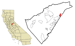 Location in Calaveras County and the state of California | |
 Dorrington Location in the United States | |
| Coordinates: 38°18′05″N 120°16′38″W / 38.30139°N 120.27722°WCoordinates: 38°18′05″N 120°16′38″W / 38.30139°N 120.27722°W | |
| Country |
|
| State |
|
| County | Calaveras |
| Area[1] | |
| • Total | 3.658 sq mi (9.474 km2) |
| • Land | 3.653 sq mi (9.461 km2) |
| • Water | 0.005 sq mi (0.013 km2) 0.14% |
| Elevation | 4,767 ft (1,453 m) |
| Population (2010) | |
| • Total | 609 |
| • Density | 170/sq mi (64/km2) |
| Time zone | Pacific (PST) (UTC-8) |
| • Summer (DST) | PDT (UTC-7) |
| ZIP code | 95223 |
| Area code(s) | 209 |
| FIPS code | 06-19570 |
| GNIS feature IDs | 1656306, 2408683 |
Dorrington is a census-designated place (CDP) in Calaveras County, California, United States. The population was 609 at the 2010 census, down from 727 at the 2000 census. Originally known as Cold Spring Ranch until 1902 (because of an icy spring), the town sits on State Route 4 and historically was a stopping point along the toll road between Murphys and Ebbetts Pass, often serving as a resort for visitors to what is now Calaveras Big Trees State Park. Dorrington is also home to the second largest Sugar Pine in the world, measuring 32 feet (9.7 m) in circumference and 220 feet (67 m) tall.
Geography
According to the United States Census Bureau, the CDP has a total area of 3.7 square miles (9.6 km2), 99.86% of it land. The elevation is 4,308 feet.
History
Originally known as Cold Springs Ranch, the town's name changed upon establishment of the post office in 1902. The name Dorrington was the maiden name of the first postmaster's wife. The post office was discontinued in 1919, but re-established in 1921 and closed for good in 1934.[2]
Demographics
2010
The 2010 United States Census[3] reported that Dorrington had a population of 609. The population density was 166.5 people per square mile (64.3/km²). The racial makeup of Dorrington was 576 (94.6%) White, 0 (0.0%) African American, 2 (0.3%) Native American, 11 (1.8%) Asian, 1 (0.2%) Pacific Islander, 1 (0.2%) from other races, and 18 (3.0%) from two or more races. Hispanic or Latino of any race were 33 persons (5.4%).
The Census reported that 609 people (100% of the population) lived in households, 0 (0%) lived in non-institutionalized group quarters, and 0 (0%) were institutionalized.
There were 294 households, out of which 44 (15.0%) had children under the age of 18 living in them, 174 (59.2%) were opposite-sex married couples living together, 14 (4.8%) had a female householder with no husband present, 3 (1.0%) had a male householder with no wife present. There were 16 (5.4%) unmarried opposite-sex partnerships, and 3 (1.0%) same-sex married couples or partnerships. 86 households (29.3%) were made up of individuals and 30 (10.2%) had someone living alone who was 65 years of age or older. The average household size was 2.07. There were 191 families (65.0% of all households); the average family size was 2.50.
The population was spread out with 76 people (12.5%) under the age of 18, 19 people (3.1%) aged 18 to 24, 58 people (9.5%) aged 25 to 44, 277 people (45.5%) aged 45 to 64, and 179 people (29.4%) who were 65 years of age or older. The median age was 57.6 years. For every 100 females there were 112.2 males. For every 100 females age 18 and over, there were 114.9 males.
There were 1,689 housing units at an average density of 461.8 per square mile (178.3/km²), of which 269 (91.5%) were owner-occupied, and 25 (8.5%) were occupied by renters. The homeowner vacancy rate was 6.2%; the rental vacancy rate was 17.1%. 553 people (90.8% of the population) lived in owner-occupied housing units and 56 people (9.2%) lived in rental housing units.
2000
As of the census[4] of 2000, there were 727 people, 336 households, and 235 families residing in the CDP. The population density was 197.7 people per square mile (76.3/km²). There were 1,523 housing units at an average density of 414.1 per square mile (159.8/km²). The racial makeup of the CDP was 94.22% White, 0.41% Black or African American, 0.14% Native American, 0.41% Asian, 2.34% from other races, and 2.48% from two or more races. 5.36% of the population were Hispanic or Latino of any race.
There were 336 households out of which 16.7% had children under the age of 18 living with them, 64.9% were married couples living together, 3.0% had a female householder with no husband present, and 29.8% were non-families. 25.3% of all households were made up of individuals and 6.3% had someone living alone who was 65 years of age or older. The average household size was 2.16 and the average family size was 2.56.
In the CDP the population was spread out with 16.2% under the age of 18, 3.3% from 18 to 24, 19.0% from 25 to 44, 45.4% from 45 to 64, and 16.1% who were 65 years of age or older. The median age was 50 years. For every 100 females there were 102.5 males. For every 100 females age 18 and over, there were 105.7 males.
The median income for a household in the CDP was $85,000, and the median income for a family was $89,423. Males had a median income of $68,750 versus $48,750 for females. The per capita income for the CDP was $53,832. None of the population or families were below the poverty line.
Politics
In the state legislature, Dorrington is in the 8th Senate District, represented by Republican Tom Berryhill,[5] and the 5th Assembly District, represented by Republican Frank Bigelow.[6] Federally, Dorrington is in California's 4th congressional district, represented by Republican Tom McClintock.[7]
References
- ↑ "2010 Census U.S. Gazetteer Files – Places – California". United States Census Bureau.
- ↑ Durham, David L. (1998). California's Geographic Names: A Gazetteer of Historic and Modern Names of the State. Clovis, Calif.: Word Dancer Press. p. 767. ISBN 1-884995-14-4.
- ↑ "2010 Census Interactive Population Search: CA - Dorrington CDP". U.S. Census Bureau. Retrieved July 12, 2014.
- ↑ "American FactFinder". United States Census Bureau. Retrieved 2008-01-31.
- ↑ "Senators". State of California. Retrieved March 21, 2013.
- ↑ "Members Assembly". State of California. Retrieved March 21, 2013.
- ↑ "California's 4th Congressional District - Representatives & District Map". Civic Impulse, LLC. Retrieved March 2, 2013.
