Mountain Ranch, California
| Mountain Ranch | |
|---|---|
| census-designated place | |
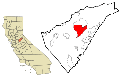 Location in Calaveras County and the state of California | |
 Mountain Ranch Location in the United States | |
| Coordinates: 38°13′42″N 120°32′27″W / 38.22833°N 120.54083°WCoordinates: 38°13′42″N 120°32′27″W / 38.22833°N 120.54083°W | |
| Country |
|
| State |
|
| County | Calaveras |
| Area[1] | |
| • Total | 41.244 sq mi (106.822 km2) |
| • Land | 41.188 sq mi (106.677 km2) |
| • Water | 0.056 sq mi (0.145 km2) 0.14% |
| Elevation[2] | 2,123 ft (647 m) |
| Population (2010) | |
| • Total | 1,628 |
| • Density | 37.7/sq mi (14.6/km2) |
| Time zone | Pacific (PST) (UTC-8) |
| • Summer (DST) | PDT (UTC-7) |
| ZIP code | 95246 |
| Area code(s) | 209 |
| FIPS code | 06-49628 |
| GNIS feature IDs | 229196, 2408882 |
| Official name | El Dorado[3] |
| Reference no. | 282 |
Mountain Ranch (formerly, El Dorado and El Dorado Town) is a census-designated place (CDP) in Calaveras County, California, United States. The population was 1,628 at the 2010 census, up from 1,557 at the 2000 census. The town is registered as California Historical Landmark #282.[3] The town center is quite small with fewer than 50 people living in it, the 5 mile square area surrounding the town accounts for the balance of the population.
History
The settlement was established during the California Gold Rush.[4] Mountain Ranch's post office was established in 1858.[5] In 1868, it was moved to another town called El Dorado Camp 1.5 miles south, as there was already an El Dorado post office in CA, El Dorado Camp became known as Mountain Ranch. Currently, there are 3 post office buildings in the town. The present one, a small post office which was built in 1956, and a post office built in 1923 which was once billed as the world's smallest post office. The original location of the town of Mountain Ranch also has a historical landmark. The bell on the historical marker was used in the local school from 1885 to 1953. Established as Cave City School District in 1855, this school joined with the Banner District in 1946 to become the El Dorado Union Elementary School District. In 1942 the last of the gold mines closed.[4] Further economic losses took place in the 1970s, when local saw mills shuttered, and also in 1983 when the Calaveras Cement Co. closed in 1983.[4] In 2015, the town was ravaged by the Butte Fire. More than 350 homes[4] along the outskirts burned, but firefighters and local ranchers were able to save most of the downtown.
Geography
According to the United States Census Bureau, the CDP has a total area of 41.2 square miles (107 km2), of which 99.86% is land, and 0.14% is water.
Demographics
2010
The 2010 United States Census[6] reported that Mountain Ranch had a population of 1,628. The population density was 39.5 people per square mile (15.2/km²). The racial makeup of Mountain Ranch was 1,472 (90.4%) White, 15 (0.9%) African American, 33 (2.0%) Native American, 18 (1.1%) Asian, 2 (0.1%) Pacific Islander, 15 (0.9%) from other races, and 73 (4.5%) from two or more races. Hispanic or Latino of any race were 123 persons (7.6%).
The Census reported that 1,628 people (100% of the population) lived in households, 0 (0%) lived in non-institutionalized group quarters, and 0 (0%) were institutionalized.
There were 748 households, out of which 113 (15.1%) had children under the age of 18 living in them, 410 (54.8%) were opposite-sex married couples living together, 53 (7.1%) had a female householder with no husband present, 23 (3.1%) had a male householder with no wife present. There were 50 (6.7%) unmarried opposite-sex partnerships, and 5 (0.7%) same-sex married couples or partnerships. 211 households (28.2%) were made up of individuals and 89 (11.9%) had someone living alone who was 65 years of age or older. The average household size was 2.18. There were 486 families (65.0% of all households); the average family size was 2.60.
The population was spread out with 213 people (13.1%) under the age of 18, 86 people (5.3%) aged 18 to 24, 201 people (12.3%) aged 25 to 44, 712 people (43.7%) aged 45 to 64, and 416 people (25.6%) who were 65 years of age or older. The median age was 55.3 years. For every 100 females there were 105.8 males. For every 100 females age 18 and over, there were 106.3 males.
There were 960 housing units at an average density of 23.3 per square mile (9.0/km²), of which 620 (82.9%) were owner-occupied, and 128 (17.1%) were occupied by renters. The homeowner vacancy rate was 2.8%; the rental vacancy rate was 9.8%. 1,352 people (83.0% of the population) lived in owner-occupied housing units and 276 people (17.0%) lived in rental housing units.
2000
As of the census[7] of 2000, there were 1,557 people, 656 households, and 474 families residing in the CDP. The population density was 37.8 people per square mile (14.6/km²). There were 816 housing units at an average density of 19.8 per square mile (7.6/km²). The racial makeup of the CDP was 90.30% White, 1.41% Black or African American, 1.73% Native American, 0.83% Asian, 0.58% from other races, and 5.14% from two or more races. 5.07% of the population were Hispanic or Latino of any race.
There were 656 households out of which 19.7% had children under the age of 18 living with them, 64.6% were married couples living together, 5.3% had a female householder with no husband present, and 27.7% were non-families. 21.8% of all households were made up of individuals and 7.6% had someone living alone who was 65 years of age or older. The average household size was 2.37 and the average family size was 2.76.
In the CDP the population was spread out with 18.7% under the age of 18, 3.8% from 18 to 24, 18.9% from 25 to 44, 38.3% from 45 to 64, and 20.4% who were 65 years of age or older. The median age was 50 years. For every 100 females there were 103.3 males. For every 100 females age 18 and over, there were 100.3 males.
The median income for a household in the CDP was $38,311, and the median income for a family was $39,324. Males had a median income of $33,864 versus $33,289 for females. The per capita income for the CDP was $19,594. About 10.0% of families and 13.5% of the population were below the poverty line, including 9.7% of those under age 18 and 2.1% of those age 65 or over.
Politics
In the state legislature, Mountain Ranch is in the 8th Senate District, represented by Republican Tom Berryhill,[8] and the 5th Assembly District, represented by Republican Frank Bigelow.[9] Federally, Mountain Ranch is in California's 4th congressional district, represented by Republican Tom McClintock.[10]
Notable natives
References
- ↑ "2010 Census U.S. Gazetteer Files – Places – California". United States Census Bureau.
- ↑ "Mountain Ranch". Geographic Names Information System. United States Geological Survey. Retrieved April 18, 2015.
- 1 2 "El Dorado". Office of Historic Preservation, California State Parks. Retrieved 2012-10-06.
- 1 2 3 4 "Northern California Town Fights Back After Being Nearly Burned Off Map". Insurance Journal. September 28, 2015. Retrieved September 29, 2015.
- ↑ Durham, David L. (1998). California's Geographic Names: A Gazetteer of Historic and Modern Names of the State. Clovis, Calif.: Word Dancer Press. p. 806. ISBN 1-884995-14-4.
- ↑ "2010 Census Interactive Population Search: CA - Mountain Ranch CDP". U.S. Census Bureau. Retrieved July 12, 2014.
- ↑ "American FactFinder". United States Census Bureau. Retrieved 2008-01-31.
- ↑ "Senators". State of California. Retrieved March 21, 2013.
- ↑ "Members Assembly". State of California. Retrieved March 21, 2013.
- ↑ "California's 4th Congressional District - Representatives & District Map". Civic Impulse, LLC. Retrieved March 2, 2013.
