Conneaut Creek
| Conneaut Creek | |
| Stream | |
 Mouth of Conneaut Creek on Lake Erie at Conneaut, Ohio | |
| Country | United States |
|---|---|
| States | Ohio, Pennsylvania |
| Counties | Ashtabula, Erie, Crawford |
| Tributaries | |
| - left | West Branch Conneaut Creek |
| - right | East Branch Conneaut Creek |
| Source | |
| - location | Linesville, Crawford County, Pennsylvania |
| - elevation | 1,273 ft (388 m) [1] |
| - coordinates | 41°40′41″N 80°23′19″W / 41.67806°N 80.38861°W [2] |
| Mouth | Lake Erie |
| - location | Ohio–Pennsylvania border |
| - elevation | 768 ft (234 m) [1] |
| - coordinates | 41°58′11″N 80°32′53″W / 41.96972°N 80.54806°WCoordinates: 41°58′11″N 80°32′53″W / 41.96972°N 80.54806°W [2] |
| Length | 43.5 mi (70 km) [1] |
| Basin | 152 sq mi (394 km2) [1] |
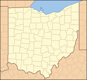 Location of the mouth of Conneaut Creek in Ohio
| |
 Location of the mouth of Conneaut Creek in Pennsylvania
| |
Conneaut Creek /ˈkɒni.ɒt/ is a 43.5-mile (70.0 km) tributary of Lake Erie in northwestern Pennsylvania and northeastern Ohio in the United States.[3] Via Lake Erie, the Niagara River and Lake Ontario, it is part of the watershed of the St. Lawrence River, which flows to the Atlantic Ocean.
Conneaut Creek rises in western Crawford County, Pennsylvania, and initially flows north-northwestwardly past Conneautville into western Erie County. Near Albion, it turns to the west-southwest and roughly parallels the shoreline of Lake Erie for some length, at a distance of about 5 mi (8 km) inland, into northeastern Ashtabula County, Ohio, where, at Kingsville, it turns to the northeast to flow into Lake Erie at the city of Conneaut.[4][5]
Variant names and spellings
According to the Geographic Names Information System, Conneaut Creek has also been known historically as:[2]
- Caneaught Creek
- Conneaut River
- Coneaught Creek
- Conneaugh River
- Conneought Creek
- Conyeayout Creek
- Counite Riviere
See also
References
- 1 2 3 4 Shaw, L. C.; W. F. Busch (June 1984). Pennsylvania Gazetteer of Streams, Part II. Water Resources Bulletin. 16. Prepared in Cooperation with the United States Department of the Interior Geological Survey. Harrisburg, PA: Pennsylvania Department of Forest and Waters. p. 382.
- 1 2 3 "Conneaut Creek". Geographic Names Information System. 2008. Retrieved 2008-09-25.
- ↑ Columbia Gazetteer of North America entry
- ↑ DeLorme (2003). Pennsylvania Atlas & Gazetteer. Yarmouth, ME: DeLorme. ISBN 0-89933-280-3.
- ↑ DeLorme (1991). Ohio Atlas & Gazetteer. Yarmouth, ME: DeLorme. ISBN 0-89933-233-1.
