Hueston Woods State Park
| Hueston Woods State Park | |
|---|---|
|
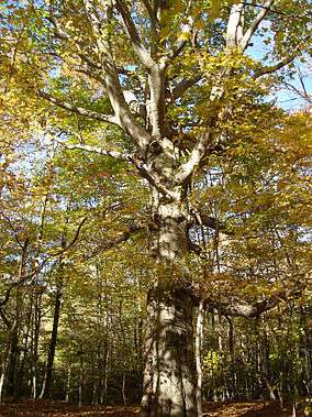
A beech tree in the park | |
| Location | Ohio, United States |
| Nearest city | College Corner, Ohio |
| Area |
Land: 2,936 acres (1,188 ha) Water: 625 acres (253 ha)[1] |
| Established | 1957 |
| Governing body | Ohio Department of Natural Resources |
Hueston Woods State Park is a state park located in Butler and Preble counties of the U.S. state of Ohio, about five miles (8 km) northeast of Oxford in the southwestern part of the state. It has 3,596 acres (1,455 ha), including a man-made lake of 625 acres (253 ha).[1] The state bought the land in 1941, but the park did not open until 1957.[2] It has 12 miles (19 km) of trails, a 96 room lodge, and an eighteen hole golf course.
The state used the land initially as a prison camp.[2] In 1956, Four Mile Creek was dammed to form Acton Lake, named for Clyde Acton, the member of the Ohio General Assembly who persuaded the legislature to buy the property.
The park lies in Oxford Township, Butler County, and Israel Township, Preble County.
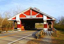
The Hueston Woods Covered Bridge in Preble County was completed and opened for traffic in June 2012. The $2.0 million Burr arch truss structure spans 108 feet over Four Mile Creek north and west of the park. The structure supports 40 ton tractor trailer traffic and has a life expectancy of over 100 years. [3]
| Acton Lake | |
|---|---|
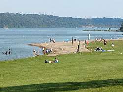 Acton Lake | |
| Location | southwestern Ohio |
| Coordinates | 39°33′24″N 084°44′06″W / 39.55667°N 84.73500°W |
| Lake type | reservoir |
| Basin countries | United States |
| Surface area | 625 acres (253 ha) [1] |
References
- 1 2 3 Hueston Woods State Park Ohio Department of Natural Resources Official Site
- 1 2 ODNR Hueston Woods History
- ↑ Hueston Woods Lodge press release
External links
- Art Weber. Ohio State Parks. Saginaw, Michigan: Glovebox Guidebooks, 1995. ISBN 1-881139-04-2
- Hueston Woods Park Map from ODNR Official Website
- Hueston Woods Campground Map from ODNR Official Website
- Hueston Woods Trail Map from ODNR Official Website
- U.S. Geological Survey Geographic Names Information System: Acton Lake
Coordinates: 39°34′34″N 84°44′44″W / 39.57611°N 84.74556°W