Coalport, Pennsylvania
| Coalport, Pennsylvania | |
|---|---|
| Borough | |
|
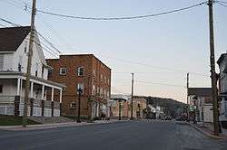
Main Street south of Spruce | |
|
Map showing Coalport in Clearfield County | |
|
Map showing Clearfield County in Pennsylvania | |
 Coalport Location in Pennsylvania | |
| Coordinates: 40°44′53″N 78°32′04″W / 40.74806°N 78.53444°WCoordinates: 40°44′53″N 78°32′04″W / 40.74806°N 78.53444°W | |
| Country | United States |
| State | Pennsylvania |
| County | Clearfield |
| Settled | 1876 |
| Incorporated | 1883 |
| Government | |
| • Type | Borough Council |
| Area | |
| • Total | 0.38 sq mi (0.98 km2) |
| • Land | 0.37 sq mi (0.97 km2) |
| • Water | 0.004 sq mi (0.01 km2) |
| Elevation | 1,382 ft (421 m) |
| Population (2010) | |
| • Total | 523 |
| • Density | 1,398/sq mi (539.8/km2) |
| Time zone | Eastern (EST) (UTC-5) |
| • Summer (DST) | EDT (UTC-4) |
| ZIP code | 16627 |
| Area code(s) | 814 |
Coalport is a borough in Clearfield County, Pennsylvania, United States. The population was 523 at the 2010 census.[1]
Geography
Coalport is located in southern Clearfield County at 40°44′53″N 78°32′04″W / 40.748040°N 78.534322°W,[2] on the east side of Clearfield Creek, a north-flowing tributary of the West Branch Susquehanna River. Pennsylvania Route 53 passes through the borough, leading north 2 miles (3 km) to Irvona and south 2 miles (3 km) to Flinton in Cambria County.
According to the United States Census Bureau, Coalport has a total area of 0.38 square miles (0.98 km2), of which 0.004 square miles (0.01 km2), or 1.45%, is water.[1]
Demographics
| Historical population | |||
|---|---|---|---|
| Census | Pop. | %± | |
| 1890 | 855 | — | |
| 1900 | 938 | 9.7% | |
| 1910 | 876 | −6.6% | |
| 1920 | 1,079 | 23.2% | |
| 1930 | 1,222 | 13.3% | |
| 1940 | 1,121 | −8.3% | |
| 1950 | 1,052 | −6.2% | |
| 1960 | 821 | −22.0% | |
| 1970 | 796 | −3.0% | |
| 1980 | 739 | −7.2% | |
| 1990 | 578 | −21.8% | |
| 2000 | 490 | −15.2% | |
| 2010 | 523 | 6.7% | |
| Est. 2015 | 507 | [3] | −3.1% |
| Sources:[4][5][6] | |||
As of the census[5] of 2000, there were 490 people, 223 households, and 132 families residing in the borough. The population density was 1,273.9 people per square mile (497.9/km2). There were 260 housing units at an average density of 675.9 per square mile (264.2/km2). The racial makeup of the borough was 98.57% White, 1.02% Asian, 0.20% from other races, and 0.20% from two or more races. Hispanic or Latino of any race were 0.20% of the population.
There were 223 households, out of which 21.1% had children under the age of 18 living with them, 45.7% were married couples living together, 9.0% had a female householder with no husband present, and 40.8% were non-families. 36.8% of all households were made up of individuals, and 15.7% had someone living alone who was 65 years of age or older. The average household size was 2.20 and the average family size was 2.89.
In the borough the population was spread out, with 19.0% under the age of 18, 9.4% from 18 to 24, 27.6% from 25 to 44, 25.3% from 45 to 64, and 18.8% who were 65 years of age or older. The median age was 42 years. For every 100 females there were 92.2 males. For every 100 females age 18 and over, there were 93.7 males.
The median income for a household in the borough was $26,528, and the median income for a family was $40,833. Males had a median income of $28,438 versus $20,313 for females. The per capita income for the borough was $16,232. About 12.1% of families and 15.6% of the population were below the poverty line, including 24.6% of those under age 18 and 9.6% of those age 65 or over.
References
- 1 2 "Geographic Identifiers: 2010 Census Summary File 1 (G001): Coalport borough, Pennsylvania". U.S. Census Bureau, American Factfinder. Retrieved April 30, 2015.
- ↑ "US Gazetteer files: 2010, 2000, and 1990". United States Census Bureau. 2011-02-12. Retrieved 2011-04-23.
- ↑ "Annual Estimates of the Resident Population for Incorporated Places: April 1, 2010 to July 1, 2015". Retrieved July 2, 2016.
- ↑ "Census of Population and Housing". U.S. Census Bureau. Archived from the original on 11 May 2015. Retrieved 11 December 2013.
- 1 2 "American FactFinder". United States Census Bureau. Archived from the original on 2013-09-11. Retrieved 2008-01-31.
- ↑ "Incorporated Places and Minor Civil Divisions Datasets: Subcounty Resident Population Estimates: April 1, 2010 to July 1, 2012". Population Estimates. U.S. Census Bureau. Archived from the original on 17 June 2013. Retrieved 11 December 2013.
Municipalities and communities of Clearfield County, Pennsylvania, United States | ||
|---|---|---|
| City | ||
| Boroughs | ||
| Townships | ||
| CDPs | ||
| Unincorporated communities | ||
| Footnotes | ‡This populated place also has portions in an adjacent county or counties | |