Brisbin, Pennsylvania
| Brisbin, Pennsylvania | |
|---|---|
| Borough | |
|
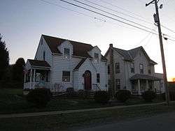
Brisbin, Pennsylvania | |
|
Map showing Brisbin in Clearfield County | |
|
Map showing Clearfield County in Pennsylvania | |
 Brisbin Location in Pennsylvania | |
| Coordinates: 40°50′15″N 78°21′10″W / 40.83750°N 78.35278°WCoordinates: 40°50′15″N 78°21′10″W / 40.83750°N 78.35278°W | |
| Country | United States |
| State | Pennsylvania |
| County | Clearfield |
| Settled | 1854 |
| Incorporated | 1883 |
| Government | |
| • Type | Borough Council |
| Area | |
| • Total | 0.73 sq mi (1.89 km2) |
| • Land | 0.71 sq mi (1.85 km2) |
| • Water | 0.02 sq mi (0.04 km2) |
| Elevation | 1,590 ft (480 m) |
| Population (2010) | |
| • Total | 411 |
| • Density | 575/sq mi (222.2/km2) |
| Time zone | Eastern (EST) (UTC-5) |
| • Summer (DST) | EDT (UTC-4) |
| Zip code | 16620 |
| Area code(s) | 814 |
Brisbin is a borough in Clearfield County, Pennsylvania, United States. The population was 411 at the 2010 census.[1]
Geography
Brisbin is located in southeastern Clearfield County at 40°50′15″N 78°21′10″W / 40.837600°N 78.352704°W.[2] It is nearly surrounded by Woodward Township, though Decatur Township partially borders it on the east. The borough of Houtzdale is directly to the south.
According to the United States Census Bureau, the borough has a total area of 0.73 square miles (1.89 km2), of which 0.71 square miles (1.85 km2) is land and 0.02 square miles (0.04 km2), or 1.98%, is water.[1] Gose Run flows through the borough, leading east to Beaver Run, which in turn flows east to Moshannon Creek, a tributary of the West Branch Susquehanna River.
Demographics
| Historical population | |||
|---|---|---|---|
| Census | Pop. | %± | |
| 1890 | 1,508 | — | |
| 1900 | 666 | −55.8% | |
| 1910 | 459 | −31.1% | |
| 1920 | 570 | 24.2% | |
| 1930 | 436 | −23.5% | |
| 1940 | 501 | 14.9% | |
| 1950 | 463 | −7.6% | |
| 1960 | 398 | −14.0% | |
| 1970 | 364 | −8.5% | |
| 1980 | 387 | 6.3% | |
| 1990 | 369 | −4.7% | |
| 2000 | 413 | 11.9% | |
| 2010 | 411 | −0.5% | |
| Est. 2015 | 396 | [3] | −3.6% |
| Sources:[4][5][6] | |||
As of the census[5] of 2000, there were 413 people, 166 households, and 124 families residing in the borough. The population density was 655.2 people per square mile (253.1/km2). There were 181 housing units at an average density of 287.1 per square mile (110.9/km2). The racial makeup of the borough was 98.79% White, 0.24% African American, 0.24% from other races, and 0.73% from two or more races. Hispanic or Latino of any race were 0.24% of the population.
There were 166 households, out of which 34.3% had children under the age of 18 living with them, 60.2% were married couples living together, 12.0% had a female householder with no husband present, and 24.7% were non-families. 22.3% of all households were made up of individuals, and 10.2% had someone living alone who was 65 years of age or older. The average household size was 2.49 and the average family size was 2.91.
In the borough the population was spread out, with 23.5% under the age of 18, 5.3% from 18 to 24, 31.2% from 25 to 44, 24.5% from 45 to 64, and 15.5% who were 65 years of age or older. The median age was 38 years. For every 100 females there were 88.6 males. For every 100 females age 18 and over, there were 81.6 males.
The median income for a household in the borough was $30,250, and the median income for a family was $35,875. Males had a median income of $28,750 versus $21,250 for females. The per capita income for the borough was $13,805. About 16.0% of families and 18.8% of the population were below the poverty line, including 30.5% of those under age 18 and 7.5% of those age 65 or over.
References
| Wikimedia Commons has media related to Brisbin, Pennsylvania. |
- 1 2 "Geographic Identifiers: 2010 Census Summary File 1 (G001): Brisbin borough, Pennsylvania". U.S. Census Bureau, American Factfinder. Retrieved April 29, 2015.
- ↑ "US Gazetteer files: 2010, 2000, and 1990". United States Census Bureau. 2011-02-12. Retrieved 2011-04-23.
- ↑ "Annual Estimates of the Resident Population for Incorporated Places: April 1, 2010 to July 1, 2015". Retrieved July 2, 2016.
- ↑ "Census of Population and Housing". U.S. Census Bureau. Archived from the original on 11 May 2015. Retrieved 11 December 2013.
- 1 2 "American FactFinder". United States Census Bureau. Archived from the original on 2013-09-11. Retrieved 2008-01-31.
- ↑ "Incorporated Places and Minor Civil Divisions Datasets: Subcounty Resident Population Estimates: April 1, 2010 to July 1, 2012". Population Estimates. U.S. Census Bureau. Archived from the original on 17 June 2013. Retrieved 11 December 2013.
Municipalities and communities of Clearfield County, Pennsylvania, United States | ||
|---|---|---|
| City | ||
| Boroughs | ||
| Townships | ||
| CDPs | ||
| Unincorporated communities | ||
| Footnotes | ‡This populated place also has portions in an adjacent county or counties | |