Amberley, Ohio
| Amberley Village, Ohio | |
|---|---|
| Village | |
|
James Baxter House, built 1807 | |
 Location in Hamilton County and the state of Ohio. | |
| Coordinates: 39°11′57″N 84°25′14″W / 39.19917°N 84.42056°WCoordinates: 39°11′57″N 84°25′14″W / 39.19917°N 84.42056°W | |
| Country | United States |
| State | Ohio |
| County | Hamilton |
| Government | |
| • Mayor | Thomas Muething (R)[1] |
| Area[2] | |
| • Total | 3.50 sq mi (9.06 km2) |
| • Land | 3.50 sq mi (9.06 km2) |
| • Water | 0 sq mi (0 km2) |
| Elevation[3] | 797 ft (243 m) |
| Population (2010)[4] | |
| • Total | 3,585 |
| • Estimate (2012[5]) | 3,585 |
| • Density | 1,024.3/sq mi (395.5/km2) |
| Time zone | Eastern (EST) (UTC-5) |
| • Summer (DST) | EDT (UTC-4) |
| ZIP Code | 45237, 45213 |
| Area code(s) | 513 |
| FIPS code | 39-01672[6] |
| GNIS feature ID | 1037396[3] |
| Website |
www |

Amberley, locally known as Amberley Village, is a village in Hamilton County, Ohio, United States. The population was 3,585 at the 2010 census.[7]
History
Amberley was incorporated as a village on April 5, 1940. The town was named after a village in England.[8]
Amberley was designated a Tree City USA by the National Arbor Day Foundation. Amberley is home to French Park, owned by the city of Cincinnati.
Geography
Amberley is located at 39°11′57″N 84°25′14″W / 39.19917°N 84.42056°W (39.199259, -84.420601).[9]
According to the United States Census Bureau, the village has a total area of 3.50 square miles (9.06 km2), all land.[2]
Amberley has approximately 26 miles (42 km) of streets.
Demographics
| Historical population | |||
|---|---|---|---|
| Census | Pop. | %± | |
| 1950 | 885 | — | |
| 1960 | 2,951 | 233.4% | |
| 1970 | 4,761 | 61.3% | |
| 1980 | 3,442 | −27.7% | |
| 1990 | 3,108 | −9.7% | |
| 2000 | 3,425 | 10.2% | |
| 2010 | 3,585 | 4.7% | |
| Est. 2015 | 3,591 | [10] | 0.2% |
| Sources:[11][12][6][13] | |||
The village has a large Jewish population.[14]
2010 census
As of the census[4] of 2010, there were 3,585 people, 1,385 households, and 1,084 families residing in the village. The population density was 1,024.3 inhabitants per square mile (395.5/km2). There were 1,466 housing units at an average density of 418.9 per square mile (161.7/km2). The racial makeup of the village was 85.7% White, 9.5% African American, 0.1% Native American, 3.0% Asian, 0.3% from other races, and 1.4% from two or more races. Hispanic or Latino of any race were 1.3% of the population.
There were 1,385 households of which 29.2% had children under the age of 18 living with them, 71.7% were married couples living together, 4.7% had a female householder with no husband present, 1.9% had a male householder with no wife present, and 21.7% were non-families. 18.1% of all households were made up of individuals and 9.4% had someone living alone who was 65 years of age or older. The average household size was 2.59 and the average family size was 2.96.
The median age in the village was 49.1 years. 24% of residents were under the age of 18; 4.2% were between the ages of 18 and 24; 15.8% were from 25 to 44; 34.7% were from 45 to 64; and 21.4% were 65 years of age or older. The gender makeup of the village was 47.9% male and 52.1% female.
2000 census
As of the census[6] of 2000, there were 3,425 people, 1,338 households, and 1,098 families residing in the village. The population density was 985.4 people per square mile (380.0/km²). There were 1,382 housing units at an average density of 397.6 per square mile (153.3/km²). The racial makeup of the village was 87.42% White, 8.85% African American, 0.09% Native American, 2.39% Asian, 0.32% from other races, and 0.93% from two or more races. Hispanic or Latino of any race were 0.53% of the population.
There were 1,338 households out of which 28.1% had children under the age of 18 living with them, 75.6% were married couples living together, 4.7% had a female householder with no husband present, and 17.9% were non-families. 15.8% of all households were made up of individuals and 9.4% had someone living alone who was 65 years of age or older. The average household size was 2.56 and the average family size was 2.86.
In the village the population was spread out with 23.0% under the age of 18, 3.3% from 18 to 24, 18.3% from 25 to 44, 31.0% from 45 to 64, and 24.4% who were 65 years of age or older. The median age was 48 years. For every 100 females there were 96.3 males. For every 100 females age 18 and over, there were 92.4 males.
The median income for a household in the village was $81,492, and the median income for a family was $92,684. Males had a median income of $61,220 versus $37,750 for females. The per capita income for the village was $51,225. About 3.5% of families and 3.5% of the population were below the poverty line, including 3.5% of those under age 18 and 5.1% of those age 65 or over.
References
- ↑ "Hamilton County Officials 2016" (PDF). Hamilton County Board of Elections. 27 January 2016. p. 26. Retrieved 1 February 2016.
- 1 2 "US Gazetteer files 2010". United States Census Bureau. Archived from the original on 2012-01-24. Retrieved 2013-01-06.
- 1 2 "US Board on Geographic Names". United States Geological Survey. 2007-10-25. Retrieved 2008-01-31.
- 1 2 "American FactFinder". United States Census Bureau. Retrieved 2013-01-06.
- ↑ "Population Estimates". United States Census Bureau. Archived from the original on 2013-06-17. Retrieved 2013-06-17.
- 1 2 3 "American FactFinder". United States Census Bureau. Archived from the original on 2013-09-11. Retrieved 2008-01-31.
- ↑ "Profile of General Population and Housing Characteristics: 2010 Demographic Profile Data (DP-1): Amberley village, Ohio". U.S. Census Bureau, American Factfinder. Archived from the original on September 11, 2013. Retrieved October 31, 2012.
- ↑ "Profile for Amberley, Ohio, OH". ePodunk. Retrieved 2012-05-07.
- ↑ "US Gazetteer files: 2010, 2000, and 1990". United States Census Bureau. 2011-02-12. Retrieved 2011-04-23.
- ↑ "Annual Estimates of the Resident Population for Incorporated Places: April 1, 2010 to July 1, 2015". Retrieved July 2, 2016.
- ↑ "Number of Inhabitants: Ohio" (PDF). 18th Census of the United States. U.S. Census Bureau. Retrieved 22 November 2013.
- ↑ "Ohio: Population and Housing Unit Counts" (PDF). U.S. Census Bureau. Retrieved 22 November 2013.
- ↑ "Incorporated Places and Minor Civil Divisions Datasets: Subcounty Population Estimates: April 1, 2010 to July 1, 2012". U.S. Census Bureau. Archived from the original on 17 June 2013. Retrieved 25 November 2013.
- ↑ "An oasis in flux". Cincinnati Enquirer. 2006-12-12. Retrieved 2008-01-30.
External links
Municipalities and communities of Hamilton County, Ohio, United States | ||
|---|---|---|
| Cities | 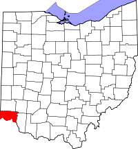 | |
| Villages | ||
| Townships | ||
| CDPs |
| |
| Other unincorporated communities | ||
| Footnotes | ‡This populated place also has portions in an adjacent county or counties | |
