Aguinaldo Highway
| Aguinaldo Highway | |
|---|---|
| Radial Road 1 | |
 | |
|
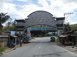
Aguinaldo Highway looking south towards Nueno Avenue in Imus | |
| Route information | |
| Length: | 41.4 km (25.7 mi) |
| Component highways: |
|
| Major junctions | |
| North end: | Alabang–Zapote Road in Las Piñas, Manila-Cavite Expressway in Bacoor |
| South end: | Tagaytay-Nasugbu Road in Tagaytay |
| Location | |
| Major cities: | Las Piñas, Bacoor, Imus, Dasmariñas, Tagaytay |
| Towns: | Silang, Alfonso, Nasugbu, Tuy, Balayan |
| Highway system | |
| Highways in the Philippines | |

The Aguinaldo Highway also known as Cavite-Batangas Road and Manila West Road is a 6-lane, 41-kilometre (25 mi) highway passing through the busiest towns and cities of Cavite, Philippines. It is the busiest and most congested of the three major highways located in the province, the others are Governor's Drive and Antero Soriano Highway.

The northern terminus of the highway is at Las Piñas in Metro Manila. It then travels along Bacoor, Imus, Dasmariñas, Silang, and then ends at Tagaytay.
The highway is named after General Emilio Aguinaldo, the country's first President.
Route description
Aguinaldo Highway starts as a continuation of Diego Cera Avenue at Zapote Bridge. It crosses and becomes a 6-lane road past Molino Boulevard which leads to Molino, and Aguinaldo Boulevard, which connects with Manila-Cavite Expressway. It then intersects with Tirona Highway that leads to Kawit and Cavite City. It then passes Imus and enters Dasmarinas, where it reduces to a 4-lane road and sometimes becoming a divided highway at some portions. Afterwards, it then intersects with Governor's Drive at Palapala.
Past Palapala, it begins its climb to Tagaytay, passing Silang and then enters Tagaytay. At Tagaytay Rotunda, it intersects with Tagaytay-Calamba Road, which connects with Santa Rosa-Tagaytay Road to Santa Rosa) and Tagaytay-Talisay Road, a zigzag road running downslope to Talisay. The highway soon continues westbound as a segment of Tagaytay-Nasugbu Road to Nasugbu via Palico. Tagaytay-Nasugbu Road from Tagaytay Rotunda to Mendez Crossing is signed as Aguinaldo Highway. It passes near Our Lady of Lourdes Parish, Leslie's, Josephine, Robinsons Summit Ridge, Sky Ranch, and Taal Vista Hotel before it ends at Mendez Crossing.
List of Intersections (Southbound)
| KM | Intersection | Location | Route description |
|---|---|---|---|
| 14 | Alabang–Zapote Road (Longos flyover Northbound) | Las Piñas | Leads to Alabang-Zapote Road that passes through Las Piñas all the way up to CAVITEx |
| Molino National Road Junction (Northbound) | Bacoor | Left goes to Molino National Road that leads to eastern Bacoor, Daang Hari Boulevard and to Barangays Molino and Paliparan. Right goes to Real Street (Gen. E. Evangelista Road) where you can find the Bacoor Municipal Grounds. | |
| 13 | Las Piñas-Talaba Junction | Right goes to Manila-Cavite Expressway (CAVITEx). | |
| Molino Blvd./Mayor E.S. Gabriel Road | Right goes to Brgy. Mambog and Bayanan | ||
| 15 | Niog Road (Fabian St.) Junction (Northbound) | Right goes to Real Street, left goes to Barangay Molino, Palico and Mambog. | |
| 17 | Daniel Tirona Highway Junction (Southbound) | Tirona Highway goes to the Centennial Road and the Antero Soriano Highway in Tanza, Cavite. SM City Bacoor is the most prominent structure that can be found in the junction. | |
| 19 | |||
| Buhay na Tubig Road Intersection | Imus | Right goes to Brgy. Buhay na Tubig leading to Bahayang Pag-Asa Subd. upit ends to Daang Hari Road in Brgy. Pasong Buwaya, Imus. | |
| Salinas-Palico-Mambog Intersection | Right goes to Palico Daanan Road that is connected to Salinas Road going to Barangay Mabolo in Bacoor. Left goes to Mambog Road that leads to Barangay Bayanan, also in Bacoor. | ||
| 20 | Nueno Avenue Junction | This road goes to the city proper of Imus. The Lumina Point Mall is located at this junction. | |
| 22 | Patindig Araw/Palanas Road Junction | Turning right goes to Barangay Bayan Luma, Bucandala and Alapan. Turning left goes to Anabu Road going to Brgys. of Salitran and Burol, and end in Buhay na Tubig Road in Barangay Buhay na Tubig. | |
| 25 | Daang Hari Road Intersection | Turning right goes to Barangay Malagasang and the road ends in C.M. Delos Reyes Avenue in General Trias, Cavite. Going left goes to SM Center Molino, eastern Bacoor and Muntinlupa. District mall, the first Ayala Mall in Cavite, is located in this intersection. | |
| 27 | |||
| 28 | Salitran Road Junction | Dasmariñas | Left goes to Barangay Salitran, The Orchard Golf & Country Club, Barangay Salawag, then the road ends in Molino National Road. Central Mall Dasmariñas is located at this junction. |
| 31 | Congressional Road Intersection | Left goes to De La Salle University Dasmariñas, DLSU Medical Center, De La Salle Health Sciences Institute, SM Marketmall Dasmariñas and the Dasmariñas Resettlement Area. Right side goes to the Dasmarinas City Proper. Waltermart Dasmariñas is located in this busy intersection. | |
| 32 | Don Placido Campos Ave. Intersection | Right goes to the City proper of Dasmariñas. | |
| Ramona Tirona Ave. Junction | Left goes to Via Verde and Southcrest Subd. in Brgy. San Agustin 2 and Summerwind Village 4 in Brgy. Burol Main, this is an alternative road leading to Dasmariñas Resettlement Area via Anabu Road. | ||
| 34 | Governor's Drive Intersection | The Governor's Drive is the second main highway traversing the province. It is the widest among the three major highways. Left goes to Carmona, GMA, Laguna Province and South Luzon Expressway (SLEX). Right goes to Trece Martires, General Trias, Naic and Indang. SM City Dasmariñas, Robinsons Place Dasmariñas, Terazza Dasma, Dasmariñas Commercial Complex and Grand Terminal are all located here in this intersection. Barangay Sampaloc 1 (Pala-pala), where the intersection is located, is the Central Business District (CBD) of Dasmariñas. | |
| Pala-pala Road Junction | This is an alternative diversion road going to Governor's Drive (Eastbound) whenever heavy traffic builds-up at the main intersection. | ||
| 39 | |||
| 41 | Jose Rizal Avenue Intersection | Silang | Left (north end) goes to Silang Town Proper and south end goes to Amadeo and Indang. |
| 44 | Silang-Banaybanay Road Intersection | ||
| 53 | Buho-Amadeo Road Junction | Right goes to Amadeo, few steps away from in Silang-Amadeo boundary. | |
| 54 | |||
| 56 | Tagaytay Rotunda | Tagaytay | This is the southern terminus of the highway. Right goes to Tagaytay City Proper, Mendez, Alfonso in Cavite and Nasugbu in Batangas. Left goes to People's Park in the Sky, Tagaytay Highlands, Santa Rosa in Laguna via Tagaytay-Santa Rosa Road and Calamba and Tanauan, also in rotonda located a bronze statue of late Senator Ninoy Aquino. |
Tagaytay-Nasugbu Road/Palico-Balayan Road
| KM | Intersection | Location | Route description |
|---|---|---|---|
| 56 | Tagaytay Rotunda | Tagaytay | |
| 58 | Mahogany Ave. Intersection | Right goes to the City proper of Tagaytay, Mahogany Beef Market (also known as Jose Rizal Ave.) | |
| 59 | Tagaytay-Amadeo Road Junction | Right goes to City Hall of Tagaytay and Amadeo town, Sky Ranch Tagaytay is located in this junction | |
| 61 | Mahogany Ave. Intersection | Right goes to the City proper of Tagaytay, Mahogany Beef Market (also known as Jose Rizal Ave.) | |
| 63 | Mendez Crossing Junction | Right goes to the towns of Mendez-Nuñez and Indang | |
| 64 | Maglabe Drive Junction | Right goes to the towns of Mendez-Nuñez and Indang | |
| 65 | |||
| 66 | Luksuhin Road Junction | Alfonso, Cavite | Right goes to Barangay Luksuhin, Mangas and the Town Proper of Alfonso as well leading to the town of Maragondon, Cavite |
| 72 | Amuyong Road Junction | Right goes to Barangay Amuyong, Kaytitinga and Sinaliw, also serves as road leading to the towns of Magallanes and Bailen. | |
| 74 | Diokno Highway Junction | Left goes to the towns of Laurel, Lemery and Calaca, this road is near the boundary of the Province of Cavite and Batangas | |
| 83 | Palico-Nasugbu Road Junction | Nasugbu, Batangas | Right goes to the towns of Lian and Nasugbu town proper |
| 87 | |||
| 92 | J.P. Rizal Ave. (Tuy) Junction | Tuy, Batangas | Left goes to the town proper of Tuy |
| 100 | |||
| 106 | Balayan Rotonda | Balayan, Batangas | Left goes to the towns of Lemery, Calaca, Taal, and leading to Batangas City, Right goes to the town of Calatagan. |
See also
- Transportation in the Philippines
- Department of Public Works and Highways (Philippines)
- Roxas Boulevard
- Manila-Cavite Expressway
External links
| Wikimedia Commons has media related to Aguinaldo Highway. |
Coordinates: 14°17′4″N 120°57′35″E / 14.28444°N 120.95972°E