List of named corners of the Snaefell Mountain Course

The Snaefell Mountain Course, a motorsport racing circuit that was once part of Grand Prix motorcycle racing, has more than 60 named corners, bends, straightaways, and other features. Unlike the closed-circuit race tracks now used in all Grand Prix championship races,[note 1] the course runs 37.73 miles (60.72 km) almost-entirely along public roads of the Isle of Man.[note 2]
This list includes prominent corners and other landmarks along the course with names that are used in media coverage and by racers, spectators, and administrators.
The number of turns in the course is subject to debate. All agree that there are more than 200; a 2011 report asserted there are 264 turns.[1] Some of the curves, S-bends, turns at crossroads, and other features in the course would not seem significant to car drivers in public traffic, while they are very significant for high-speed racers. 133.962 mph (215.591 km/h) is the highest average speed over one lap of the course that has been attained, by Michael Dunlop on 10 June 2016.[2] At jumps where most motorcycle racers clear off the ground, drivers of cars at slow speeds might not even notice a bump. At each corner, racers must adjust their entering speed, focus on their pre-planned line, lean according to the nature of the turn, and anticipate accelerating, decelerating, turning again, or otherwise handling their vehicles as needed while coming out of the turn.
During race season there are marker boards, first introduced as banners in 1921,[3] posted in advance of major turns bearing these names that inform practice racers and during races may remind racers what is coming. The turns aren't labelled by numbers as done on other short racing circuits.
Spectators also focus on named corners and other landmarks beside the course; many of the best vantage points are at turns where racers can be better-seen as they slow down. As a guidebook for visitors to the Isle of Man describes:
Spectators gather all around the course at locations which have become part of road-racing history: Bray Hill, Quarter Bridge, Ballacraine, Laurel Bank, Baaregarrow, Ballaugh Bridge, Quarry Bends, Sulby Straight, Ramsey Hairpin, Gooseneck, Verandah, 32nd Milestone, Windy Corner, Kate's Cottage, Creg-ny-Baa, Hillberry, Signpost, Governor's Bridge.[4]
Naming Practices
While there exist named turns in other racing circuits, naming of corners and other turns elsewhere is usually less salient. For example, there is the notable "Dunlop Curve" of the 24 Hours of Le Mans' automobile race circuit and motorcycle race circuit. But the turns in many courses are primarily referred to by numbers, e.g. turns of the 1909-built Indianapolis Motor Speedway in the U.S. are referred to as Turn 1 through Turn 4. The Snaefell Mountain Course is one of the longer racing circuits and has more turns.
In common with corners on other circuits that are named, many are named after champion racers, and examples in the Snaefell course are Joey's Corner at the 26th Milestone, posthumously-named there to commemorate the 26 racing victories by racer Joey Dunlop on this course prior to his death racing in Estonia, and Hailwood's Rise/Hailwood's Height, named after famous rider Mike Hailwood, killed in a road traffic accident in central England. A change to the naming-convention occurred in 2013 when McGuinness's and Molyneux's were named in honour of living rider John McGuinness and sidecar driver Dave Molyneux, ranking second and third in the tally of TT race wins.[5]
Some corners in the Snaefell course are named for riders who suffered accidents at the corner or nearby: Doran's Bend after Bill Doran and Brandish Corner, after Walter Brandish. Others refer to the corner's physical shape: Verandah, The Nook. More take names of nearby artificial or natural landmarks: Creg-ny-Baa (a pub), Tower Bends, Bray Hill. Landmark-based names may continue to be used long after their namesake is gone: Keppel Gate, Signpost Corner.
.svg.png)
The roads serve two-way public traffic for most of the year, and are closed during practice times and races. For the entire racing season of several weeks in May/June and August/September, the mountain portion of the course (from Ramsey to Douglas) is restricted to one-way in the race direction, and parking is prohibited from various areas.[6] These and other provisions allow inexperienced racers and visiting motorcyclists to learn the corners and informally practice on the course.
The following is a partial list of named corners and other landmarks along the course. Turns described as left- or right-handers assume that travel is in the race direction, which is clockwise around the circuit.
Named corners
| Corner Mileage |
Photo | Location | Notes |
|---|---|---|---|
| Startline 0.00 |
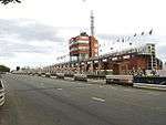  |
On A2 Glencrutchery Road, high-above Douglas Bay at a height of 280 ft (85 m) above sea level,[7] 54°10′4″N 4°28′41″W / 54.16778°N 4.47806°W |
Grandstand complex developed in 1985/1986, replacing the earlier 1926 version.[8] Concourse with pre-race assembly area/Parc Ferme, start/finishline, spectator seating, scoreboard, race control, pit lane with re-fuelling, exit with acceleration lane, scrutineering, post race podiums, retailing, hospitality, exhibitions.[9] |
| St Ninian's Crossroads 0.29 |
 .jpg) |
On A2 (Ramsey to Douglas road) multi-junction, location of first permanent traffic signals in Isle of Man. 54°09′54″N 4°29′01″W / 54.16500°N 4.48361°W |
At St. Ninian's Church (dedicated to Ninian of Whithorn). Close to the startline, a left-jink needing careful machine placement for the racing line into the Bray Hill descent. Taken very fast on a flying lap [i.e., without stopping at the pits for running repairs, refuelling and/or tyre(s)] |
| Bray Hill 0.64 |
 |
On A2 (Ramsey to Douglas road) 54°09′42″N 4°29′23″W / 54.16167°N 4.48972°W |
Very steep descent soon after the startline, with a slight curve, a sudden bottoming-out and a subsequent steep rise up another slightly curving hill. The physics of it causes bikes to unload suspension after the base compression at 160 mph |
| Quarterbridge Road 0.79 |
 |
On A2 (Ramsey to Douglas road), after multi side-road junction, Bray Hill becomes Quarterbridge Road 54°09′39″N 4°29′30″W / 54.16083°N 4.49167°W |
After the bottom of Bray Hill, a subsequent steep rise (previously known as Brown's Hill)[10] causes modern race machines to wheelie[11] up a stretch now famously known as "Ago's leap" (after 1960s-70s Italian race-ace Giacomo Agostini)[12][13] and then crowning-out to a flat area, historically one of several startlines for early racing, with machines assembled in Selborne Drive side-turning.[14] Road surface was altered after Ago's departure (early 1970s) but machines are now twice as powerful (100 bhp/200 bhp) with larger engines than were allowed in World Championship racing. Followed by a steep descent and the first heavy-braking area of the lap at Quarter Bridge |
| Quarterbridge 1.26 |
 |
Road junction of A2 Quarterbridge Road and A1 Peel Road 54°09′21″N 4°30′06″W / 54.15583°N 4.50167°W |
Also known as Quarter Bridge, a tight right turn on the course at a major junction with a traffic roundabout. At the bridge spanning the River Glass, at boundary of the historic "quarterlands" of Ballabrooie and Ballaquayle. Historically one of several startlines of early car racing. |
| Braddan Bridge 1.70 |
  |
'S' bend and junction with two staggered side-roads on A1 Peel Road 54°09′41″N 4°30′20″W / 54.16139°N 4.50556°W |
Second heavy-braking point on the lap, 'S' bend to left then right, at a bridge spanning the River Dhoo and former railway line, which has been converted to provide access under course during race closures.[15][16] Seated viewing in church land. Historically one of several viewing areas within walking distance of visitors passing through Douglas town centre ferry terminal. |
| Snugborough 2.4 |
On A1 Peel Road with side-turn junction leading to industrial estate 54°10′01″N 4°30′59″W / 54.16694°N 4.51639°W |
Dip in road on approach to Union Mills | |
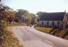
| Union Mills 2.7 |
 |
On A1 Peel Road with staggered side-turn junctions Cronk Road and A22 Strang Road 54°10′07″N 4°31′20″W / 54.16861°N 4.52222°W |
Several curves passing through a large residential village |
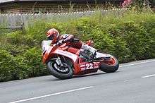
| Ballagarey Corner 3.75 |
 |
On A1 (Douglas to Peel Road) 54°10′26″N 4°32′58″W / 54.17389°N 4.54944°W |
Very fast right-curve, slang-term Ballascarey. Scene of two crashes in 2010, Guy Martin and New Zealander Paul Dobbs (who died). Named after Manx: Bailey ny liargee - farm of the slope[17] |
| Glen Vine 3.9 |
On A1 Peel Road with side-turn junction A26 54°10′40″N 4°33′20″W / 54.17778°N 4.55556°W |
Passing through a small residential village before Crosby | |
| Crosby Crossroads 4.81 |
 |
On A1 Douglas to Peel road, with side-junctions A23 and B35. 54°11′01″N 4°33′55″W / 54.18361°N 4.56528°W |
In the village of Crosby, population approximately 900. |
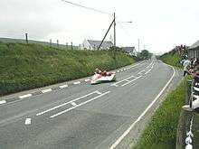
| The Highlander 5.1 |
 |
On A1 Peel Road 54°11′25″N 4°34′53″W / 54.19028°N 4.58139°W |
Long straight, passing by former coaching house and pub (closed), through one of the fastest parts of the course, previously a speed-trap location.[18] |
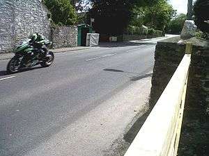
| Greeba Castle and Greeba Bridge 5.8 and 6.3 |
 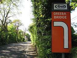 |
On A1 (Douglas to Peel road) 54°11′35″N 4°35′20″W / 54.19306°N 4.58889°W 54°11′48″N 4°36′19″W / 54.19667°N 4.60528°W |
Greeba Castle, a period-style large residence, closely followed by Greeba Bridge name derived from Scandinavian: Gnipa, a peak. Previously known as Cronk Dhoo.[19] In an area of farmland. Nearby summits include Beary Mountain (311m), Greeba Mountain (422m), Slieau Ruy (479) and Slieau Whallian (333m). |
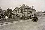
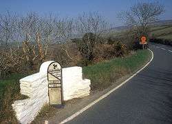
| Ballacraine 7.65 |
 |
Junction of A1 and A3 (Castletown to Ramsey road) 54°12′10″N 4°37′34″W / 54.20278°N 4.62611°W |
Right-hand turn onto the A3 at a cross-road junction. At east end of St. Johns village, with Ballacraine farm on the inside of the turn and the former Ballacraine Arms (Hotel), a former public house, across the corner.[20] |
| Doran's Bend 8.44 |
On A3 (Castletown to Ramsey) road 54°12′43″N 4°37′52″W / 54.21194°N 4.63111°W |
Named after Bill Doran, who crashed and broke a leg here during practice for the 1950 Isle of Man TT races, and who again crashed near here two years later, in practice for the 1952 Isle of Man TT, putting him out of that set of races, too. | |
| Laurel Bank 8.75 |
On A3 Castletown to Ramsey Road 54°13′3″N 4°37′57″W / 54.21750°N 4.63250°W |
Fast right-hand turn[21] (Manx: Cronk-y-Killey)[22] | |
| Black Dub 8.800 to 9.30 |
 |
On A3 Castletown to Ramsey road 54°13′16″N 4°37′32″W / 54.22111°N 4.62556°W |
Leading on from Laurel Bank, a left then right followed by another long sweeping left-hander into Glen Helen. Now a resrticted (non-viewing) area. Named after the dark, boggy area close by the adjacent river-valley |
| Glen Helen 9.60 to 9.90 |
  |
On A3 Castletown to Ramsey road 54°13′33″N 4°37′02″W / 54.22583°N 4.61722°W |
Leading on from Black Dub, through the sweeping left-hander at Glen Helen and uphill towards Sarah's and Creg Willey's |
| Sarah's Cottage 9.93 |
 |
on A3 Castletown to Ramsey road 54°13′40″N 4°37′12″W / 54.22778°N 4.62000°W |
After Glen Helen, Sarah's is a right-turning bend at a small stone cottage on the outside of the bend, half-way up Creg Willey's Hill leading to Lambfell. Named after the "Sarah" who, c.1900, lived there and served refreshments for travellers. |
| Creg Willey's 10.00 |
on A3 Castletown to Ramsey road 54°13′47″N 4°37′08″W / 54.22972°N 4.61889°W |
Although the hill starts at Glen Helen, Creg Willey's is the name given to a steep climb after the right-turn at Sarah's, leading to Lambfell. Some confusion about the etymology which could be a corruption of Creg Willy Syl. Also quoted as "Creg Willies Hill".[23] Creg Willy's Hillclimb event starts just before Glen Helen and ends after the hill tops-out on the straight. | |
| Lambfell 10.23 |
 |
on A3 Castletown to Ramsey road 54°13′49″N 4°37′07″W / 54.23028°N 4.61861°W |
Right/left curve after Creg Willey's before the Cronk-y-Voddy Straight. AKA Lambfell Cottage and (the area) Lambfell Moar |
| Cronk-y-Voddy Straight 10.75 |
 |
on A3 Castletown to Ramsey road 54°14′17″N 4°36′37″W / 54.23806°N 4.61028°W |
Cronk-y-Voddy Straight – very fast but bumpy and undulating[23][24] |
| Molyneux's 11.03 |
 |
on A3 Castletown to Ramsey road 54°14′29″N 4°36′23″W / 54.24139°N 4.60639°W |
Right hander at the end of Cronk-y-Voddy straight, with nearby road-sign indicating the preceding small cross-road side junctions, Little London Road and Ballabrooie Road, providing spectator-parking. Named in 2013 after multi-TT winning sidecar racer Dave Molyneux[5] |
| 11th Milestone 11.49 |
 |
On A3 (Castletown to Ramsey) road 54°14′43″N 4°35′48″W / 54.24528°N 4.59667°W |
A distinctive S-bend, also known as "Drinkwater's Bend",[25] named after Ben Drinkwater who crashed fatally at this point during the 1949 350 cc Junior TT Race. |
| McGuinness's 12.45 |
Left hander before the top of Barregarrow on the A3 | Named in 2013 after multi-TT winning rider John McGuinness[5] | |
| Barregarrow 12.75 |
  |
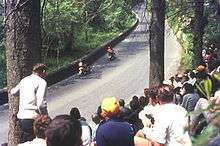
From top of "Barregarroo hill" on the A3 Douglas road; crossing C4 (Ballaleigh Road). | Crossroads before chapel and steep hill. Also spelt Barregarroo and otherwise, after Manx name "Bayr Garroo" meaning Rough Road, commonly pronounced "B'Garrow". A popular vantage point with limited viewing. |
| Rhencullen 14.90 |
 |
On A3 (Castletown to Ramsey) road 54°17′31″N 4°34′36″W / 54.29194°N 4.57667°W |
A series of four curves, name equates to Holly Ridge. |
| Birkin's Bend 15.26 |
 |
On A3 (Castletown to Ramsey) road 54°17′34″N 4°34′41″W / 54.29278°N 4.57806°W |
Named after racer Archie Birkin who was killed from crash here, when avoiding a fish-van, during practice for the 1927 Isle of Man TT. From 1928 on, public roads were closed for practice runs. No longer a clear turn due to roadway changes; part of the Rhencullen series of four bends. |
| Dub Cottage 16.21 |
 |
On A3 (Castletown to Ramsey) road 54°18′14″N 4°33′48″W / 54.30389°N 4.56333°W |
|
| Ballaugh Bridge 17.20 |
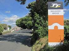 |
Bridge at junction of C37 Ballaugh Glen Road and A10 (Ballaugh Station Road) 54°18′34″N 4°32′28″W / 54.30944°N 4.54111°W |
Only remaining hump-backed bridge on the course, since removal of Ballig Bridge in 1935.[26] |
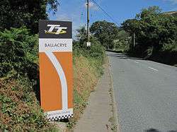
| Ballacrye Corner 17.84 |
|
A3 (Castleton to Ramsey road) 54°18′40″N 4°31′36″W / 54.31111°N 4.52667°W |
"Ballacrye" derives from Manx: McCray or Cry's farm.[27] There's a drop in the road here that makes a jump—many racing motor-cycles lift off into the air—said to be the fastest and most dangerous jump on the course. Spectators are not allowed there, but television cameras placed below the jump show it well.[28] |
| Quarry Bends 18.46 |
 |
On A3 54°18′56″N 4°30′48″W / 54.31556°N 4.51333°W |
A complex of bends. A small railway siding off the Manx Northern Railway built in 1879 to serve Clarke's stone quarry at Ballavolley crossed the road here at Close e Volley, later renamed Quarry Bends.[29] |
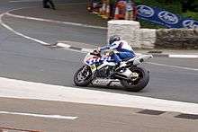
| Sulby Straight 19.16 |
 |
On A3 54°19′08″N 4°29′24″W / 54.319°N 4.490°W |
1.5-mile (2.4 km) straight through Sulby, Isle of Man village. Racer Bruce Anstey reached 206 mph (331.51 km/h) here during practice for the 2006 Isle of Man TT,[30] which in 2015 remains the unofficial speed record on the racecourse and for the Isle of Man. He won the Superstock TT that year, and held the course lap record during 2014–2015. |
| Sulby Bridge 20.13 |
On A3 54°N 4°W / 54°N 4°W |
A wide 90-degree right turn at the end of Sulby Straight, exiting flat then with a slight rise climbing towards Ginger Hall | |
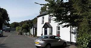
| Ginger Hall 20.30 |
 |
On A3 (Lezayre Road) 54°19′16″N 4°28′16″W / 54.321°N 4.471°W |
Climbing left-hander at the Ginger Hall Hotel, named after the ginger beer once brewed and served there. A popular vantage point with parking and refreshments leading to Kerrowmoar . |
| Kerrowmoar 20.62 |
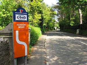 |
On A3 (Lezayre Road) 54°19′15″N 4°27′45″W / 54.32083°N 4.46250°W |
Complex of bends through countryside. |
| Glentramman |
On A3 (Lezayre Road) 54°19′05.1″N 4°25′57.8″W / 54.318083°N 4.432722°W |
Medium-speed left-hand bend between Glen Duff and Churchtown, scene of a number of racing incidents. | |
| Lezayre (Churchtown) 22.70 |
.jpg) .jpg) |
On A3 (Lezayre Road) 54°19′08″N 4°25′25″W / 54.31889°N 4.42361°W |
Complex of curves leading into Ramsey outskirts, adjacent to small side-road junctions and Churchtown War Memorial for locals fallen in the First and Second World Wars. Popular spectator vantage point. |
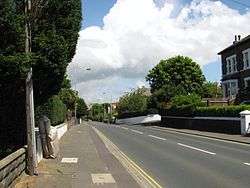
| School House Corner 23.50 |
 |
on A3 (Lezayre Road), a left curve beyond a straight adjacent to the school premises with pedestrian overbridge 54°19′14″N 4°23′37″W / 54.32056°N 4.39361°W |
Name derives from the nearby Ramsey Grammar School and was formerly known as Russell's Corner after Benjy Russell[31] who crashed fatally during the Lightweight Race for the 1949 Manx Grand Prix.[32] |
| Parliament Square |  |
A3 (Lezayre Road) 54°19′20″N 4°23′12″W / 54.32222°N 4.38667°W |
A hard right-hander after fierce braking into the central square and multi-road junction in the town of Ramsey, closely followed by a medium left-hander heading out of the square along Queen's Pier Road |
| Queen's Pier Road and May Hill |  |
A18 Queen's Pier Road/May Hill | Queen's Pier Road at slightly above sea level 24 ft (7.3 m),[7] joining with May Hill starting to climb,[33] heading out of the town of Ramsey towards Cruickshank's Corner |
| Cruickshank's Corner |
 |
A18 Queen's Pier Road/May Hill | Right curve on A18 Queen's Pier Road at multi-junction where A18 becomes May Hill, slightly uphill leading out of the residential area on the outskirts of Ramsey |
| Whitegates | A18 May Hill/Hughenden Terrace 54°19′01″N 4°23′01″W / 54.31694°N 4.38361°W |
Whitegates, a left-hander heading out of the town of Ramsey towards Stella Maris | |
| Stella Maris 24.00 |
 |
A18 May Hill 54°18′53″N 4°23′00″W / 54.31472°N 4.38333°W |
Sweeping right-curve,[34] climbing to the very outskirts of the Ramsey settlement, closely preceding the Hairpin |
| Ramsey Hairpin 24.54 |
 |
A18 Mountain Road 54°18′49″N 4°23′01″W / 54.31361°N 4.38361°W |
Hairpin curve at Ballacowle Glen in the outskirts of the town of Ramsey |
| Waterworks 25.94 |
On A18 Mountain Road 54°18′47″N 4°22′35″W / 54.31306°N 4.37639°W |
Two right-handers after Ramsey Hairpin whose name derives from the nearby Ballure Reservoir, was built in 1859 and extended in 1884.[35] | |
| Tower Bends 25.10 |
 |
On A18 Mountain Road54°18′29″N 4°22′52″W / 54.30806°N 4.38111°W | S-bend corner. Named after 45-foot granite and slate tower on Albert's Mount up to the east, at location where, in 1847, Albert, Prince Consort climbed up to see the view, on excursion from the Royal Yacht HMY Victoria and Albert. Queen Victoria remained on board.[36] |
| Gooseneck 25.96 |
 |
A18 Mountain Road 54°18′17″N 4°22′51″W / 54.30472°N 4.38083°W |
Right-turn, climbing corner that is a popular vantage point, as spectators can be very close to the riders.[37] Fatal accidents in 1955[38] and 1994.[38] occurred coming into and out of this corner. |
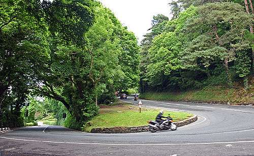
| 26th Milestone 26.15 |
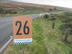 |
A18 Mountain Road 54°18′04″N 04°23′37″W / 54.30111°N 4.39361°W |
Also known as Joey's, named after 26-time-race-winner Joey Dunlop. Site of 2007 crash killing 1 rider and 2 spectators (the only spectators ever killed on the course). |
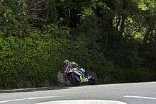
| Verandah 29.80 |
On A18 Mountain Road 54°15′45″N 4°26′57″W / 54.26261°N 04.449246°W |
Series of four bends, a relatively flat section at a height of 1300 feet (396 metres) at 30 miles around the circuit,[39] before climb resumes at The Bungalow. Road follows contour of slope down from mount Snaefell to the right, with long drop-off to the left, and one irregular corner. In the 1934 Isle of Man TT Lightweight Race, Syd Crabtree, a previous race winner, went over the edge in fog here and was killed.[40] Fatal accident of Gilberto Parlotti, race-leader of a 1972 Isle of Man TT race,[41] contributed to the demise of Isle of Man TT being used for world championship races.[42][43] | |
| The Bungalow 30.93 |
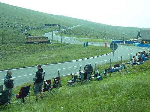 |
Junction of A18 (Snaefell Mountain Road) and A14 (Sulby Glen Road) and the road-tramway crossing for the Snaefell Mountain Railway 54°15′04″N 4°27′47″W / 54.25111°N 4.46306°W |
Left then right corners, where course crosses tramway of the Snaefell Mountain Railway.[44] Vantage point including tramway station, cafe, and a pedestrian bridge over the course. Dominated by Snaefell (elevation of 2036 feet (621m) and other summits. Named after a former Swiss Chalet-style hotel there, the Bungalow Hotel. |
| Hailwood's Rise 31.00 |
.jpg) |
On A18 Mountain Road 54°14′55″N 4°27′53″W / 54.24861°N 4.46472°W |
Hailwood's Rise is the incline leading from the 'S' bend and pedestrian overbridge at the Bungalow towards Hailwood's Height, both named in memory of Mike Hailwood, the former world champion racer who died after a road car crash in 1981. |
| Hailwood's Height 31.56 |
On A18 Mountain Road near the B10 road junction 54°14′36″N 4°28′12″W / 54.24333°N 4.47000°W |
Hailwood's Height is a small area with an informal Memorial bench close to the highest point of the course measuring 1,385 feet (422 m) above sea level named in memory of Mike Hailwood, the former world champion racer who died after a road car crash in 1981. | |
| Brandywell 31.65 |
 |
On A18 Mountain Road at (or near?) B10 road junction 54°14′34.2″N 4°28′10.2″W / 54.242833°N 4.469500°W |
A left-curve. Its name originates from a nearby water-well that was used by local shepherds to brand and sort flocks of mountain sheep.[45] The area has a stone shelter and an Isle of Man Department of Transport Weather Station.[46] |
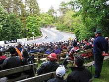
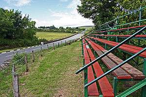
| 32nd Milestone 32.07 |
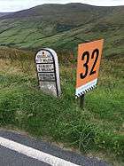  |
On A18 Mountain Road 54°14′07.8″N 4°28′27.5″W / 54.235500°N 4.474306°W |
One of the more-famous named vantage points, spectators can watch from behind the elevated field-fencing on the left hand (outside) of the course.[4] 32nd or "Dukes" (in honour of English-born former racer turned Manx-domiciled businessman Geoff Duke, OBE)[47] is a sweeping series of three sharp left hand bends on the high speed descent from Brandywell to the infamous right-hander at Windy Corner. The race Marshals' stone shelter is on the left side of the course at the centre of the complex. |
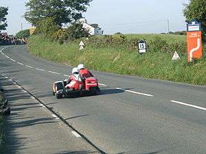
| Windy Corner 32.53 |
 |
On A18 Mountain Road 54°13′50.4624″N 4°28′12.302″W / 54.230684000°N 4.47008389°W |
Righthander in open area. Prevailing wind, often strong and sometimes gusty, is channeled up a gully on the left (east). For spectators, the wind "whistles up your trouser-leg as you stand on the corner watching the riders hurl their bikes through the right-hander".[48][49][50][51][52] |
| Keppel Gate 33.79 |
 |
A18 Mountain Road 54°12′50″N 4°28′47″W / 54.21389°N 4.47972°W |
A bend to the left.[53][54] Early on, the course along here was "little more than a cart and horse track" with gates between farm fields. Keppel Gate was a gate across the road to restrict sheep. Another sheep-gate was at Kate's House (54°12′40″N 4°28′38″W / 54.21111°N 4.47722°W), itself a well-known landmark, just past. In early years, "[i]t was the duty of the first rider round in the morning to open all the gates along the way, with the last rider responsible in shutting them."[55] |
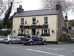
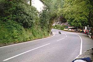
| Creg-ny-Baa 34.52 |
 |
Junction of A18 with secondary B12 Creg-ny-baa Back Road. 54°12′24″N 4°28′07″W / 54.20667°N 4.46861°W |
Right-turn corner, at the Keppel Hotel and its Creg-ny-Baa pub. Creg-ny-Baa means "Manx: rock of the cow."[56] One of three official "fanzones" with temporary grandstands and facilities is placed here.[55] One of the most photographed views on the course is from here, back up a long straightaway from Kate's Cottage. |
| Gob-ny-Geay 34.92 |
A18 54°11′59″N 4°28′30″W / 54.19972°N 4.47500°W |
Right-jink in a very fast downhill straight at the 35th Milestone,[57][58] halfway between the corners at Creg and Brandish. Previously a site for speed-trap,[59] can be spelt differently, e.g., Gob-y-Geay, Gob-na-Geay, Gobnageay | |
| Brandish Corner 35.41 |
 |
A18 much improved in recent years 54°11′44″N 4°28′40″W / 54.19556°N 4.47778°W |
Named after Walter Brandish who crashed, breaking a leg, in the right-hand gutter here while trying to pass a competitor, during practice for the 1923 Isle of Man TT |
| Hillberry Corner 36.00 |
  |
At A18 Mountain Road junction with C22 Little Mill Road 54°11′16″N 4°28′32″W / 54.18778°N 4.47556°W |
The run downhill from Brandish bottoms-out at Hillberry, before heading steeply uphill towards Cronk-ny-Mona. Once the location of startline for automobile races, including the 1908 Tourist Trophy race for racing automobiles on the Four Inch Course. An iron-framed spectators' grandstand remains at the site. |
| Cronk-ny-Mona 36.32 |
 |
A18 54°11′00″N 4°28′33″W / 54.18333°N 4.47583°W |
A steep hill following on from Hillberry topping out with sweeping left hand bend. The hill interrupts the descent from Snaefell Mountain, which resumes at the next vantage point, the right turn at Signpost Corner starting the run down into the outskirts of Douglas town |
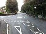
| Signpost Corner 36.67 |
|
A18 (Hillberry Road), A18 Sheading Bdy(?), B11(?) Hillberry becomes Avondale Road(?) |
Right turn corner. When a rider passed, observers at a signal station here would telephone ahead to an official in the TT Grandstand area, who would switch on that rider's individual scoreboard light. This warned pit-crew and race-officials that the rider has passed Signpost Corner and may shortly be pulling into the pit lane at the TT Grandstand to refuel.[60] |
| Bedstead Corner 36.90 |
 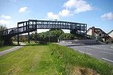 |
On A18 Bemahague Road from Signpost, the left-hander at Bedstead (with pedestrian overbridge) leads to a small side-junction accessing the The Nook 54°10′38″N 4°28′17″W / 54.17722°N 4.47139°W |
Bedstead Corner and the general area between Signpost Corner and Governor's Bridge was rural through agricultural countryside, developed c. 1990–2015 into large-scale housing/support infrastructure on either side with a recent pedestrian footbridge across,[61] and much improvement to the road/course surface |
| The Nook 37.08 |
  |
From A18 Bemahague Road, a right-turn at a small side-junction leads into Old Bemahague Road, followed by a slight-left and short straight before the Governor's Bridge/Governor's Dip link. Section is racetrack-only avoiding 'new' improved road and junction with modern traffic islands. 54°10′28″N 4°28′07″W / 54.17444°N 4.46861°W |
"The Nook" (Middle English: a corner or recess) is in the approach to the nearby Governor's Bridge road junction and hairpin bends, on a stretch of the original A18 Bemahague Road that the race course still runs through, although the alignment of the modern A18 has been shifted away. |
| Governor's Bridge/Governor's Dip 37.30 |
  |
On Old Bemahague Road, a hard right-turn at hairpin bend with road junction and sudden elevation-drop into Governor's Bridge Dip, followed by a left before exiting with a right from a small, historic side-junction (now an exit-only slip road for race use) to the main A2 Glencrutchery Road |
"Governor's Bridge", a road junction, hairpin bend and bridge over a stream, on a stretch of the original historic course. Traditionally damp and slippery road surface due to overhead tree canopy and little air movement in the dip. |
| Glencrutchery Road 37.5 |
  |
A2 54°10′14″N 4°28′16″W / 54.17056°N 4.47111°W |
The slip-road exiting Governor's Bridge Dip at a height of 265 ft (81 m) above sea-level joins the right-side of the Glencrutchery Road close to the mini-island, a straight run climbing a slight incline, crowning-out at 285 ft (87 m) before the slight descent to the finishing line at the TT Grandstand.[7] |
| Deceleration lane and Return road 38.00 |
A2 54°09′59″N 4°28′52″W / 54.16639°N 4.48111°W |
Notes
- ↑ See Grand Prix motorcycle racing#MotoGP circuits. All 18 circuits in MotoGP 2016 are race tracks.
- ↑ Following road improvements, The Nook and Governor's Bridge near the end of a lap are race-only, otherwise closed to normal traffic.
References
- ↑ Joyce, Gare (May 5, 2011), Man vs. Isle: Get as close as you'll ever come to the world's most deadly motorcycle road race, ESPN
- ↑ (unstated author) (4 June 2016). "Dunlop wins cracking Senior TT". IOM Today. Retrieved 6 June 2016.
- ↑ Motor Cycle 15 June 1967, Diamond TT number, pp.798-801. Flashbacks over 60 years. Howard R. Davies of HRD Motorcycles interviewed by Bob Currie. "Advance warnings for the major bends—by banners across the road—were brought into use in 1921". Accessed 20 June 2015
- 1 2 Trevor Kneale. The Isle of Man. The Pevensey Press. p. 100.
- 1 2 3 Manx Radio 10 April 2013. Retrieved 9 Sept 2015
- ↑ "TT Road Races Traffic Management Provisions 2014" (PDF, within www.isle-of-man.org.im, findable by google search) and "TT Road Races 2015: Roads Closed to the Public"
- 1 2 3 The TT Mountain Course, by Fred Hanks (sidecar driver), p.inside cover. Lucas map of the T.T. course, 1973. Accessed 9 October 2016
- ↑ Manx Grand Prix, 1985 Official programme, p.11 "Grandstands", Peter Kneale. Accessed 1 June 2016
- ↑ IoM TT race regulations 2014 with concourse diagram p.5, pp.14-15, p.26 Retrieved 21 November 2016
- ↑ The Glory of the Manx TT 1907-1975, Bob Currie, 1976, p.8 "A move to the Mountain". New English Library, Accessed 30 May 2015
- ↑ Tourist Trophy 75 - The Story, Fred Hanks (sidecar racer), a TT Special publication, 1975 p.68 [img] "On his record lap, Mick Grant doing a wheelie along Quarter Bridge Road". Accessed 31 May 2016
- ↑ Trial magazine, 18 February 2015. Retrieved 17 July 2015
- ↑ Ago's Leap; 100 Years of the Isle of Man TT at Google Books. Retrieved 18 July 2015
- ↑ Motor Cycle Racing, Peter Carrick, 1970, Hamlyn, p.34 [img] "The machines are assembled for examination and sealing before the start of the 1911 Junior TT". Accessed 30 May 2016
- ↑ TT roads closure notice 2016 Retrieved 1 June 2016
- ↑ TVIM, 28 August 2013, Retrieved 1 June 2016
- ↑ Place Names of the Isle of Man by John Kneen MA page 155 (1970) Yn Cheshaght Ghailckagh The Scolar Press
- ↑ Isle of Man TT, by Charles Deane, 1975, p.39, (a Patrick Stephens publication) "...it's head down behind the screen for the 'flying run' through the speed trap set up outside the Highlander pub. Anything up to 150 mph will be achieved by the big bikes on this extremely fast downhill stretch". Accessed 1 June 2016
- ↑ Place Names of the Isle of Man by John Kneen MA pp396 (1970) Yn Cheshaght Ghailckagh The Scolar Press
- ↑ Per map in Prohibited and Restricted Areas.
- ↑ ttwebsite.com
- ↑ Place Names of the Isle of Man by John Kneen MA pp400 (1970) Yn Cheshaght Ghailckagh The Scolar Press
- 1 2 TT Racing, by Ray Knight, p.28. Creg Willies Hill to Rhencullen. "The Cronk-y-Voddy Straight may be straight but it is anything but flat. Quite apart from the bumps, for good measure this section undulates and you climb three minor hills in the average gradual climb to the Cronk-y-Voddy crossroads". 1974 Speedsport Motobooks, Brentford, England. ISBN 0-85113-078-X Accessed 24 December 2015
- ↑ The TT Mountain Course (second edition), by Fred Hanks p.16 Cronk y Voddy Straight. "Very bumpy, but flat out." 1975, A TT Special publication. Accessed 24 December 2015
- ↑ Harris, Nick. Motocourse History of the Isle of Man Tourist Trophy. p. 58.
- ↑ Isle of Man Weekly Times dated 25 May 1935
- ↑ Place Names of the Isle of Man by John Kneen MA pp454 (1970) Yn Cheshaght Ghailckagh The Scolar Press
- ↑ "Ballacrye TT Isle of Man by martimotos.com". Youtube. 1 September 2013.
- ↑ The British Narrow Gauge Railway No 2c – The Isle of Man Railway Volume III An Outline History of the Isle of Man Railway by James I.C. Boyde page 52 (1996) (1st Edition) The Oakwood Press ISBN 978-0-85361-479-1
- ↑ http://www.motorcycledaily.com/20june06_ttspeed.htm New Isle of Man Top Speed Record (retrieved 12 August 2006)
- ↑ Mona's Herald. 16 September 1947. p. 5. Missing or empty
|title=(help) - ↑ Isle of Man Weekly Times. 15 September 1947. p. 3. Missing or empty
|title=(help) - ↑ The TT Mountain Course, by Fred Hanks (sidecar driver), p.28 "May Hill. The start of the climb...from here, just above sea level, to Brandywell, 1,400 ft in varying degrees of steepness". Accessed 9 October 2016
- ↑ Motor Cycle, 10 September 1964. 'Lightweight Manx Grand Prix report'. p.530 [image caption]: "Heeling into Stella Maris, the right hand sweep on the approach to Ramsey Hairpin"Accessed 2015-07-08
- ↑ Motor Cycle, 10 September 1964. 'Lightweight Manx Grand Prix report'. p.531 [image caption]: "...the winner Gordon Keith heeling his Greeves Silverstone Mark 2 round the second of the two Waterworks bends". Accessed 2015-07-29
- ↑ Webber, David T. (1997). An Illustrated Encyclopedia of the Isle of Man. Revised by Frank Cowin and F.J. Radcliffe. The Manx Experience. p. 12. ISBN 1-873120-25-7.
- ↑ Wright, David (2013). 100 Years of the Isle of Man TT: A Century of Motorcycle Racing. Crowood Press – via Google Books.
- 1 2 Isle of Man Examiner page 6 dated 9 September 1955
- ↑ The Lucas contour map of the T.T. circuit, 1973. Accessed 21 December 2015
- ↑ Bradford, Paul (2008). Isle of Man TT & MGP Memorial 1907–2007. The Copy Shop. p. 18. ISBN 978-0-9560151-0-5.
- ↑ Mona's Herald. 13 June 1972. p. 4. Missing or empty
|title=(help) - ↑ Harris, Nick (1990). Motorcourse History of the Isle of Man Tourist Trophy Races (1st ed.). Hazelton Publishing Graficias Estella SA. p. 148. ISBN 0-905138-71-6.
- ↑ TT News (Preview ed.). Isle of Man Newspapers Ltd; Johnson Press Publishing Bridson & Horrox Publishing Ltd. 2012. pp. 16–18.
- ↑ TT 100 The Official Authorised History of the Isle of Man Tourist Trophy Racing page 26 by Mick Duckworth (2007) Lily Publications Ltd ISBN 1 899602 67 4 - "....At the Bungalow, go in late for the left, or you'll be too far over for the second corner and keep it straight over the tramlines.... The Mountain Course. A lap of the legendary circuit accompanied by the record holder John McGuinness.
- ↑ An Illustrated Encyclopedia of the Isle of Man by David T. Webber, revised by Frank Cowin and F.J. Radcliffe pp 24 (1997) The Manx Experience ISBN 1-873120-25-7
- ↑ Isle of Man Examiner pp4 dated 9 September 2008
- ↑ "IoM TT Official website". www.iomtt.com. Retrieved 2016-01-16.
- ↑ Kneale, Trevor. The Isle of Man. The Pevensey Press. p. 100.
Spectators gather all around the course at locations which have become part of road-racing history: Bray Hill, Quarter Bridge, Ballacraine, Laurel Bank, Baaregarrow, Ballaugh Bridge, Quarry Bends, Sulby Straight, Ramsey Hairpin, Gooseneck, the Verandah, 32nd Milestone, Windy Corner, Kate's Cottage, Creg-ny-Baa, Hillberry, Signpost, Governor's Bridge.
- ↑ "Around the TT". Motorcycle Mechanics: 74. June 1973.
Windy Corner gets its name from the wind that whistles up your trouser-leg as you stand on the corner watching the riders hurl their bikes through the right-hander
- ↑ Duckworth, Mick (2007). TT 100 The Official Authorised History of the Isle of Man Tourist Trophy Racing. Lily Publications. p. 26. ISBN 1-899602-67-4.
... The wind can catch you out approaching Brandywell. It's as well to go in steady and take a classic racing line though, then you have to work hard through a tricky little right. I feel comfortable making the 32nd (Milestone) into three apexes, even though most of the riders say it's two. Windy Corner is okey but since it was altered it's even worse now if it's gusty, because you're banked further over and for longer. Also, I've been caught my knee-slider on the cat's-eyes on the inside of the bend.
- ↑ Higgins, L.R. & Quantrill, C. (1960). A History of the TT Races 1907–1960. BP Publication Jarrold & Sons; Shell Mex & BP Publication. p. 46.
... wind that always blows over the hills from Laxey at this point.
- ↑ TT Special. 3 September 1946. p. 8.
Windy Corner, so called not because riders get the wind up, but because very strong winds blow up from the gully on the left.
Missing or empty|title=(help) - ↑ Isle of Man TT, by Charles Deane, 1975, p.43, (a Patrick Stephens publication) "The surface is extremely bumpy on the narrow line into the corner which widens considerably before the right-hand bend leading to Keppel Gate. Over this section of the Mountain, the bike tends to run away from you and it takes extra concentration to bring the bouncing, bucking machine under control as you brake hard for the right and then tight left-hand corner at Keppel Gate". Accessed 27 May 2016
- ↑ The TT Mountain Course, 1975, Fred Hanks (sidecar racer), a TT Special publication, p.37 "...right leading into KEPPEL GATE, a tightening left continuing". Accessed 28 May 2016
- 1 2 "The History of the TT". Isle of Man TT. 2009. Retrieved 2015-04-04.
- ↑ 1705 Dioc. Reg. Cregnyba – Manx Note Book
- ↑ The TT Mountain Course, 1975, Fred Hanks (sidecar racer), a TT Special publication, pp.38-39 "Steep downhill straight. Past 35 Milestone. Very fast right kink". Accessed 28 May 2016
- ↑ The Lucas Contour Map of the T.T. Circuit (based on Ordnance Survey), The Lucas Electrical Company Ltd, 1975. Accessed 28 May 2016
- ↑ TT '78 A Motorcycle News Special. p.42, section writer Peter Howdle. "While a speed trap claim of 191 mph with a tail wind on the Creg-ny-Baa to Brandish descent was highly suspect, Grant's Kawasaki was almost certainly the quickest-ever bike along the straights". Accessed 25 May 2016
- ↑ Deane, Charles (1975). Isle of Man TT (1st ed.). Patrick Stevens. pp. 10–11. ISBN 0-85059-172-4.
- ↑ Work starts on new link bridge BBC News, 10 October 2011. Retrieved 11 July 2015
External links
- IOMTT: Where To Watch
- IOMTT discussion of landmarks
- IOMTT Prohibited and Restricted areas, in 2014 and 2015 are: Part 1, Part 2,
- Part 3
- Ultimate TT Course Map, a Google map