West Isles Parish, New Brunswick
| West Isles Deer Island | |
|---|---|
| Parish | |
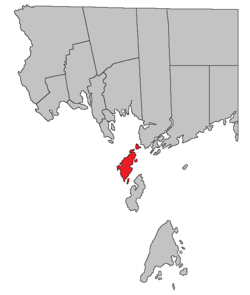 Location within Charlotte County. | |
| Country |
|
| Province |
|
| County | Charlotte County |
| Established | 1786 |
| Area[1] | |
| • Land | 38.01 km2 (14.68 sq mi) |
| Population (2011)[1] | |
| • Total | 731 |
| • Density | 19.2/km2 (50/sq mi) |
| • Pop 2006-2011 |
|
| • Dwellings | 485 |
| Time zone | AST (UTC-4) |
| • Summer (DST) | ADT (UTC-3) |
West Isles is a Canadian parish including Deer Island and numerous smaller islands in Charlotte County, New Brunswick.[2]
History
The West Isles Parish were established in 1786 to include Deer Island and adjacent islands: West Isles Parish included Campobello Parish until 1803 and Grand Manan Parish until 1816. The islands are part of the Fundy Islands.
Delineation
West Isles Parish is defined in the Territorial Division Act[3] as being bounded:
- To consist of Deer Island and the lesser islands contiguous to it, not included in the parishes[lower-alpha 1] before-mentioned.
Governance
The entire parish forms the local service district of the parish of West Isles, established in 1970 to assess for fire protection. First aid and ambulance services were added in 1982 and recreational facilities in 1987. The LSD is often called Deer Island for its only inhabited island.
Communities
Parish population total does not include incorporated municipalities (in bold).
|
|
|
Bodies of water & Islands
This is a list of rivers, lakes, streams, creeks, marshes and Islands that are at least partially in this parish
|
|
|
Demographics
Population
| Canada census – West Isles Parish, New Brunswick community profile | |||
|---|---|---|---|
| 2011 | 2006 | 2001 | |
| Population: | 731 (-11.3% from 2006) | 824 (-3.2% from 2001) | 851 (0.0% from 1996) |
| Land area: | 38.01 km2 (14.68 sq mi) | 37.93 km2 (14.64 sq mi) | 37.93 km2 (14.64 sq mi) |
| Population density: | 19.2/km2 (50/sq mi) | 21.7/km2 (56/sq mi) | 22.4/km2 (58/sq mi) |
| Median age: | 47.5 (M: 46.5, F: 48.4) | 43.6 (M: 42.4, F: 44.9) | 39.6 (M: 37.8, F: 42.0) |
| Total private dwellings: | 485 | 499 | 494 |
| Median household income: | $.N/A | $40,640 | $37,221 |
| Notes: 2011 income data for this area has been suppressed for data quality or confidentiality reasons. – References: 2011[4] 2006[5] 2001[6] | |||
| Historical Census Data - West Isles Parish, New Brunswick[7] | ||||||||||||||||||||||||||
|---|---|---|---|---|---|---|---|---|---|---|---|---|---|---|---|---|---|---|---|---|---|---|---|---|---|---|
|
|
| ||||||||||||||||||||||||
Language
| Canada Census Mother Tongue - West Isles Parish, New Brunswick[7] | ||||||||||||||||||
|---|---|---|---|---|---|---|---|---|---|---|---|---|---|---|---|---|---|---|
| Census | Total | English |
French |
English & French |
Other | |||||||||||||
| Year | Responses | Count | Trend | Pop % | Count | Trend | Pop % | Count | Trend | Pop % | Count | Trend | Pop % | |||||
| 2011 |
730 |
710 | |
97.26% | 15 | |
2.05% | 5 | |
0.69% | 0 | |
0.00% | |||||
| 2006 |
820 |
820 | |
100.00% | 0 | |
0.00% | 0 | |
0.00% | 0 | |
0.00% | |||||
| 2001 |
850 |
830 | |
97.65% | 10 | |
1.18% | 0 | |
0.00% | 10 | |
1.18% | |||||
| 1996 |
850 |
850 | n/a | 100.00% | 0 | n/a | 0.00% | 0 | n/a | 0.00% | 0 | n/a | 0.00% | |||||
Access Routes
Highways and numbered routes that run through the parish, including external routes that start or finish at the parish limits:[8]
|
|
|
|
See also
Notes
- ↑ all other parishes in Charlotte County
References
- 1 2 "West Isles, New Brunswick (Code 1302006) and Charlotte, New Brunswick (Code 1302) (table)". 2011 Census of Population. Statistics Canada. Retrieved 2012-07-16.
- ↑ New Brunswick Provincial Archives - West Isles Parish
- ↑ "Territorial Division Act (R.S.N.B. 1973, c. T-3)". Government of New Brunswick website. Retrieved 30 August 2016.
- ↑ "2011 Community Profiles". Canada 2011 Census. Statistics Canada. July 5, 2013. Retrieved 2014-03-19.
- ↑ "2006 Community Profiles". Canada 2006 Census. Statistics Canada. March 30, 2011. Retrieved 2014-03-19.
- ↑ "2001 Community Profiles". Canada 2001 Census. Statistics Canada. February 17, 2012. Retrieved 2014-03-19.
- 1 2 Statistics Canada: 1996, 2001, 2006, 2011 census
- ↑ Atlantic Canada Back Road Atlas ISBN 978-1-55368-618-7 Pages 4, 12
 |
Bay of Fundy Saint Andrews Parish |
Bay of Fundy Saint Patrick Parish |
Bay of Fundy Saint George Parish |
|
| |
||||
| ||||
| | ||||
| Bay of Fundy Campobello Parish |
| Subdivisions | |
|---|---|
| Cities | |
| Counties | |
| |
Coordinates: 44°58′54″N 66°56′40″W / 44.981799°N 66.944504°W