Albert County, New Brunswick
| Albert | |
|---|---|
| County | |
|
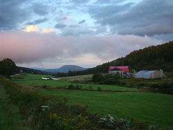
Farm landscape near Alma | |
 Location within New Brunswick | |
| Coordinates: 45°49′N 64°51′W / 45.82°N 64.85°WCoordinates: 45°49′N 64°51′W / 45.82°N 64.85°W | |
| Country |
|
| Province |
|
| Established | 1845 |
| Area[1] | |
| • Land | 1,806.54 km2 (697.51 sq mi) |
| Population (2011)[1] | |
| • Total | 28,846 |
| • Density | 16.0/km2 (41/sq mi) |
| • Pop 2006-2011 |
|
| • Dwellings | 12,573 |
| Time zone | AST (UTC-4) |
| • Summer (DST) | ADT (UTC-3) |
| Area code(s) | 506 |
| Wikimedia Commons has media related to Albert County, New Brunswick. |
Albert County (2011 population 28,846) is a county located in southeastern New Brunswick, Canada on Chignecto Bay in the Bay of Fundy. Prior to the abolition of county government in 1967, the shire town was Hopewell Cape. The county was established in 1845 from parts of Westmorland County and Saint John County, and named after Prince Albert.[2]
Census subdivisions
Communities
There are four municipalities within Albert County (listed by 2011 population):[1]
| Official Name | Status | Area km2 | Population | Parish |
|---|---|---|---|---|
| Riverview | Town | 33.88 | 19,128 | Coverdale |
| Hillsborough | Village | 12.98 | 1,350 | Hillsborough |
| Riverside-Albert | Village | 3.41 | 353 | Harvey |
| Alma | Village | 47.64 | 232 | Alma |
Parishes
The county is subdivided into six parishes (listed by 2011 population):[1]
| Official Name | Area km2 | Population | municipalities | Unincorporated communities |
|---|---|---|---|---|
| Coverdale | 236.15 | 4,401 | Riverview (town) | Colpitts Settlement / Five Points / Grub Road / Lower Coverdale / Lower Turtle Creek / Middlesex / Middle Coverdale / Nixon / Pine Glen / Price / Salisbury Back Road / Stoney Creek / Synton / Turtle Creek / Upper Coverdale |
| Hillsborough | 303.73 | 1,395 | Hillsborough (village) | Albert Mines / Baltimore / Beech Hill / Berryton / Caledonia Mountain / Dawson Settlement / Edgetts Landing / Isaiah Corner / Osborne Corner / Rosevale / Salem / Shenstone / Steeves Mills / Steevescote / Weldon |
| Elgin | 519.38 | 968 | Church Hill / Churchs Corner / Elgin / Ferndale / Forest Hill / Goshen / Gowland Mountain / Harrison Settlement / Hillside / Little River / Mapleton / Meadow / Midland / Parkindale / Pleasant Vale / Prosser Brook / Ross Corner | |
| Hopewell | 149.32 | 643 | Cape Station / Chemical Road / Chester / Curryville / Demoiselle Creek / Hopewell Cape / Hopewell Hill / Lower Cape / McGinleys Corner / Memel Settlement / Mountville / Shepody | |
| Harvey | 276.84 | 376 | Riverside-Albert (village) | Beaver Brook / Brookville / Cape Enrage / Derrys Corner / Germantown / Harvey / Harvey Bank / Little Ridge / Midway / New Horton / New Ireland / Upper New Horton / Waterside / West River |
| Alma | 222.79 | 0 | Alma (village) | Mitchells Corner / Teahans Corner |
Demographics
Population
| Canada census – Albert County, New Brunswick community profile | |||
|---|---|---|---|
| 2011 | 2006 | 2001 | |
| Population: | 28,846 (+4.7% from 2006) | 27,562 (+3.0% from 2001) | 26,749 (+1.0% from 1996) |
| Land area: | 1,806.54 km2 (697.51 sq mi) | 1,806.12 km2 (697.35 sq mi) | 1,806.12 km2 (697.35 sq mi) |
| Population density: | 16.0/km2 (41/sq mi) | 15.3/km2 (40/sq mi) | 14.8/km2 (38/sq mi) |
| Median age: | 42.9 (M: 41.8, F: 43.9) | 41.0 (M: 40.2, F: 41.7) | 38.6 (M: 37.8, F: 39.3) |
| Total private dwellings: | 12,573 | 11,503 | 10,705 |
| Median household income: | $60,952 | $54,297 | $47,799 |
| References: 2011[1] 2006[3] 2001[4] | |||
| Historical Census Data - Albert County, New Brunswick[5] | ||||||||||||||||||||||||||||||||||||||||||||||||||||||||||||||||||||||||||||||||
|---|---|---|---|---|---|---|---|---|---|---|---|---|---|---|---|---|---|---|---|---|---|---|---|---|---|---|---|---|---|---|---|---|---|---|---|---|---|---|---|---|---|---|---|---|---|---|---|---|---|---|---|---|---|---|---|---|---|---|---|---|---|---|---|---|---|---|---|---|---|---|---|---|---|---|---|---|---|---|---|---|
|
|
| ||||||||||||||||||||||||||||||||||||||||||||||||||||||||||||||||||||||||||||||
Language
| Canada Census Mother Tongue - Albert County, New Brunswick[5] | ||||||||||||||||||
|---|---|---|---|---|---|---|---|---|---|---|---|---|---|---|---|---|---|---|
| Census | Total | English |
French |
English & French |
Other | |||||||||||||
| Year | Responses | Count | Trend | Pop % | Count | Trend | Pop % | Count | Trend | Pop % | Count | Trend | Pop % | |||||
| 2011 |
28,590 |
26,135 | |
91.41% | 1,845 | |
6.45% | 200 | |
0.70% | 410 | |
1.43% | |||||
| 2006 |
27,260 |
25,130 | |
92.19% | 1,575 | |
5.78% | 65 | |
0.24% | 490 | |
1.80% | |||||
| 2001 |
26,470 |
24,640 | |
93.09% | 1,440 | |
5.44% | 115 | |
0.43% | 275 | |
1.04% | |||||
| 1996 |
26,255 |
24,665 | n/a | 93.94% | 1,300 | n/a | 4.95% | 100 | n/a | 0.38% | 190 | n/a | 0.72% | |||||
Access Routes
Highways and numbered routes that run through the county, including external routes that start or finish at the county limits:[6]
|
|
Protected areas and attractions

Sunset over the Bay of Fundy near Waterside
- Fundy National Park
- Chignecto North
- Headquarters
- Point Wolfe
- Visitors Centre
- Hopewell Rocks
- McManus Hill Natural Protected Area
- Shepody National Wildlife Area
- Wilson Brook Natural Protected Area
- Cape Enrage
- Albert County Museum
Notable people
Main article: List of people from Albert County
See also
References
- 1 2 3 4 5 "2011 Community Profiles". Canada 2011 Census. Statistics Canada. July 5, 2013. Retrieved 2014-03-31.
- ↑ Hamilton, William Baillie (1996). Place Names of Atlantic Canada. University of Toronto Press. p. 43. ISBN 0-8020-7570-3.
- ↑ "2006 Community Profiles". Canada 2006 Census. Statistics Canada. March 30, 2011. Retrieved 2014-03-31.
- ↑ "2001 Community Profiles". Canada 2001 Census. Statistics Canada. February 17, 2012. Retrieved 2014-03-31.
- 1 2 Statistics Canada: 1996, 2001, 2006, 2011 census
- ↑ Atlantic Canada Back Road Atlas ISBN 978-1-55368-618-7
External links
 |
Westmorland County | | ||
| Kings County Saint John County |
|
Westmorland County | ||
| ||||
| | ||||
| Bay of Fundy |
| Subdivisions | |
|---|---|
| Cities | |
| Counties | |
| |
This article is issued from Wikipedia - version of the 8/29/2016. The text is available under the Creative Commons Attribution/Share Alike but additional terms may apply for the media files.