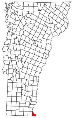
Vernon, Vermont
| Vernon, Vermont | |
|---|---|
| Town | |
 | |
 Vernon, Vermont | |
 Vernon, Vermont Location in the United States | |
| Coordinates: 42°46′6″N 72°31′9″W / 42.76833°N 72.51917°WCoordinates: 42°46′6″N 72°31′9″W / 42.76833°N 72.51917°W | |
| Country | United States |
| State | Vermont |
| County | Windham |
| Area | |
| • Total | 20.0 sq mi (51.8 km2) |
| • Land | 19.4 sq mi (50.2 km2) |
| • Water | 0.6 sq mi (1.6 km2) |
| Elevation | 325 ft (99 m) |
| Population (2000) | |
| • Total | 2,141 |
| • Density | 110.5/sq mi (42.7/km2) |
| Time zone | Eastern (EST) (UTC-5) |
| • Summer (DST) | EDT (UTC-4) |
| ZIP code | 05354 |
| Area code(s) | 802 |
| FIPS code | 50-74800[1] |
| GNIS feature ID | 1462234[2] |
| Website | www.vernon-vt.org |
Vernon is a town in Windham County, Vermont, Vermont, in the United States. The population was 2,206 at the 2010 census. Vernon is the site of the now-shut Vermont Yankee, the state of Vermont's only nuclear power plant, which closed in December 2014.[3]
History
The town was chartered in 1672 as part of the Massachusetts Grant. In 1736 the area was granted by Massachusetts as part of Fall Town, and in 1753 the area was granted as Hinsdale. When the Connecticut River was established as a boundary, two separate towns were created: Hinsdale, New Hampshire and Hinsdale, Vermont.[4] The people who lived in Hinsdale, Vermont wanted a separate name, and in 1802 the Vermont legislature changed the town's name to Vernon.[5] The name is said to have been chosen after President George Washington's plantation home, Mount Vernon.[6]
Fort Bridgman, in Vernon, was burned in 1755, a casualty of the French and Indian War.[7]
Geography
According to the United States Census Bureau, the town has a total area of 20.0 square miles (51.8 km2), of which 19.4 square miles (50.2 km2) is land and 0.6 square mile (1.6 km2) (3.15%) is water.
Climate
This climatic region is typified by large seasonal temperature differences, with warm to hot (and often humid) summers and cold (sometimes severely cold) winters. According to the Köppen Climate Classification system, Vernon has a humid continental climate, abbreviated "Dfb" on climate maps.[8]
Demographics
| Historical population | |||
|---|---|---|---|
| Census | Pop. | %± | |
| 1790 | 482 | — | |
| 1800 | 480 | −0.4% | |
| 1810 | 521 | 8.5% | |
| 1820 | 627 | 20.3% | |
| 1830 | 681 | 8.6% | |
| 1840 | 705 | 3.5% | |
| 1850 | 821 | 16.5% | |
| 1860 | 725 | −11.7% | |
| 1870 | 764 | 5.4% | |
| 1880 | 652 | −14.7% | |
| 1890 | 567 | −13.0% | |
| 1900 | 578 | 1.9% | |
| 1910 | 606 | 4.8% | |
| 1920 | 556 | −8.3% | |
| 1930 | 609 | 9.5% | |
| 1940 | 559 | −8.2% | |
| 1950 | 712 | 27.4% | |
| 1960 | 865 | 21.5% | |
| 1970 | 1,024 | 18.4% | |
| 1980 | 1,175 | 14.7% | |
| 1990 | 1,850 | 57.4% | |
| 2000 | 2,141 | 15.7% | |
| 2010 | 2,206 | 3.0% | |
| Est. 2014 | 2,184 | [9] | −1.0% |
| U.S. Decennial Census[10] | |||
As of the census[1] of 2000, there were 2,141 people, 741 households, and 574 families residing in the town. The population density was 110.5 people per square mile (42.7/km2). There were 784 housing units at an average density of 40.5 per square mile (15.6/km2). The racial makeup of the town was 98.60% White, 0.28% African American, 0.19% Native American, 0.14% Asian, 0.05% Pacific Islander, and 0.75% from two or more races. Hispanic or Latino of any race were 0.84% of the population.
There were 741 households out of which 37.5% had children under the age of 18 living with them, 66.7% were married couples living together, 7.3% had a female householder with no husband present, and 22.5% were non-families. 17.7% of all households were made up of individuals and 6.6% had someone living alone who was 65 years of age or older. The average household size was 2.76 and the average family size was 3.12.
In the town the population was spread out with 27.2% under the age of 18, 5.5% from 18 to 24, 27.7% from 25 to 44, 26.2% from 45 to 64, and 13.5% who were 65 years of age or older. The median age was 39 years. For every 100 females there were 100.8 males. For every 100 females age 18 and over, there were 92.6 males.
The median income for a household in the town was $49,688, and the median income for a family was $55,625. Males had a median income of $35,845 versus $25,139 for females. The per capita income for the town was $19,720. About 2.5% of families and 2.8% of the population were below the poverty line, including 3.3% of those under age 18 and 2.0% of those age 65 or over.
Education
Vernon is served by the Windham Southeast Supervisory Union. Vernon Elementary School is a public school located in Vernon and serves kindergarten to sixth grade.[11] There is one public middle school, the Brattleboro Area Middle School (BAMS), and one public high school, the Brattleboro Union High School (BUHS).[12] There is also a career development center, the Windham Regional Career Center.[13]
Notable people
- Jonathan Hunt, US congressman[14]
Vermont Yankee nuclear power plant
The town is the site of the now-closed Vermont Yankee nuclear power plant, which shut down on December 29, 2014.
References
- 1 2 "American FactFinder". United States Census Bureau. Archived from the original on September 11, 2013. Retrieved 2008-01-31.
- ↑ "US Board on Geographic Names". United States Geological Survey. 2007-10-25. Retrieved 2008-01-31.
- ↑ "Entergy to Close, Decommission Vermont Yankee". Entergy. Entergy. Retrieved 27 August 2013.
- ↑ "Welcome to the Town of Vernon Website". Town of Vernon, Vermont. Retrieved May 14, 2014.
- ↑ "Vernon, Vermont". Virtual Vermont. Retrieved May 14, 2014.
- ↑ "Profile for Vernon, Vermont, VT". ePodunk. Retrieved May 14, 2014.
- ↑ "Archived copy". Archived from the original on June 9, 2007. Retrieved December 17, 2011.
- ↑ Climate Summary for Vernon, Vermont
- ↑ "Annual Estimates of the Resident Population for Incorporated Places: April 1, 2010 to July 1, 2014". Retrieved June 4, 2015.
- ↑ "U.S. Decennial Census". United States Census Bureau. Archived from the original on May 11, 2015. Retrieved May 16, 2015.
- ↑ "Vernon School District Schools". GreatSchools, Inc. Retrieved May 14, 2014.
- ↑ "Vernon Brattleboro Union High School". Brattleboro Union High School. Retrieved May 14, 2014.
- ↑ "Windham Regional Career Center". Windham Regional Career Center. Retrieved May 14, 2014.
- ↑ "HUNT, Jonathan, (1787 - 1832)". Biographical Directory of the United StatesCongress. Retrieved May 14, 2014.
External links
| Wikimedia Commons has media related to Vernon, Vermont. |
Municipalities and communities of Windham County, Vermont, United States | ||
|---|---|---|
| Towns | 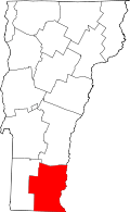 | |
| Villages | ||
| CDPs | ||
| Other communities | ||
| Footnotes | ‡ Disincorporated | |
