Towns County, Georgia
| Towns County, Georgia | |
|---|---|
 Towns County courthouse in Hiawassee | |
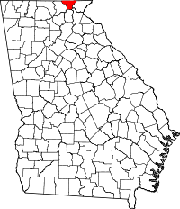 Location in the U.S. state of Georgia | |
 Georgia's location in the U.S. | |
| Founded | 1856 |
| Named for | George W. Towns |
| Seat | Hiawassee |
| Largest city | Young Harris |
| Area | |
| • Total | 172 sq mi (445 km2) |
| • Land | 167 sq mi (433 km2) |
| • Water | 5.4 sq mi (14 km2), 3.2% |
| Population | |
| • (2010) | 10,471 |
| • Density | 63/sq mi (24/km²) |
| Congressional district | 9th |
| Time zone | Eastern: UTC-5/-4 |
| Website |
www |
Towns County is a county located on the northern border of the U.S. state of Georgia. As of the 2010 census, the population was 10,471.[1] Its county seat is Hiawassee.[2] The county was created on March 6, 1856 and named for United States lawyer, legislator, and politician George W. Towns.
Geography
According to the U.S. Census Bureau, the county has a total area of 172 square miles (450 km2), of which 167 square miles (430 km2) is land and 5.4 square miles (14 km2) (3.2%) is water.[3] Towns is mostly in the Hiwassee River sub-basin of the Middle Tennessee-Hiwassee basin, with a part of the county in the Tugaloo River sub-basin in the larger Savannah River basin, as well as a small portion of the county's southwestern corner in the Chattahoochee River sub-basin of the ACF River Basin (Apalachicola-Chattahoochee-Flint River Basin),[4] near the source of the Chattahoochee in neighboring Union County.
Towns County is located amidst the Blue Ridge Mountains, (part of the Appalachian Mountains), some of which are protected by the Chattahoochee National Forest. Brasstown Bald, the highest mountain in Georgia, rises in southwest Towns County, straddling the Union County line. The source of the Hiwassee River is located in eastern Towns County, from which it flows northward into North Carolina. Chatuge Lake, an artificial reservoir created by the completion of Chatuge Dam by the Tennessee Valley Authority in the 1940s, dominates the northeastern section of Towns County and extends into North Carolina. State Route 515 from north of Atlanta ends here at the North Carolina state line near Young Harris.
The county was traversed by a road built upon a traditional Cherokee trading path, which ran north to south through the county, passing through Unicoi Gap. It served as a line between European-American settlers and the Cherokee until after the Indian cessions and Indian Removal in the 1830s, when it fell solely into the hands of the whites. When the Cherokee were expelled by US forces from their villages, they were forced temporarily into "removal forts." One had been constructed in what is now Hiawassee, the county seat. They were forced to travel what is known as the Trail of Tears to Indian Territory west of the Mississippi River, a journey during which many Cherokee died.
Major highways
Adjacent counties
- Clay County, North Carolina (north)
- Rabun County (east)
- Habersham County (southeast)
- White County (south)
- Union County (west)
National protected area
- Appalachian Trail (part)
- Chattahoochee National Forest (part)
Demographics
| Historical population | |||
|---|---|---|---|
| Census | Pop. | %± | |
| 1860 | 2,459 | — | |
| 1870 | 2,780 | 13.1% | |
| 1880 | 3,261 | 17.3% | |
| 1890 | 4,064 | 24.6% | |
| 1900 | 4,748 | 16.8% | |
| 1910 | 3,932 | −17.2% | |
| 1920 | 3,937 | 0.1% | |
| 1930 | 4,346 | 10.4% | |
| 1940 | 4,925 | 13.3% | |
| 1950 | 4,803 | −2.5% | |
| 1960 | 4,538 | −5.5% | |
| 1970 | 4,565 | 0.6% | |
| 1980 | 5,638 | 23.5% | |
| 1990 | 6,754 | 19.8% | |
| 2000 | 9,319 | 38.0% | |
| 2010 | 10,471 | 12.4% | |
| Est. 2015 | 11,182 | [5] | 6.8% |
| U.S. Decennial Census[6] 1790-1960[7] 1900-1990[8] 1990-2000[9] 2010-2013[1] | |||
2000 census
As of the census[10] of 2000, there were 9,319 people, 3,998 households, and 2,826 families residing in the county. The population density was 56 people per square mile (22/km²). There were 6,282 housing units at an average density of 38 per square mile (15/km²). The racial makeup of the county was 98.80% White, 0.13% Black or African American, 0.17% Native American, 0.31% Asian, 0.18% from other races, and 0.41% from two or more races. 0.72% of the population were Hispanic or Latino of any race.
There were 3,998 households out of which 20.80% had children under the age of 18 living with them, 61.90% were married couples living together, 6.30% had a female householder with no husband present, and 29.30% were non-families. 26.00% of all households were made up of individuals and 13.10% had someone living alone who was 65 years of age or older. The average household size was 2.20 and the average family size was 2.61.
In the county the population was spread out with 16.30% under the age of 18, 9.10% from 18 to 24, 20.50% from 25 to 44, 28.30% from 45 to 64, and 25.90% who were 65 years of age or older. The median age was 49 years. For every 100 females there were 89.90 males. For every 100 females age 18 and over, there were 87.80 males.
The median income for a household in the county was $31,950, and the median income for a family was $37,295. Males had a median income of $28,657 versus $21,813 for females. The per capita income for the county was $18,221. About 8.80% of families and 11.80% of the population were below the poverty line, including 13.60% of those under age 18 and 10.40% of those age 65 or over. Towns County is inside the Bible Belt.
2010 census
As of the 2010 United States Census, there were 10,471 people, 4,510 households, and 2,981 families residing in the county.[11] The population density was 62.9 inhabitants per square mile (24.3/km2). There were 7,731 housing units at an average density of 46.4 per square mile (17.9/km2).[12] The racial makeup of the county was 97.7% white, 0.4% black or African American, 0.4% Asian, 0.3% American Indian, 0.6% from other races, and 0.6% from two or more races. Those of Hispanic or Latino origin made up 2.0% of the population.[11] In terms of ancestry, 16.3% were Irish, 15.4% were German, 13.8% were English, 11.7% were American, and 8.3% were Scotch-Irish.[13]
Of the 4,510 households, 20.2% had children under the age of 18 living with them, 56.0% were married couples living together, 7.6% had a female householder with no husband present, 33.9% were non-families, and 30.1% of all households were made up of individuals. The average household size was 2.17 and the average family size was 2.65. The median age was 51.1 years.[11]
The median income for a household in the county was $39,540 and the median income for a family was $48,020. Males had a median income of $31,668 versus $27,127 for females. The per capita income for the county was $21,527. About 5.6% of families and 9.3% of the population were below the poverty line, including 13.2% of those under age 18 and 7.7% of those age 65 or over.[14]
Government
Towns County's Sole Commissioner is Bill Kendall, who has served since 2005.[15]
Towns County's Sheriff, Chris Clinton, was elected in a special election in 2007. Sheriff Clinton was re-elected in the general election in 2008, where he ran unopposed after serving only four months in office.
Towns County's Judge of Magistrate and Probate Court is D. David Rogers, who was elected in 2008, beating 30 year Democrat incumbent, Wayne Garrett. David and his wife, Alicia, live in Young Harris, GA. He is the son of well-known minister, Rev. James "Jimmy" Rogers of Hayesville, NC and Helen Adams Rogers of Andrews, NC. David and Alicia have three sons: Tyler Moody, D.J., and Andrew, all of Young Harris. David has gone uncontested since his inauguration to the office in 2009. The Towns County Probate and Magistrate Court is one of very few, or the only one of its kind in the state. David serves as both the Probate Judge and the Chief Magistrate of Towns County.
Cities and Communities
Incorporated Cities
Unincorporated Communities
- Alexanders Mill
- Plott Town
- Bugscuffle
- Fodder Creek
- Tate City (only accessible from Rabun County)
- Hog Creek
- Bell Creek
- StreakHill
- Shake Rag
- HighTower
Notable natives
- Zell Miller — former Georgia governor and U.S. senator.
See also
References
| Wikimedia Commons has media related to Towns County, Georgia. |
- 1 2 "State & County QuickFacts". United States Census Bureau. Retrieved June 26, 2014.
- ↑ "Find a County". National Association of Counties. Retrieved 2011-06-07.
- ↑ "US Gazetteer files: 2010, 2000, and 1990". United States Census Bureau. 2011-02-12. Retrieved 2011-04-23.
- ↑ "Georgia Soil and Water Conservation Commission Interactive Mapping Experience". Georgia Soil and Water Conservation Commission. Retrieved 2015-11-17.
- ↑ "County Totals Dataset: Population, Population Change and Estimated Components of Population Change: April 1, 2010 to July 1, 2015". Retrieved July 2, 2016.
- ↑ "U.S. Decennial Census". United States Census Bureau. Retrieved June 26, 2014.
- ↑ "Historical Census Browser". University of Virginia Library. Retrieved June 26, 2014.
- ↑ "Population of Counties by Decennial Census: 1900 to 1990". United States Census Bureau. Retrieved June 26, 2014.
- ↑ "Census 2000 PHC-T-4. Ranking Tables for Counties: 1990 and 2000" (PDF). United States Census Bureau. Retrieved June 26, 2014.
- ↑ "American FactFinder". United States Census Bureau. Retrieved 2008-01-31.
- 1 2 3 "DP-1 Profile of General Population and Housing Characteristics: 2010 Demographic Profile Data". United States Census Bureau. Retrieved 2015-12-30.
- ↑ "Population, Housing Units, Area, and Density: 2010 - County". United States Census Bureau. Retrieved 2015-12-30.
- ↑ "DP02 SELECTED SOCIAL CHARACTERISTICS IN THE UNITED STATES – 2006-2010 American Community Survey 5-Year Estimates". United States Census Bureau. Retrieved 2015-12-30.
- ↑ "DP03 SELECTED ECONOMIC CHARACTERISTICS – 2006-2010 American Community Survey 5-Year Estimates". United States Census Bureau. Retrieved 2015-12-30.
- ↑ The man in the driver’s seat of Towns County, Hiawassee River Watershed Coalition
External links
 |
Clay County, North Carolina | | ||
| Union County | |
Rabun County | ||
| ||||
| | ||||
| White County | Habersham County |
Municipalities and communities of Towns County, Georgia, United States | ||
|---|---|---|
| City | | |
| Town | ||
| CDP | ||
Template:Georgia
Coordinates: 34°55′N 83°44′W / 34.92°N 83.74°W