Savannah River
- For the Department of Energy facility, see Savannah River Site
| Savannah River | |
| Tugaloo River | |
| River | |
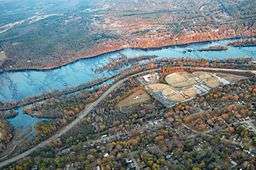 Savannah River at Augusta, with the Augusta Canal running alongside | |
| Country | United States |
|---|---|
| States | North Carolina, South Carolina, Georgia |
| Tributaries | |
| - left | Seneca River |
| - right | Tugaloo River |
| Cities | Savannah, Augusta |
| Source | Lake Hartwell |
| - elevation | 655 ft (200 m) [1] |
| - coordinates | 34°26′37″N 82°51′22″W / 34.44361°N 82.85611°W [2] |
| Mouth | Atlantic Ocean |
| - location | Tybee Roads |
| - elevation | 0 ft (0 m) [1] |
| - coordinates | 32°2′16″N 80°51′0″W / 32.03778°N 80.85000°WCoordinates: 32°2′16″N 80°51′0″W / 32.03778°N 80.85000°W [2] |
| Length | 301 mi (484 km) |
| Basin | 9,850 sq mi (25,511 km2) [3] |
| Discharge | for near Clyo, GA |
| - average | 11,720 cu ft/s (332 m3/s) [3] |
 Map of the Savannah River watershed | |

The Savannah River is a major river in the southeastern United States, forming most of the border between the states of South Carolina and Georgia. Two tributaries of the Savannah, the Tugaloo River and the Chattooga River, form the northernmost part of the border. The Savannah River drainage basin extends into the southeastern side of the Appalachian Mountains just inside North Carolina, bounded by the Eastern Continental Divide. The river is around 301 miles (484 km) long.[4] It is formed by the confluence of the Tugaloo River and the Seneca River. Today this confluence is submerged beneath Lake Hartwell. The Tallulah Gorge is located on the Tallulah River, a tributary of the Tugaloo River that forms the northwest branch of the Savannah River.
Two major cities are located along the Savannah River: Savannah, and Augusta, Georgia. They were nuclei of early English settlements during the Colonial period of American history.
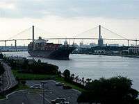
The Savannah River is tidal at Savannah proper. Downstream from there, the river broadens into an estuary before flowing into the Atlantic Ocean. The area where the river's estuary meets the ocean is known as "Tybee Roads". The Intracoastal Waterway flows through a section of the Savannah River near the city of Savannah.
Name
The name "Savannah" comes from a group of Shawnee who migrated to the Piedmont region in the 1680s. They destroyed the Westo and occupied established Westo lands at the Savannah River's head of navigation on the fall line, near present-day Augusta.[5] These Shawnee were called by several variant names that all derive from their native name, Ša·wano·ki (literally, "southerners").[6] The local variants included Shawano, Savano, Savana, and Savannah.[7]
Another theory is that the name was derived from the English term "savanna", a kind of tropical grassland, which was borrowed by the English from Spanish sabana and used in the colonial southeast. The Spanish word was borrowed from the Taino word zabana.[8] Other theories interpret the name Savannah to come from Atlantic coastal tribes, who spoke Algonquian languages, as there are similar terms meaning not only "southerner" but perhaps "salt".[9][10]
History
Historical and variant names of the Savannah River, as listed by the U.S. Geological Survey, include May River, Westobou River (for the Westo tribe), Kosalu River, Isundiga River and Girande River, among others.[2]
The Westobou River was the former name of the Savannah River that was derived from the Westo (also known as Westoe) Native American Indians. The Westo were thought to have come from the northeast, pushed out by the more powerful tribes of the Iroquois Confederacy, who had acquired firearms through trade. This migration beginning in the late 16th century resulted in the Westo Indians reaching the present area of Augusta, Georgia, in what was likely to be the 1660s.
The Westo used the river for fishing and water supplies, for transportation, and for trade. They were strong enough to hold off the Spanish colonists making incursions from Florida. The Carolina Colony needed the Westo alliance during its early years. When Carolinians desired to expand its trade to Charleston, they viewed the Westo tribe as an obstacle. In order to remove the tribe, they sent a group called the Goose Creek Men to arm the Savanna (also known as the Savannah) Indians, a Shawnee tribe, who defeated the Westo in the Westo War of 1680.
Following this, the English colonists renamed the river as the Savannah; it was integral to early development. They founded two major cities on the river during the colonial era: Savannah was established in 1733 as a seaport on the Atlantic Ocean, and Augusta is located where the river crosses the Fall Line of the Piedmont. The two large cities on the Savannah served as Georgia's first two state capitals. In the nineteenth century, the sandy river channel changed frequently, causing numerous steamboat accidents.
During the American Civil War, President Abraham Lincoln proclaimed a blockade around the Confederate states, forcing merchantmen to use specific ports along the coast best suited for this purpose. The harbor at Savannah became one of the busiest ports for blockade runners bringing in supplies for the Confederacy.[11]
The Savannah River was significant during the 1950s when construction started on the U.S. government's Savannah River Plant for making plutonium and tritium for nuclear weapons. In 1956 Clyde L. Cowan and Frederick Reines detected neutrinos with an experiment carried out at the Savannah River Nuclear Plant, after a preliminary experiment at the Hanford Site. They placed a 10-ton tank of water next to a powerful nuclear reactor engaged in making plutonium for use in nuclear weapons. After shielding the neutrino trap underground and running it for about 100 days over the course of a year, they detected a few synchronized flashes of gamma radiation that signaled the interaction of a few neutrinos with the protons in the water. The neutrinos were not themselves observed, and they never have been. Their presence is inferred by an exceedingly rare interaction. One out of every billion billion neutrinos that pass through the water tank hits a proton, producing the telltale burst of radiation. In 1995 Reines was awarded the Nobel Prize in Physics for this accomplishment, but Cowen did not live long enough to share it.[12]
Between 1946 and 1985, the U.S. Army Corps of Engineers built three major dams on the Savannah for hydroelectricity, flood control, and navigation. The J. Strom Thurmond Dam (1954), the Hartwell Dam (1962), and the Richard B. Russell Dam (1985) and their reservoirs combine in order to form over 120 miles (190 km) of lakes.[13]
Donnie Thompson named a small subdivision "Westobou Crossing" which is located in North Augusta, South Carolina. The area of the subdivision is located marks the first natural ford that crosses the Savannah River, thus promoting trade and allowing travel. Many native artifacts were found in the area and these now belong to private collections.
Natural history
The Savannah River flows through a variety of climates and ecosystems throughout its course. It is considered an alluvial river, draining a 10,577-square-mile (27,390 km2) drainage basin and carrying large amounts of sediment to the ocean. At its headwaters in the Blue Ridge Mountains, the climate is quite temperate. The river's tributaries receive a small amount of snow-melt runoff in the winter. The majority of the river's flow through the Piedmont region is dominated by large reservoirs. Below the Fall Line, the river slows, and is surrounded by large blackwater bald cypress swamps. Numerous oxbow lakes mark the locations of old river channels, which have been moved by earthquakes and silting. Another prominent feature is the numerous large bluffs that line the river in some locations, most notably Yamacraw Bluff, the location selected to build the city of Savannah. The river becomes a large estuary at the coast, where fresh- and saltwater mix. River dredging operations to maintain the Port of Savannah have caused the estuary zone to move further upstream than its historical home. This is causing the transition of rare freshwater marshland into saltwater spartina marsh.
The river supports a large variety of native and introduced aquatic species:
- Upper section - yellow perch, brook trout, brown trout, rainbow trout, smallmouth bass, largemouth bass, crappie, striped bass, hybrid striped bass, white bass, bluegill, North American river otter, American mink, North American beaver, catfish
- Middle section - largemouth bass, crappie, striped bass, spotted bass, bluegill, redbreast sunfish, catfish, American eel, North American river otter, American mink, North American beaver, shortnose sturgeon, chain pickerel, bowfin, longnose gar, snapping turtles, American alligator, water moccasin
- Lower section, estuary - largemouth bass, crappie, striped bass, spotted bass, bluegill, redbreast sunfish, catfish, American eel, North American river otter, American mink, North American beaver, shortnose sturgeon, Atlantic sturgeon, chain pickerel, bowfin, longnose gar, snapping turtles, American alligator, snakes, red drum, flounder, spotted seatrout, bull shark, tarpon, common bottlenose dolphin, West Indian manatee, diamondback terrapin
Additionally, the river is one of only four left in the southeast with significant populations of Hymenocallis coronaria, the shoals spider-lily. It has three populations in the primary river basin and one each in the tributaries of Stevens Creek in South Carolina and the Broad River in Georgia.[14]
Navigation
Through the building of several locks and dams in the first half of the 20th century (such as the New Savannah Bluff Lock and Dam, completed in 1937 during the Great Depression), and upstream reservoirs like Lake Hartwell, the Savannah River was once navigable by freight barges between Augusta, Georgia (on the Fall Line) and the Atlantic Ocean. Maintenance of this channel for commercial shipping ended in 1979, and the one lock below Augusta has been deactivated.[15]
When a large piece of equipment (a deaerator) needed to be delivered to the Vogtle Electric Generating Plant construction site in 2013, the barge travelled upstream from the Port of Savannah only to the Georgia Power’s Plant McIntosh site, near Rincon, Georgia; from there, the cargo was moved by a road transporter.[16]
Pollution
The Savannah River has the fourth-highest toxic discharge in the country, according to a 2009 report by Environment America.[17]
Notable tributaries
- Black Creek
- Brier Creek
- Broad River
- Chattooga River
- Ebenezer Creek
- Knoxboro Creek
- Little River (Columbia County, Georgia)
- Little River (McCormick County, South Carolina)
- McBean Creek
- Rocky River
- Seneca River
- Stevens Creek
- Tugaloo River
Crossings
This is a list of crossings of the Savannah River.
Dams
- Hartwell Dam
- Richard B. Russell Dam
- J. Strom Thurmond Dam (Clarks Hill Dam)
- Stevens Creek Dam
- Augusta City Dam
- New Savannah Bluff Lock and Dam
See also
References
- Stokes, Thomas, L, The Savannah (Rivers of America Series), Rinehart, 1951
- Wise, Stephen R. (1991). Lifeline of the Confederacy: Blockade Running During the Civil War.
Univ of South Carolina Press. p. 403. Url
| Wikimedia Commons has media related to Savannah River. |
External links
- Two Historic Savannah River Ferries historical marker
Notes
- 1 2 Google Earth elevation for GNIS coordinates.
- 1 2 3 U.S. Geological Survey Geographic Names Information System: Savannah River
- 1 2 Water Resource Data, South Carolina, 2005, USGS, p. 559. Gages farther downriver affected by tides.
- ↑ U.S. Geological Survey. National Hydrography Dataset high-resolution flowline data. The National Map, accessed April 26, 2011
- ↑ Cashin, Edward J. (1986). Colonial Augusta: "Key of the Indian Countrey". Mercer University Press. p. 4. ISBN 978-0-86554-217-4.
- ↑ "Shawnee", in Webster's Collegiate Dictionary, 11th ed., 1145
- ↑ Savannah River Basin, Georgia River Network.
- ↑ Bright, William (2004). Native American Place names of the United States. University of Oklahoma Press. p. 424. ISBN 978-0-8061-3598-4.
- ↑ Names in South Carolina, Volume 22, Institute for Southern Studies.
- ↑ Names in South Carolina, Volume 16, Institute for Southern Studies.
- ↑ Wise, 1991 p.24
- ↑ http://hyperphysics.phy-astr.gsu.edu/hbase/particles/cowan.html
- ↑ Army Corps of Engineers J. Strom Thurmond Lake and Dam Hydropower
- ↑ Markwith, Scott H.; Scanlon, Michael J. (May 11, 2006). "Multiscale analysis of Hymenocallis coronaria (Amaryllidaceae) genetic diversity, genetic structure, and gene movement under the influence of unidirectional stream flow". American Journal of Botany. Botanical Society of America. Retrieved October 1, 2012.
- ↑ Pavey, Rob. New Plant Vogtle parts could require dredging; Augusta Chronicle; September 3, 2009.
- ↑ Massive unit 3 component delivered to Vogtle, 2013-02-26
- ↑ "Wasting Our Waterways: Toxic Industrial Pollution and the Unfulfilled Promise of the Clean Water Act". Environment America. 2009-10-21. Retrieved 2010-06-05.