Topoľa


Topoľa (Ukrainian: Тополя) is a village and municipality situated in the buffer zone of the Poloniny National Park. It offers easy access to most of the National Park's hiking trails. Havesova, a component of the Primeval Beech Forests of the Carpathians UNESCO World Heritage Site, is also located close to the village.
In historical records the village was first mentioned in 1337. The Greek Catholic wooden church of Archangel Michael located on the hill above the village dates back as far as 1700. There is a cemetery of soldiers who fell in World War I adjacent to the church. The name of the village means poplar (topoli), a tree.
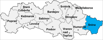
The municipality is located in Snina District in the Prešov Region of north-eastern Slovakia. It lies at an altitude of 384 metres and covers an area of 26.384 km². According to the 2013 census it had a population of 159 inhbabitants.
See also
External links
Coordinates: 49°03′N 22°22′E / 49.050°N 22.367°E