Texas City Dike
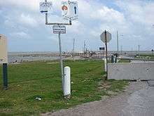
The Texas City Dike is a levee located in Texas City, TX that projects nearly 5 miles (8.0 km) south-east into the mouth of Galveston Bay.[1] It is flanked by the north-eastern tip of Galveston Island and the south-western tip of the Bolivar Peninsula. The dike, one of the area's most beloved and enduring landmarks, was originally designed to reduce the impact of sediment accumulation along the lower Bay.[2] The Bay itself connects the Houston Ship Channel, one of the nation's most important commercial waterways, and the Port of Houston with the Gulf of Mexico some 35 nautical miles (65 km) distant. However, as Texas City expanded from its industrial roots to become a thriving residential community, the dike's purpose changed, and it became the city's best hope against a catastrophic incursion of water surging westward into the low-lying community from a hurricane landfall in the Bay. It was hoped that the dike, Texas City's primary defence against potential encroachment of water from Galveston Bay and the Gulf of Mexico, would lessen or even entirely deflect substantial damage to the city from such a potentially cataclysmic event.
Construction
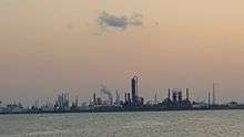
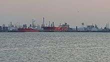
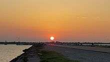
The dike, whose construction was authorized by the Texas State Legislature in 1935, was constructed of tumbled granite blocks, ranging in size from that of a small suitcase to roughly that of a sub-compact car, with a wide paved road extending its entire length. Boasting numerous fishing piers, bait and tackle shops, and restaurants awash in local color, the dike was often referred to by locals as "the world's longest man-made fishing pier." Along its length, it offered magnificent views of the lower Bay, the constant stream of commercial shipping and private pleasure craft that ply its waves, and nearby coastlines and islands including the Bolivar Peninsula, Virginia Point, Pelican Island, and the East End of Galveston. It was also famous for the many brown pelicans that called it home year-round.
Legal Status
In general, individual US states have sovereign control over their coastal seafloors, including those under man-made structures, but the Texas City Dike is an exception. An Act of the Texas Legislature in the mid-1930s ceded ownership of the dike along its length (and 500 feet on each side from the original centerline) to the Municipal government of Texas City.
Hurricane Ike damage
The dike was over-topped (and structures destroyed) by what was measured as an 11-foot (3.4 m) storm surge driven into the Bay by Hurricane Ike. Significant waves were witnessed to batter the dike as early as the afternoon of Friday, September 12, 2008, fully twelve hours ahead of the tropical cyclone's arrival on nearby Galveston Island's East End. It is not known whether the destruction of the dike's structures occurred before, or following Ike's entrance into Galveston Bay proper at approximately 3:00 a.m. Central Daylight Time on Saturday, September 13, 2008.[3] It was reopened on September 11, 2010, two days before the two-year anniversary of Hurricane Ike's destruction of the dike.[4]
Residents of Texas City are given tags to enter the dike via automobile for free while visitors outside the city must pay a $5 entry fee between 6 AM and 9 PM during the summer months. Fines for littering the new dike cost $200.00 and vendors cannot sell on the dike.

In pop-culture
A song, Texas City Dyke, by Gene Kelton is a play on words.
See also
References
- ↑ Wikimapia, aerial photo
- ↑ houstonfreeways.com, "Texas City Dike ", last updated 2008-06-15. Retrieved on 2008-09-14. Site contains numerous photographs.
- ↑ USA Today Video
- ↑ Stanton, Robert (11 September 2010). "Recovered from Ike, Texas City Dike reopens today". Houston Chronicle. Retrieved 1 July 2013.
Almost two years after Ike hit in the early morning of Sept. 13, 2008, the city celebrated the reopening of the dike Friday with a ceremonial ribbon-cutting that was followed by a 5K and 10K Dike Hike race.
Coordinates: 29°23′24.99″N 94°53′10.03″W / 29.3902750°N 94.8861194°W
| Large cities | 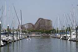 | |
|---|---|---|
| Other cities | ||
| CDPs and non- municipalities | ||
| Counties | ||
| Subregions | ||
| Bodies of water | ||
| Major ports | ||
| Nature preserves | ||
| Counties | 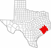 | |
|---|---|---|
| "Principal" cities | ||
| Other cities |
For a complete listing, see list of cities and towns in Houston–The Woodlands–Sugar Land MSA | |
| Unincorporated areas | ||
| Bodies of water | ||