La Porte, Texas
| City of La Porte | |
|---|---|
| City | |
|
Entrance sign | |
| Nickname(s): "L.P." | |
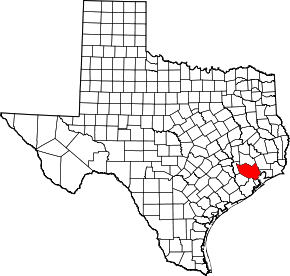
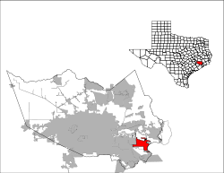 Location in Harris County in the state of Texas | |
| Coordinates: 29°39′53″N 95°2′27″W / 29.66472°N 95.04083°WCoordinates: 29°39′53″N 95°2′27″W / 29.66472°N 95.04083°W | |
| Country |
|
| State |
|
| County | Harris |
| Government | |
| • Type | Council-Manager |
| • Mayor | Louis R. Rigby |
| • City Council |
List
|
| • City Manager | Corby Alexander |
| Area | |
| • Total | 20.0 sq mi (51.8 km2) |
| • Land | 18.6 sq mi (48.3 km2) |
| • Water | 1.4 sq mi (3.6 km2) |
| Elevation | 20 ft (6 m) |
| Population (2010) | |
| • Total | 33,800 |
| • Density | 1,700/sq mi (650/km2) |
| Time zone | Central (CST) (UTC-6) |
| • Summer (DST) | CDT (UTC-5) |
| ZIP codes | 77571-77572 |
| Area code(s) | 281 |
| FIPS code | 48-41440[1] |
| GNIS feature ID | 2411580[2] |
| Website | Official website |

La Porte (/lə ˈpɔərt/ lə PORT) is a city in Harris County, Texas, United States, within the Bay Area of the Houston–Sugar Land–Baytown metropolitan area. As of the 2010 census, the city population was 33,800.[3] La Porte is the fourth-largest incorporated city in Harris County.
When La Porte celebrated its centennial in 1992, it was the home of Barbours Cut Terminal, operated by the Port of Houston Authority since 1977. Fifteen years later, the Port of Houston's newest addition, Bayport Terminal, was established just south of La Porte. The area around La Porte has served an increasingly important role in international trade since the 1970s.
The area around modern La Porte gained fame early in Texas history as the location of the Battle of San Jacinto on April 21, 1836, which ended the Texas Revolution, establishing the independence of the Republic of Texas from Mexico. The San Jacinto Monument, in the unincorporated area of La Porte, commemorates the battle. During the early 20th century, particularly the 1920s and 1930s, La Porte's Sylvan Beach became a nationally known tourist destination attracting some of the nation's most well-known entertainers. As a result of changing economics in the Houston area and beach erosion, the tourist business declined while industrial development in the area grew. During World War II and afterward, La Porte's economy rapidly shifted toward petroleum/petrochemicals and shipping, which developed as the dominant industries in the Pasadena-Baytown area.
History

The community of La Porte was founded in 1892 as a speculative real estate venture by an investment group.[4] A 22-acre (0.089 km2) public space known as Sylvan Grove was reserved by the waterfront.[5] The area around Sylvan Grove soon was developed with amenities including bathhouses, boating piers, and a Victorian hotel with a dance pavilion. La Porte quickly became the most popular tourist destination in the Houston area.[4][5][6] Sylvan Grove Park was acquired in 1896 by a company known as Adoue and Lobit and renamed Sylvan Beach.[5] Cottage retreats were built around the waterfront.[5][6]
In 1900, the devastating Galveston Hurricane hit the shoreline, seriously damaging the community's attractions.[6] As the Texas Oil Boom took hold beginning in 1901, and neighboring Houston became home to many wealthy businessmen, La Porte quickly rebuilt and re-established itself as a tourist center. It was, however, damaged again by a major fire and another hurricane in 1915.[4][5] The community rebuilt again.
During the 1920s and 1930s Sylvan Beach Amusement Park became a nationally recognized destination, featuring beauty contests and regular performances by famous bands, in addition to a growing gallery of amenities.[5] Some of the most well-known performers of the era, including Guy Lombardo, the Dorsey Brothers, Phil Harris, and Benny Goodman, appeared at the park.[4][5] In the 1930s the park was completely revamped, with additions of a large boardwalk, amusement rides, and many other attractions.[5] The residential community remained small, supported exclusively by Sylvan Beach tourism and the nearby Bay Ridge community, an area of beachfront summer homes in neighboring Morgan's Point built by wealthy Houstonians.[4]
The beachfront began to physically shrink beginning around 1928 because of erosion from the wakes of shipping traffic, and land subsidence resulting from the extraction of groundwater in the area due to development.[7] Gas rationing in World War II slowed tourism. A hurricane in 1943 destroyed most of the tourist attractions. Most of the damaged structures at Sylvan Beach were never rebuilt after this time, as the area was changing, and La Porte's tourist industry rapidly declined.[5] By the later 20th century, erosion had completely eliminated the beach.[7]
As shipyards and industrial plants in World War II were developed in nearby communities such as Pasadena, Baytown, and Deer Park, the community's residents became more dependent on these businesses. The opening of the La Porte-Baytown tunnel in 1954 further spurred development.[4] The later establishment of the Johnson Space Center in the nearby Clear Lake Area, the Barbours Cut shipping terminal in neighboring Morgan's Point, and the Bayport Industrial District within La Porte's jurisdiction have gradually made the community successful as part of the Houston area's industrial heartland.[4][8]
Much of the history of La Porte's glory years as a tourist haven has been preserved by the La Porte Bay Area Heritage Society.[7] Plans have been discussed for many years to restore La Porte's status as a tourist destination.[4] A project to restore the beachfront at Sylvan Beach Park began in 2009 and finished in 2013, with sand brought in from other areas and dredging operations.[7][9] Other plans, including building a large hotel on the shoreline, have been discussed as well.[4]
Geography

According to the United States Census Bureau, the city has a total area of 20.0 square miles (51.8 km2), of which 18.6 square miles (48.3 km2) is land and 1.4 square miles (3.6 km2), or 6.91%, is water.[10]
La Porte has many small 1940s frame houses.[11]
Climate
The climate in this area is characterized by hot, humid summers and generally mild to cool winters. According to the Köppen Climate Classification system, La Porte has a humid subtropical climate, abbreviated "Cfa" on climate maps.[12]
Communities
La Porte contains many communities. Lomax was once a separate jurisdiction but was annexed by La Porte.
Demographics
| Historical population | |||
|---|---|---|---|
| Census | Pop. | %± | |
| 1900 | 537 | — | |
| 1910 | 678 | 26.3% | |
| 1920 | 889 | 31.1% | |
| 1930 | 1,280 | 44.0% | |
| 1940 | 3,072 | 140.0% | |
| 1950 | 4,429 | 44.2% | |
| 1960 | 4,512 | 1.9% | |
| 1970 | 7,149 | 58.4% | |
| 1980 | 14,062 | 96.7% | |
| 1990 | 27,910 | 98.5% | |
| 2000 | 31,880 | 14.2% | |
| 2010 | 33,800 | 6.0% | |
| Est. 2015 | 35,148 | [13] | 4.0% |
As of the census[1] of 2000, there were 31,880 people, 10,928 households, and 8,578 families residing in the city. The population density was 1,683.3 people per square mile (649.9/km²). There were 11,720 housing units at an average density of 618.8 per square mile (238.9/km²). The racial makeup of the city was 81.39% White, 6.25% Black or African American, 0.48% Native American, 1.13% Asian, 0.08% Pacific Islander, 8.52% from other races, and 2.15% from two or more races. 20.45% of the population were Hispanic or Latino of any race.
There were 10,928 households out of which 43.2% had children under the age of 18 living with them, 62.8% were married couples living together, 11.4% had a female householder with no husband present, and 21.5% were non-families. 17.4% of all households were made up of individuals and 4.6% had someone living alone who was 65 years of age or older. The average household size was 2.90 and the average family size was 3.28.
In the city the population was spread out with 29.7% under the age of 18, 8.9% from 18 to 24, 32.7% from 25 to 44, 21.8% from 45 to 64, and 6.9% who were 65 years of age or older. The median age was 33 years. For every 100 females there were 98.5 males. For every 100 females age 18 and over, there were 95.0 males.
The median income for a household in the city was $55,810, and the median income for a family was $60,034. Males had a median income of $46,118 versus $29,514 for females. The per capita income for the city was $21,178. About 6.2% of families and 7.5% of the population were below the poverty line, including 8.4% of those under age 18 and 11.2% of those age 65 or over.
Economy
The city is located adjacent to three major economic hubs of the Bay Area and Greater Houston: the Bayport Industrial District, the Battleground Industrial District, and the Barbours Cut shipping terminal.[15]
Government
As with the majority of home-rule cities in Texas, La Porte has a charter for a council-manager form of government. The elected council members serve as a legislative body to make policy; they hire the city manager, who is the operating officer for the city. Since 2012 the city manager has been Corby Alexander, from Henderson, Texas. Elections for city council members are held at the same time as for the school board of the city's school district.
The United States Postal Service operates the La Porte Post Office at 801 West Fairmont Parkway.[16]
Education
The area is zoned to the La Porte Independent School District, including La Porte High School.
Primary and secondary schools include: Jennie Reid Elementary, Rizzuto Elementary, Lomax Elementary, La Porte Elementary, Bayshore Elementary, College Park Elementary, and Heritage Elementary. The secondary schools include Baker Sixth Grade Campus, La Porte Junior High, Lomax Junior High and La Porte High School.
Public libraries
The city is served by the 23,357-square-foot (2,169.9 m2) La Porte Branch Library of Harris County Public Library (HCPL), located at 600 South Broadway. The library first opened in 1929. The City of La Porte maintains the buildings and furnishings while HCPL staffs and operates the library.[17]
Infrastructure
Transportation

Harris County Transit provides public transportation in La Porte.[18]
La Porte Municipal Airport is located in the La Porte city limits.
The closest major airports with commercial airline service are William P. Hobby Airport and George Bush Intercontinental Airport in Houston.[19]
La Porte is linked to Interstate 10 (see map) by State Highway 146, crossing the Fred Hartman Bridge into the nearby city of Baytown; the bridge was built in 1995, replacing the Baytown Tunnel, to allow deepening of the Houston Ship Channel.
La Porte is located on the northwest end of Galveston Bay at the mouth of Buffalo Bayou and the San Jacinto River.
Notable people
- Jessica Boone is an actress and was born in La Porte.
- Kerron Clement, Olympic gold and silver medalist (track and field)
- Sarah Emma Edmonds (December 1841 – September 5, 1898), Canadian-born woman who served as a man in the American Civil War under the assumed identity of "Franklin T. Thompson."[20]
- Curvin Richards was a former NFL Player who played for the Dallas Cowboys.
- Shaun Rogers, an NFL Player.
- Ed Thompson, member of the Texas House of Representatives from Brazoria County; reared in La Porte and graduated from La Porte High School
- Gene Washington is a 2x Pro Bowler who was born in La Porte.
See also
References
- 1 2 "American FactFinder". United States Census Bureau. Retrieved 2008-01-31.
- ↑ U.S. Geological Survey Geographic Names Information System: City of La Porte
- ↑ "Profile of General Population and Housing Characteristics: 2010 Demographic Profile Data (DP-1): La Porte city, Texas". U.S. Census Bureau, American Factfinder. Retrieved June 15, 2012.
- 1 2 3 4 5 6 7 8 9 Kolodzy, Ron: La Porte, Texas from the Handbook of Texas Online. Retrieved 19 January 2010. Texas State Historical Association.
- 1 2 3 4 5 6 7 8 9 Adams, Denise. "Sylvan Beach: La Porte's Swinging Shoreline". Regional Vue Point. Archived from the original on July 17, 2011. Retrieved 19 January 2010.
- 1 2 3 Antrobus (2005), p. 51–52.
- 1 2 3 4 Christian, Carol (14 May 2009). "Restoration project on Sylvan Beach has begun $3.5 million plan will create 2,000 feet of shoreline, protective barricade". Houston Chronicle.
- ↑ "City of La Porte: Bayport Industrial District, Battleground Industrial District". City of La Porte, Texas. Retrieved 15 January 2010.
- ↑ "Press Release: Beach restoration brings back historic park's former glory" (PDF). Texas General Land Office. 20 May 2009.
- ↑ "Geographic Identifiers: 2010 Demographic Profile Data (G001): La Porte city, Texas". U.S. Census Bureau, American Factfinder. Retrieved June 15, 2012.
- ↑ Kearney, p. 224.
- ↑ Climate Summary for La Porte, Texas
- ↑ "Annual Estimates of the Resident Population for Incorporated Places: April 1, 2010 to July 1, 2015". Retrieved July 2, 2016.
- ↑ "Census of Population and Housing". Census.gov. Retrieved June 4, 2015.
- ↑ "City of La Porte: Bayport Industrial District, Battleground Industrial District". City of La Porte, Texas. Retrieved 15 January 2010.
"Barbours Cut Container Terminal". Port of Houston Authority. Retrieved 15 January 2010. - ↑ "Post Office Location - LA PORTE." United States Postal Service. Retrieved on November 29, 2008.
- ↑ "La Porte Branch Library." Harris County Public Library. Retrieved on November 29, 2008.
- ↑ "Routes / Maps." Harris County Transit. Retrieved on January 15, 2010.
- ↑ "Transportation." City of Baytown
- ↑ "Sarah Emma Edmonds". Michigan Women's Historical Center and Hall of Fame. Archived from the original on August 18, 2007. Retrieved 19 January 2010.
Further reading
- Foxworth, Erna (1986). The romance of old Sylvan Beach: a hundred years of amusement and nostalgia. Austin, TX: Waterway Press. ISBN 978-0-89896-288-8.
- Antrobus, Sally (2005). Galveston Bay. College Station, TX: Texas A&M University Press. ISBN 1-58544-461-8.
- Kearney, Sid. A Marmac Guide to Houston and Galveston: 6th Edition. Pelican Publishing, March 1, 2009. ISBN 1455608505, 9781455608508.
External links
| Wikimedia Commons has media related to La Porte, Texas. |
| Large cities | 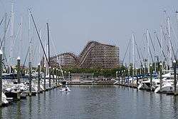 | |
|---|---|---|
| Other cities | ||
| CDPs and non- municipalities | ||
| Counties | ||
| Subregions | ||
| Bodies of water | ||
| Major ports | ||
| Nature preserves | ||
| Counties |  | |
|---|---|---|
| "Principal" cities | ||
| Other cities |
For a complete listing, see list of cities and towns in Houston–The Woodlands–Sugar Land MSA | |
| Unincorporated areas | ||
| Bodies of water | ||