Tân Phú District
For the district in Đồng Nai Province, see Tân Phú District, Đồng Nai.
| Tân Phú District Quận Tân Phú | |
|---|---|
| Urban district | |
 Position in HCMC's core | |
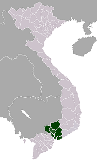
 Tân Phú District Location in Vietnam | |
| Coordinates: 10°47′32″N 106°37′31″E / 10.79222°N 106.62528°ECoordinates: 10°47′32″N 106°37′31″E / 10.79222°N 106.62528°E | |
| Country |
|
| Centrally governed city | Ho Chi Minh City |
| Seat | Hoà Thạnh ward |
| Wards | 11 phường |
| Area | |
| • Total | 16 km2 (6 sq mi) |
| Population | |
| • Total | 407,924 |
| • Density | 25,000/km2 (66,000/sq mi) |
| Demographics | |
| • Main ethnic groups | predominantly Kinh |
| Time zone | ICT (UTC+07) |
| Website | tanphu.hochiminhcity.gov.vn |
Tân Phú is an urban district of Hồ Chí Minh City, Vietnam. As of 2010, the district has a population of 407,924[1] and covers an area of 16 km².[1] The district is divided into 11 small subsets which are called wards. It borders District 12 to the north, Tân Bình District to the east, Bình Tân District to the west, and District 6 and District 11 to the south.

The district was separated from Tân Bình District in December 2003.[2] It consists of 11 wards: Tân Sơn Nhì, Tây Thạnh, Sơn Kỳ, Tân Quý, Tân Thành, Phú Thọ Hòa, Phú Thạnh, Phú Trung, Hòa Thạnh, Hiệp Tân, Tân Thới Hòa.
References
- 1 2 "HCMC's Population and population density in 2010 by district". HCMC Office of Statistics. Retrieved Feb 4, 2014.
- ↑ (Vietnamese) ..điều chỉnh địa giới hành chính quận Tân Bình để thành lập quận Tân Phú và các phường trực thuộc...
External links
- Quận Tân Phú Official site.

This article is issued from Wikipedia - version of the 4/23/2014. The text is available under the Creative Commons Attribution/Share Alike but additional terms may apply for the media files.