Suryodaya Municipality
| Suryodaya Municipality सूर्योदय नगरपालिका | |
|---|---|
 Suryodaya Municipality Suryodaya Municipality | |
| Coordinates: 26°53.45′N 88°3.90′E / 26.89083°N 88.06500°ECoordinates: 26°53.45′N 88°3.90′E / 26.89083°N 88.06500°E | |
| Country |
|
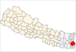
| Zone | Mechi Zone |
| District | Ilam |
| Elevation | 1,565 m (5,135 ft) |
| Population (2011) | |
| • Total | 17,240 |
| Time zone | NPT (UTC+5:45) |
| Area code(s) | 027 |
Suryodaya Municipality is a municipality in Ilam district of Nepal.
It was formed by merging three village development committees i.e. Phikal Bazar, Panchakanya and Kanyam in May 2014.[1] [2]
Population
The 2012 population was 17,240.[3]
Industry
The major industry in this municipality is Tea industry. Besides this, most of the people are based on the agriculture and animal husbandry. The milk production is also very popular in this area including other villages of Ilam. This municipality has a comparatively good quality of life than other areas of Ilam. The status of local facilities like roads, drinking water, schools and other utilities is also better. Ilam itself is a very beautiful place with many touristic attractions. There are thousands of internal and foreigners visiting and admiring its beauty every year. Suryodaya Municipality hosts many attractive places like Kanyam tea garden, Fikkal bazzar, Karfook etc. These places are spectacular for the people who love the nature.
References
- ↑ 72 new municipalities announced My Republica
- ↑ Govt announces 72 new municipalities The Kathmandu Post
- ↑ "National Census 2011" (PDF). Retrieved May 2014. Check date values in:
|access-date=(help)
