Chamaita, Ilam
| Chamaita चमैता गाविस | |
|---|---|
| Village development committee | |
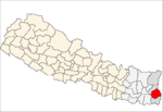
 Chamaita Location in eastern part of Nepal | |
| Coordinates: 27°01′N 87°49′E / 27.01°N 87.82°ECoordinates: 27°01′N 87°49′E / 27.01°N 87.82°E | |
| Country |
|
| Zone | Mechi Zone |
| District | Ilam District |
| Population (1991) | |
| • Total | 5,229 |
| Time zone | Nepal Time (UTC+5:45) |
Chamaita is a town and village development committee in Ilam District in the Mechi Zone of eastern Nepal. At the time of the 1991 Nepal census, it had a population of 5,229 people living in 863 individual households.[1]
References
- ↑ "Nepal Census 2001". Nepal's Village Development Committees. Digital Himalaya. Archived from the original on 12 October 2008. Retrieved 17 September 2008. Most of the People in Chamaita are farmers. Including all occupations they mostly depend upon agriculture. The main source of income is cardamom and tea.
External links
This article is issued from Wikipedia - version of the 11/19/2016. The text is available under the Creative Commons Attribution/Share Alike but additional terms may apply for the media files.