Stonebridge, Saskatoon
| Stonebridge | |
|---|---|
| Neighbourhood | |
|
Stonebrige community plan sign | |
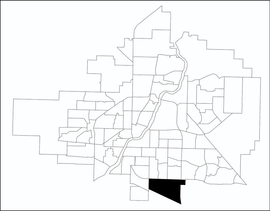 Stonebridge location map | |
| Coordinates: 52°4′46″N 106°37′29″W / 52.07944°N 106.62472°WCoordinates: 52°4′46″N 106°37′29″W / 52.07944°N 106.62472°W | |
| Country |
|
| Province |
|
| City | Saskatoon |
| Suburban Development Area | Nutana |
| Neighbourhood | Stonebridge |
| Construction | 1946-1960 |
| Government | |
| • Type | Municipal (Ward 7) |
| • Administrative body | Saskatoon City Council |
| • Councillor | vacant |
| Area | |
| • Total | 1.5 km2 (0.6 sq mi) |
| Population (2009) | |
| • Total | 994 |
| • Average Income | $78,438 |
| Time zone | UTC (UTC-6) |
| Website | Stonebridge Community Association |

Stonebridge is a mostly residential neighbourhood located in south-central Saskatoon, Saskatchewan, Canada. It is a suburban subdivision, consisting of low-density, single detached dwellings and a mix of medium-density apartment and semi-detached dwellings. As of 2009, the area is home to 994 residents. The neighbourhood is considered a middle-income area, with an average family income of $67,642, an average dwelling value of $321,004 and a home ownership rate of 72.4%.[1] According to MLS data, the average sale price of a home as of 2013 was $380,777.[2]
History

The first development in the area occurred with the purchase of land in 1976 by the University Drive Alliance Church. The congregation moved into their newly built facility, Circle Drive Alliance Church, in November 1979. Two adjacent buildings, a personal care home and senior citizens' home, were completed in 1986.[3]
The city formally annexed the land in the 1980s.,[4] though some of the northern portions of the community closest to Circle Drive were actually annexed much earlier: 1959 for lands east of Preston Avenue, and 1966 for lands to the west. However, development did not begin until 2005,[5][6] with the construction of the Stonegate Shopping Centre. Stonegate's development was tied to the construction of an overpass at Clarence Avenue South over Circle Drive.[7][8] Home building began at about the same time as the Stonegate construction. The Clarence Avenue interchange was completed and opened to traffic on November 20, 2007.[9] Another interchange at Preston Avenue was constructed as part of the South Circle Drive project.[10] The neighbourhood reached full buildout in late 2015, nearly seven years ahead of schedule.[5]
Street naming controversy
In 2007, Saskatoon City Council approved the naming of one street, Alm Crescent, after Terry Alm, who had only recently ended his tenure as a city councilor in order to enter provincial politics. Residents and some councilors expressed upset that Alm's name was chosen over other longstanding naming candidates on a list maintained by the city for future street names; the list included former mayors, 50 other former councilors, and onetime Saskatoon resident, Joni Mitchell. The decision sparked a motion by one councilor to impose a 10-year waiting period on naming streets after recently departed politicians.[11]
Government and politics
Stonebridge exists within the federal electoral district of Blackstrap. It is currently represented by Lynne Yelich of the Conservative Party of Canada, first elected in 2000 and re-elected in 2004, 2006 and 2008.
Provincially, the area is within the constituency of Saskatoon Southeast. It is currently represented by Don Morgan of the Saskatchewan Party, first elected in 2003 and re-elected in 2007.
In Saskatoon's non-partisan municipal politics, Stonebridge lies within ward 7. The council seat is held by Mairin Loewen, elected in 2011.
Institutions
Education
As of July 2015, no schools exist in Stonebridge. The community plan shows space allocated for schools in the center of neighbourhood. On October 22, 2013, the provincial government announced funding for new schools in Saskatoon, including a joint-use public/separate school in Stonebridge.[12] Greater Saskatoon Catholic Schools revealed on June 23, 2015 that the division's new elementary school in Stonebridge will be named St. Kateri after Kateri Tekakwitha and it is expected to be complete by 2017.,[13] while the public school will be named Chief Whitecap Elementary School.
Other
Samaritan Place - long term care facility operated by Amicus Health Care Inc., a subsidiary of the Catholic Health Ministry of Saskatchewan. Currently under construction.[14]
Circle Drive Alliance Church and associated seniors residence. Constructed in 1986 southeast of Preston Avenue and Circle Drive, it predated development of Stonebridge by nearly a quarter century.
Parks and recreation
- Alexander MacGillivray Young Park - 9.9 acres (4.0 ha)
- Alfred Bence Park - 0.3 acres (0.12 ha)
- Blair Nelson Park - 4.3 acres (1.7 ha)
- Cecil A. Wheaton Park - 0.4 acres (0.16 ha)
- Donald Koyl Park - 0.5 acres (0.20 ha)
- Evelyn G. Edwards Park - 0.5 acres (0.20 ha)
- Howard Harding Park - 0.8 acres (0.32 ha)
- John Cameron Park - 0.4 acres (0.16 ha)
- Mark Thompson Park - 3.4 acres (1.4 ha)
- Marshall Hawthorne Park - 8.2 acres (3.3 ha)
- Oren Willson Park - 0.5 acres (0.20 ha)
- Owen Mann Park - 0.5 acres (0.20 ha)
- Patricia Roe Park - 0.8 acres (0.32 ha)
- Peter Zakreski Park - 20.2 acres (8.2 ha)
- Robert H. Freeland Park - 0.7 acres (0.28 ha)
- Walter Wood Park - 0.3 acres (0.12 ha)
- William Anderson Park - 0.3 acres (0.12 ha)
The Stonebridge Community Association was formed in 2009 to advocate on civic and property development matters, and run affordable sport and recreation programs for children, youth and adults.[15]
The Willows golf course is located immediately southwest of the community.
Public services
Stonebridge is a part of the east division of the Saskatoon Police Services patrol system.[16] Saskatoon Fire & Protective Services' east division covers the neighbourhood.[17] Transit services to Stonebridge are provided by Saskatoon Transit on route No. 17 (University - Stonebridge via Clarence).[18]
Commercial
At present, the major commercial district of Stonebridge is the Stonegate Shopping Centre, a big box commercial development in the northwest corner that includes Walmart. Additional businesses are located west of Stonegate in an area called the Stonebridge Business Park, straddling Stonebridge Boulevard. Other mixed-used districts that include retail space are planned for the center of the neighbourhood. The Saskatoon Auto Mall, a collection of vehicle dealerships, is located immediately west of the community. The nearest enclosed shopping centre is Market Mall, approximately a kilometre to the north.
The Stonebridge commercial area includes new hotel development, marking the first time since the 1970s that new hotel accommodation has been constructed east of the river, following the closure of most hotels and motels along 8th Street between the 1970s and 1990s in deference to retail development.
Location
Stonebridge is located within the Nutana Suburban Development Area. It is bounded by Highway 11 to the east, Clarence Avenue to the west, Circle Drive to the north, and the Canadian National Railway tracks to the south, . Streets are laid out in a typical hierarchy of arterial, collector and local roads. There are no bicycle lanes or pedestrian paths into the neighbourhood.
 |
Avalon | Adelaide/Churchill - Nutana Park - Eastview | Lakeview | |
| C.N. Industrial | |
R.M. of Corman Park | ||
| ||||
| | ||||
| The Willows | R.M. of Corman Park | R.M. of Corman Park |
References
- ↑ "Stonebridge" (PDF). Neighbourhood Profiles. City of Saskatoon - City Planning Branch. 2010. Retrieved 2011-01-05.
- ↑ "Stonebridge". Saskatoon Realty. Retrieved 2014-01-08.
- ↑ Willems, Lorraine (2003). "Historical Flashbacks - Rev. & Mrs. Walter Boldt". College of Prayer. Retrieved 2011-01-05.
- ↑ "Populace Spring 2006". 8 (1). City of Saskatoon - City Planning Branch. Spring 2006: 5
- 1 2 Warren, Jeremy (2015-12-29). "A neighbourhood marks an anniversary: Stonebridge is 'basically finished'". The StarPhoenix. Retrieved 2015-12-29.
- ↑ "Future Growth & Development of Saskatoon" (PDF). City of Saskatoon - Community Services Department. December 2005. Archived from the original (PDF) on 2007-09-29. Retrieved 2007-10-28.
- ↑ Coolican, Lori (February 28, 2006). "Councillors clear way for Stonegate interchange". The StarPhoenix. CanWest MediaWorks Publications Inc. Retrieved 2011-01-07.
- ↑ "Overpass cost balloons $5.5M". The StarPhoenix. CanWest MediaWorks Publications Inc. January 5, 2007. Retrieved 2011-01-07.
- ↑ "Significant Dates". City of Saskatoon - City Archives. 2009. Retrieved 2011-01-10.
- ↑ "Circle Drive and Preston Avenue Interchange Information Session on October 19". City of Saskatoon. Retrieved 2010-11-04.
- ↑ "'Alm Crescent' street name gets bumpy ride". The StarPhoenix (reposted via Canada.com). CanWest MediaWorks Publications Inc. August 15, 2007. Retrieved 2013-01-04.
- ↑ "Province announces plan to build 9 new schools using P3". CBC News. 2013-10-22. Retrieved 2013-10-22.
- ↑ "New Catholic schools get names". StarPhoenix. 2015-06-23. Retrieved 2015-07-01.
- ↑ "Sod turned on long-term care facility". Global Television Network. CanWest. August 5, 2010. Retrieved 2002-11-20.
- ↑ "Stonebridge Community Association". City of Saskatoon - Community Development Branch. Retrieved 2011-01-05.
- ↑ "East Division". Saskatoon Police Service. Retrieved 2011-01-21.
- ↑ "Divisions - East". City of Saskatoon - Fire and Protective Services. Retrieved 2011-01-21.
- ↑ "Routes & Schedules - Route 17" (PDF). City of Saskatoon - Transit Services. Retrieved 2011-01-21.
External links
| Wikimedia Commons has media related to Stonebridge. |