Montgomery Place, Saskatoon
| Montgomery Place | |
|---|---|
| Neighbourhood | |
| Coordinates: 53°16′37″N 106°43′51″W / 53.276944°N 106.730833°W | |
| Country |
|
| Province |
|
| City | Saskatoon |
| Suburban Development Area | Confederation SDA |
| Neighbourhood | Montgomery Place |
| Government | |
| • Type | Municipal (Ward 2) |
| • Administrative body | Saskatoon City Council |
| • Councillor | Pat Lorje |
| Area | |
| • Total | 1.7 km2 (0.7 sq mi) |
| Population (2009) | |
| • Total | 2,649 |
| • Density | 1,600/km2 (4,000/sq mi) |
| • Average Income | $94,446 |
| Time zone | UTC (UTC-6) |
| Website | Montgomery Place |
| List of neighbourhoods in Saskatoon | |
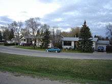
Montgomery Place is a post World War II community erected for veterans outside Saskatoon, Saskatchewan, which consists primarily of residential homes.[1][2] It was amalgamated within the city of Saskatoon in 1956, and is now a National Historic Site.[3] Montgomery Place has an average household size of 3.2 persons, and homeownership is at 93.7%. According to MLS data, the average sale price of a home as of 2013 was $403,840.[4] It was named in honour of Field Marshal The 1st Viscount Montgomery of Alamein, the famous Ulster Scots commander in the British Army during the Second World War.
History

Most of this neighbourhood was built after World War II as a part of the Veterans' Land Act settlement plan. Ten years later in 1955 it became a neighbourhood of Saskatoon[5][6][7] The area was designated a National Historic Site on July 4, 2016.[8] It was named after Field Marshal Lord Montgomery - 'Monty' - and most street names honour notable people and places associated with the war.
This monument commemorates the Canadian Forces veterans who built their homes here during the years 1946–77. Montgomery Place was established with small land holdings under the Federal Government;s Veteran's Land Act for men and women returning from World War II and the Korean War. Dedicated September 16, 1999— Image Origins of Montgomery Place
Field Marshal B.L. Montgomery (1887–1976) Montgomery was one of the most inspirational British military leaders of the Second World War. After significant victories over German General Erwin Rommel in North Africa (1942–1944), he was promoted to Field Marshal in command of British and Canadian troops. Montgomery presided over the Battles of Arnhem and Normandy and accepted the formal surrender of the German military at Luneburg Heath on May 4, 1945. His flair for command and the absolute belief in his infallibility made him a legendary, if not always popular, leader.— Image B.L. Montgomery
Lt. Colonel Cecil Merritt (1908–1991) Lt. Col. Cecil Merritt won the first Victoria Cross given to a Canadian in WWII for gallantry and inspired leadership during the disastrous raid in Dieppe. He landed with the South Saskatchewan Regiment at Pourville on August 19, 1942. To capture important high ground to the east, they had to cross the Scie by a bridge under heavy fire. Seeing the situations, Merritt walked on to the bridge, waved his helmet to encourage his men, and shouted: "Come on over, there's nothing to worry about here." After hours of heavy fighting, Merritt and his men were taken captive. Merritt was commended for his leadership while a prisoner.— Image Cecil Merritt
Future expansion
The neighbourhood was considered to have reached full build-out in the early 1980s, however in the years since some additions have occurred. Current (2013) development plans for the region call for an expansion of Montgomery Place to the west of Chappell Drive, with additional residential development (previously, the area had been earmarked for a light industrial district). Beginning in 2012, construction of residential development north of 11th Street and south of the 11th Street Bypass (constructed as part of the South Circle Drive project) began, which has added the first apartment-style multi-family developments to the community. No time frame has been presented on the western expansion. With the completion of Circle Drive, there is also potential future development land available on the west side of Dundonald Avenue, which as of 2013 no longer connects to Valley Road or the City Landfill and has a number of lots that were left vacant for decades due to uncertainty over the eventual outcome of the Circle Drive alignment.
A new law has been put into place in this community that you can no longer sub-divide lots. The community wants to keep large spacious yards a tradition for many years to come.[9]
Layout

11th Street and the new 11th Street Bypass are the northernmost roads in Montgomery Place. Chappell Drive is the furthest west road at present, whereas Dundonald Avenue and the southwest extension of Circle Drive lie to the east (Dundonald formerly linked south to Valley Road and Spadina Crescent, but is now closed at Mountbatten Street). The southern boundary of the community's residential development is denoted by Burma Road, a private (non-City of Saskatoon) roadway servicing the CN Rail yards on the south side of Montgomery Place. The neighbourhood is a conglomeration of streets and avenues in near grid fashion combined with courts. The neighbourhood naming practices honour the history and theaters of World War II.[10][11]
The city's main rail yard and passenger station is located on the south side of Montgomery Place, and the northern side of the community is in the shadow of the Viterra Grain Terminal (formerly known as Canadian Government Elevators and later AgPro), one of the city's iconic landmarks.[12]
Streets
The following streets are located in this area:
11th Street West/11th Street Bypass, Caen Street, Arnhem Street, Normandy Street, Ortona Street, Merritt Street, Dieppe Street, Mountbatten Street, Currie Avenue, McNaughton Avenue, Elevator Road, Rockingham Avenue, Haida Avenue, Simonds Avenue, Cassino Avenue & Place, Crerar Drive, Crescent Boulevard, Lancaster Boulevard & Crescent, Bader Crescent, Dundonald Avenue, Chappell Drive, Burma Road.
Burma Road, a private roadway, runs east-to-west between the residential development of Montgomery Place and the rail yards to the south. The road did not appear on official city maps prior to 2012, but was recognized by Google Maps, and unofficial street signs were erected. Beginning in 2013, the City of Saskatoon's official street map shows it, even though it is not open for public traffic.
A notable aspect of many older roadways within Montgomery Place is the lack of sidewalks. Several older streets within the community also were left unpaved for many years due to a stated desire by residents of the day to keep property taxes low.
Government and politics
Montgomery Place exists within the federal electoral district of Saskatoon--Rosetown--Biggar. It is currently represented by Kelly Block of the Conservative Party of Canada.[13]
Provincially, the area is within the constituency of Saskatoon Riversdale. It is currently represented by Danielle Chartier of the Saskatchewan New Democratic Party.[14][15]
In Saskatoon's non-partisan municipal politics, Montgomery Place lies within ward 2. It is currently represented by Pat Lorje, first elected in 2003 and re-elected in 2006.[16] Montgomery Place dropped 10 per cent below the average, causing a look at getting the city wards remapped.[17] Pat Lorje stated that she feels inner - city residents may have been undercounted during the last census.
Education
| Montgomery School | |
|---|---|
| Address | |
|
3220 Ortona Street Saskatoon, Saskatchewan, S7M 3R6 Canada | |
| Information | |
| Type | Elementary |
| School board | Saskatoon Public School Division |
| Principal | Miranda Low |
| Vice Principal | Dulcie Puobi |
| Enrollment | 274[18] (2016) |
| Education system | Public |
| Language | English |
| Website | Montgomery School |
| St. Dominic School | |
|---|---|
.jpg) | |
| Address | |
|
3301 Dieppe Street Saskatoon, Saskatchewan, S7M 3S6 Canada | |
| Information | |
| Type | Elementary |
| Religious affiliation(s) | Catholic |
| Opened | 1964[19] |
| School board | Greater Saskatoon Catholic Schools |
| Principal | Jenise Vangool |
| Vice Principal | Jennifer Millar |
| Grades | Kindergarten to Grade 8 |
| Enrollment | 157[18] (2016) |
| Education system | Separate |
| Language | English |
| Feeder to | Bethlehem High School |
| Website | St. Dominic School |
- Montgomery School - public elementary, part of the Saskatoon Public School Division[20]
- St. Dominic School - separate (Catholic) elementary, part of Greater Saskatoon Catholic Schools[21]
Shopping

The Confederation Suburban Center is the closest large retail center and contains 400 operating businesses which is 8% of Saskatoon's retail sector. The Blairmore suburban Center is under development. Montgomery residents can directly access the former via Circle Drive and the latter via 11th Street and the realigned Highway 7.
In addition Montgomery Place is home to Greg's Grocery Plus, a local bakery and convenience store. The neighbourhood was once home to the Montgomery Grocery, at the corner of Dundonald Ave. and 11th Street; the building was demolished as the intersection prepared for construction of the southwest leg of Circle Drive.

Community Events
The annual Montgomery Garage Sale occurs on the first Saturday in May. By all measures, this is the largest community garage sale in Saskatoon. Many community groups use the event as an opportunity to host fundraising barbecues and bake sales. Traffic within the neighbourhood is often abnormally congested during this event.
In addition, Montgomery Place hosts its very own Remembrance Day ceremony each year in Montgomery Park. Given its unique history as a veteran's neighbourhood (as reflected by many of the street names), there is always overwhelming community support for the service.[22][23][24]
Area parks
- Gougeon Park 2.26 acres (9,100 m2)
- Lt. Col. Drayton Walker Park 1.93 acres (7,800 m2)
- Lt. Gen. G.G. Simonds Park 2.76 acres (11,200 m2)
- Montgomery Park 8.32 acres (33,700 m2)
Other recreation
- The CN Curling Club is located on Chappell Drive on the west side of the community.
Transportation
City transit
Saskatoon Transit serves the neighbourhood with regular bus service. Route 22: Montgomery
Rail
Via Rail's Saskatoon passenger station is located off the southwest corner of the community, having been relocated there from downtown Saskatoon in the 1960s.
References
- ↑ Memorial Cairn Dedication Service URL accessed March 18, 2007
- ↑ Newspaper Articles URL accessed March 18, 2007
- ↑ [History of Saskatoon#Post War Years|History of Saskatoon] URL accessed April 1, 2007
- ↑ "Montgomery Place". Saskatoon Realty. Retrieved 2014-01-08.
- ↑ 50th Anniversary Celebration URL accessed March 18, 2007
- ↑ Montgomery Park 1955 URL accessed March 18, 2007
- ↑ Saskatoon History Review Montgomery URL accessed March 18, 2007
- ↑ Montgomery Place, Parks Canada backgrounder, July 4, 2016
- ↑ City of Saskatoon, Projected Growh Map, October 10, 2008 (accessed November 16, 2008)
- ↑ Trinity Church URL accessed March 18, 2007
- ↑ Pictures of CN URL accessed March 18, 2007
- ↑ Selling an Idea or a Product URL accessed January 27, 2007
- ↑ "Voter Information Service -". Elections Canada. Retrieved 2008-08-261. Check date values in:
|access-date=(help) - ↑ "Provincial Constituency Boundaries: City of Saskatoon". Elections Saskatchewan. Retrieved 2008-08-261. Check date values in:
|access-date=(help) - ↑ "CTI". Retrieved 2008-08-261. Check date values in:
|access-date=(help) - ↑ "City of Saskatoon · City Council · Ward Councillors · Ward 2 - Councillor Pat Lorje". Retrieved 2008-08-261. Check date values in:
|access-date=(help) - ↑ Nickel, Rod (August 26, 2008). "City wards being remapped East-side neighbourhoods show population growth". The StarPhoenix. pp. Front Page.
- 1 2 Active List of Saskatchewan Schools/Programs (PDF), retrieved 2016-11-28
- ↑ Celebrating a Century of Faith and Learning - A History of Saskatoon's Catholic Schools. Greater Saskatoon Catholic Schools. 2015. p. 199. ISBN 978-0-9947443-0-2.
- ↑ "Montgomery School". Saskatoon Public School Division. Retrieved 2015-07-04.
- ↑ "St. Dominic School". Greater Saskatoon Catholic Schools. Retrieved 2015-07-04.
- ↑ History of the Marshall Building/Mitchells URL accessed March 18, 2007
- ↑ Memories of Montgomery Place by Margaret Gent 1996 URL accessed March 18, 2007
- ↑ City of Saskatoon · Departments · Community Services · Community ... URL accessed March 18, 2007
External links
| Wikimedia Commons has media related to Montgomery, Saskatoon. |
- Neighbourhood Profile
- City of Saskatoon · Departments · Community Services · City Planning · ZAM Maps
- Populace Spring 2006
 |
AgPro Industrial Fairhaven |
| ||
| CN yards Management Area Chappell Drive | |
South West Industrial | ||
| ||||
| | ||||
| Saskatoon railway station C.N. Yards Management Area |