State (MBTA station)
STATE
STATE | ||||||||||||||||
|---|---|---|---|---|---|---|---|---|---|---|---|---|---|---|---|---|
 Eastbound Blue Line train at State in 2008 | ||||||||||||||||
| Location |
200 Washington Street Boston, Massachusetts | |||||||||||||||
| Coordinates | 42°21′31″N 71°03′28″W / 42.3587°N 71.0578°WCoordinates: 42°21′31″N 71°03′28″W / 42.3587°N 71.0578°W | |||||||||||||||
| Owned by | MBTA | |||||||||||||||
| Line(s) | ||||||||||||||||
| Platforms | 4 side platforms (2 on each level) | |||||||||||||||
| Tracks | 4 (2 on each level) | |||||||||||||||
| Construction | ||||||||||||||||
| Platform levels | 2 | |||||||||||||||
| Disabled access | Yes | |||||||||||||||
| History | ||||||||||||||||
| Opened |
December 30, 1904 (Blue Line) November 30, 1908 (Orange Line) | |||||||||||||||
| Rebuilt |
1924 (Blue Line) April 26, 2011 | |||||||||||||||
| Previous names |
Devonshire (1904–1967) Milk/State (1908–1967) State/Citizens Bank (1997–2000) State/Aquarium (2004) | |||||||||||||||
| Traffic | ||||||||||||||||
| Passengers (2013) | 13,258 (weekday average boardings)[1] | |||||||||||||||
| Services | ||||||||||||||||
| ||||||||||||||||
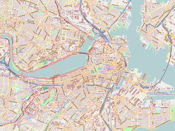
| Location | ||||||||||||||||
 | ||||||||||||||||
State, well known as State Street, is a subway station of the Massachusetts Bay Transportation Authority. Located in downtown Boston, Massachusetts, USA, State is the transfer point between the Orange Line and the Blue Line, as one of the quartet of "hub stations" on the MBTA subway system.
What later became the Blue Line platforms of State station were opened in 1904, making it the oldest surviving MBTA rapid transit (heavy rail) station. (The Tremont Street Subway, opened in 1897, serves only Green Line (light rail) streetcars). After an extensive renovation which was completed in 2011, State is fully handicapped accessible.
History
East Boston Tunnel

The Blue Line section of the station was built along with the rest of the East Boston Tunnel in the first years of the 20th century and opened on December 30, 1904, serving streetcars running from downtown to East Boston.[2] An unusual aspect of State Street station is the entrance built directly into one of Boston's best-known historic sites, the Old Massachusetts State House. This entrance often confuses first-time tourists and visitors with its unconventional location. The East Boston Tunnel station was originally known as Devonshire after the street which the Old State House is located on. The station is the only remaining station on the tunnel opened in 1904.
Effective April 18, 1924, the East Boston Tunnel was converted to heavy rail (metro) rolling stock. High platforms were installed, and trolley wire was replaced with third rail power.[2]
Washington Street Tunnel

The Washington Street Tunnel opened on November 30, 1908 to Main Line elevated trains running between Forest Hills and Sullivan Square.[2] As with the other stations in the tunnel; the two platforms were treated as completely separate stations. The northbound platform was known as State since its main entrance was at the cross street of State Street, while the southbound platform was similarly Milk Street after its entrance from Milk Street. (The station pair was designated on some maps as Milk/State).[2]
MBTA era
After taking over operations in 1964, the MBTA began rebranding efforts. The East Boston Tunnel/Revere Extension and Main Line El/Washington Street Tunnel routes were renamed as the Blue Line and Orange Line on August 25, 1965. On January 25, 1967, the separate station names of Devonshire and Milk/State were changed to State.[2]

Platform extensions on both Orange Line platforms were completed just prior to the introduction of 6-car trains on August 18, 1987. This change was prompted by the opening of new stations on the Southwest Corridor earlier that year, replacing the 4-car-long stations on the Washington Street Elevated.
From 1997 to 2000, State was renamed State/Citizens Bank in a $500,000 corporate sponsorship from Citizens Bank, who had recently moved to the area, and hoped to eventually have the name changed to simply Citizens Bank Plaza.[3] The sponsorship failed and the name reverted to State. During the renovation of Aquarium station, during which that station was closed, State was renamed temporarily State/Aquarium from October 14, 2000 to October 29, 2001.[2]
An extensive renovation of State began in 2005. New CharlieCard fare machines were installed in 2006, which involved closing the Blue Line level of the station from June 24 to July 1.[2] In April 2011, the 6-year-long reconstruction of the station was declared substantially complete. The Blue Line platforms were connected to the already-accessible Orange Line platforms by ramps, thus making the entire station handicapped accessible. All Orange Line stations are accessible, including State, as are all Blue Line stations (with the exception of Bowdoin).
Station layout


State is unique among Orange Line stations as it was built on two levels to fit under the narrow section of Washington Street while crossing the East Boston Tunnel. The southbound platform is above the northbound track and furthermore staggered considerably south of the northbound platform. The southbound platform is connected to the rest of the station by a lengthy pedestrian passageway, originally known as "the speedway".[4]
The station's headhouses are located between Government Center and the Financial District. State station has six entrances spread out over nearly 1,000 feet (300 m); after consolidation and reconstruction by the MBTA, all entrances serve both lines in all directions. One entrance is built into the basement of the Old State House and four into commercial buildings. The northernmost entrance, which is accessed from an unmarked stairwell under 28 State Street, was originally constructed to serve Adams Square but now primarily serves Boston City Hall.[4]
Three entrances are fully handicapped accessible with elevators to platform level: Old South Meeting House (Washington Street at Milk Street), 53 State Street, and 60 State Street. The other three entrances - Old State House (State Street at Devonshire Street), Devonshire Street at Water Street, and Government Center Plaza - are not handicapped accessible.[5]
Blue Line
| Platform level | Side platform, doors will open on the right | |
| Southbound | ← Blue Line toward Bowdoin or Government Center (Government Center) | |
| Northbound | → Blue Line toward Wonderland (Aquarium) → | |
| Ground | - | Exit/Entrance |
Orange Line
| Platform level | Southbound | ← Orange Line toward Forest Hills (Downtown Crossing) |
| Northbound | → Orange Line toward Oak Grove (Haymarket) → | |
Bus connections

State is served by five MBTA Bus routes:[5]
- 4 North Station - World Trade Center via Federal Courthouse & South Station
- 92 Assembly Square Marketplace - Downtown via Sullivan Square Station, Main Street and Haymarket Station
- 93 Sullivan Square Station - Downtown via Bunker Hill Street and Haymarket Station
- 352 Burlington Express - Boston via Route 128 & I-93
- 354 Woburn Express - Boston via Woburn Sq. & I-93
State is also the closest Blue Line stop to the bus hub at Downtown Crossing, which is three blocks from the Old South Meeting House entrance.[5]
In popular culture
- In the 2013 video game The Last of Us (which has segments that take place in Boston), one scene is set in a dilapidated State Street station.[6]
References
- ↑ "Ridership and Service Statistics" (PDF) (14 ed.). Massachusetts Bay Transportation Authority. 2014. Retrieved 1 August 2014.
- 1 2 3 4 5 6 7 Belcher, Jonathan (12 November 2012). "Changes to Transit Service in the MBTA district" (PDF). NETransit. Retrieved 15 November 2012.
- ↑ "Suited to a T: State Street station becomes a billboard for Citizens Bank". Boston Business Journal. December 19, 1997.
- 1 2 "The Stations of the Washington St. Tunnel, Boston, Mass.". Engineering News: A Journal of Civil, Mechanical, Mining and Electrical Engineering. 62 (15): 369. 7 October 1909.
- 1 2 3 "State Station Neighborhood Map" (PDF). Massachusetts Bay Transportation Authority. July 2012. Retrieved 24 May 2016.
- ↑ Annear, Steve (4 February 2013). "MBTA Station Featured in New End-of-the-World Playstation Game [Photo]". BostInno. Retrieved 20 October 2014.
External links
| Wikimedia Commons has media related to State (MBTA station). |
- MBTA - State
- Entrances on Google Maps Street View: Old South Meeting House, Water Street, Old State House, 60 State Street, 53 State Street
| Subway lines (List of stations) |
| |||||||||||
|---|---|---|---|---|---|---|---|---|---|---|---|---|
| Commuter Rail lines (List of stations) |
| |||||||||||
| Bus routes (List of routes) | ||||||||||||
| Other services | ||||||||||||
| Component parts of system lines | ||||||||||||
| Capital projects |
| |||||||||||
| History |
| |||||||||||
| Other | ||||||||||||