Smithville, New York
| Smithville, New York | |
|---|---|
| Town | |
 Smithville Location within the state of New York | |
| Coordinates: 42°25′25″N 75°45′14″W / 42.42361°N 75.75389°WCoordinates: 42°25′25″N 75°45′14″W / 42.42361°N 75.75389°W | |
| Country | United States |
| State | New York |
| County | Chenango |
| Government | |
| • Type | Town Council |
| • Town Supervisor | Allan I. Johnson (R) |
| • Town Council |
Members' List
|
| Area | |
| • Total | 50.9 sq mi (131.9 km2) |
| • Land | 50.5 sq mi (130.7 km2) |
| • Water | 0.5 sq mi (1.2 km2) |
| Elevation | 1,509 ft (460 m) |
| Population (2010) | |
| • Total | 1,330 |
| • Density | 26/sq mi (10.2/km2) |
| Time zone | Eastern (EST) (UTC-5) |
| • Summer (DST) | EDT (UTC-4) |
| ZIP code | 13778 |
| Area code(s) | 607 |
| FIPS code | 36-68055 |
| GNIS feature ID | 0979499 |
| Website |
smithvilleny |
Smithville is a town in Chenango County, New York, United States. The population was 1,330 at the 2010 census.[1] The town is at the west border of Chenango County, west of the city of Norwich.
History
The land was first settled around 1797. The town of Smithville was founded from part of the town of Greene in 1808.
The population of Smithville in 1865 was 1,634.
The Smithville Valley Grange No. 1397 was listed on the National Register of Historic Places in 1998.[2]
Geography
According to the United States Census Bureau, the town has a total area of 50.9 square miles (131.9 km2), of which 50.5 square miles (130.7 km2) is land and 0.46 square miles (1.2 km2), or 0.94%, is water.[1]
The west town line is the border of Broome County and Cortland County.
New York State Route 41 intersects New York State Route 220 north of Smithville Flats.
Demographics
| Historical population | |||
|---|---|---|---|
| Census | Pop. | %± | |
| 1820 | 1,553 | — | |
| 1830 | 1,829 | 17.8% | |
| 1840 | 1,762 | −3.7% | |
| 1850 | 1,771 | 0.5% | |
| 1860 | 1,661 | −6.2% | |
| 1870 | 1,405 | −15.4% | |
| 1880 | 1,492 | 6.2% | |
| 1890 | 1,318 | −11.7% | |
| 1900 | 1,105 | −16.2% | |
| 1910 | 949 | −14.1% | |
| 1920 | 843 | −11.2% | |
| 1930 | 831 | −1.4% | |
| 1940 | 805 | −3.1% | |
| 1950 | 845 | 5.0% | |
| 1960 | 891 | 5.4% | |
| 1970 | 956 | 7.3% | |
| 1980 | 1,174 | 22.8% | |
| 1990 | 1,167 | −0.6% | |
| 2000 | 1,347 | 15.4% | |
| 2010 | 1,330 | −1.3% | |
| Est. 2014 | 1,306 | [3] | −1.8% |
As of the census[5] of 2000, there were 1,347 people, 492 households, and 364 families residing in the town. The population density was 26.7 people per square mile (10.3/km²). There were 672 housing units at an average density of 13.3 per square mile (5.1/km²). The racial makeup of the town was 97.62% White, 0.52% African American, 0.30% Native American, 0.30% Asian, 0.07% from other races, and 1.19% from two or more races. Hispanic or Latino of any race were 0.89% of the population.
There were 492 households out of which 35.0% had children under the age of 18 living with them, 59.6% were married couples living together, 9.6% had a female householder with no husband present, and 26.0% were non-families. 18.9% of all households were made up of individuals and 5.5% had someone living alone who was 65 years of age or older. The average household size was 2.72 and the average family size was 3.09.
In the town the population was spread out with 27.0% under the age of 18, 7.0% from 18 to 24, 27.8% from 25 to 44, 28.0% from 45 to 64, and 10.2% who were 65 years of age or older. The median age was 38 years. For every 100 females there were 111.5 males. For every 100 females age 18 and over, there were 105.6 males.
The median income for a household in the town was $35,972, and the median income for a family was $37,361. Males had a median income of $28,867 versus $24,063 for females. The per capita income for the town was $15,074. About 6.8% of families and 9.7% of the population were below the poverty line, including 9.7% of those under age 18 and 4.5% of those age 65 or over.
Communities and locations in Smithville
- Adams Corner – A hamlet north of Smithville Center.
- Buckley Hollow – A location in the southeast part of the town near the east town line.
- Corbin Corner – A hamlet north of Adams Corner near the north town line.
- Dibble Corner – A hamlet in the northeast part of the town, northeast of Smithville Center.
- East Smithville – A former community in the town.
- Genegantslet Creek – An important stream in the town. It is a tributary of the Chenango River and part of the Susquehanna River watershed.
- Lakeview – A hamlet at the west town line by Cortland County on NY Route 41.
- Lakeville – A hamlet near the west town line and near Cortland County on NY-41.
- Seebers Tavern – A bar in Smithville.
- Smithville General Store – A small store along the main street, across from Seebers Tavern.
- Smithville Center – A hamlet in the eastern part of the town.
- Smithville Flats – A hamlet and census-designated place in the southwest part of the town on NY-41 and Genegantslet Creek.
- Tyner – A hamlet near the east town line on County Road 3, east of Smithville Center.
- Wilcox Corner – A location between Smithville Flats and Smithville Center.
References
- 1 2 "Geographic Identifiers: 2010 Demographic Profile Data (G001): Smithville town, Chenango County, New York". U.S. Census Bureau, American Factfinder. Retrieved November 24, 2014.
- ↑ National Park Service (2009-03-13). "National Register Information System". National Register of Historic Places. National Park Service.
- ↑ "Annual Estimates of the Resident Population for Incorporated Places: April 1, 2010 to July 1, 2014". Retrieved June 4, 2015.
- ↑ "Census of Population and Housing". Census.gov. Retrieved June 4, 2015.
- ↑ "American FactFinder". United States Census Bureau. Retrieved 2008-01-31.
External links
Municipalities and communities of Chenango County, New York, United States | ||
|---|---|---|
| City | 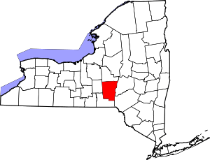 | |
| Towns | ||
| Villages | ||
| CDPs | ||
| Hamlets | ||
| Footnotes | ‡This populated place also has portions in an adjacent county or counties | |