Shire of Myrtleford
| Shire of Myrtleford Victoria | |||||||||||||
|---|---|---|---|---|---|---|---|---|---|---|---|---|---|
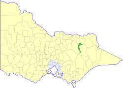 Location in Victoria | |||||||||||||
| Population | 4,370 (1992)[1] | ||||||||||||
| • Density | 5.5/km2 (14.1/sq mi) | ||||||||||||
| Established | 1960 | ||||||||||||
| Area | 800 km2 (308.9 sq mi) | ||||||||||||
| Council seat | Myrtleford | ||||||||||||
| County | Bogong, Delatite | ||||||||||||
 | |||||||||||||
The Shire of Myrtleford was a local government area about 280 kilometres (174 mi) northeast of Melbourne, the state capital of Victoria, Australia. The shire covered an area of 800 square kilometres (308.9 sq mi), and existed from 1960 until 1994.
History
Myrtleford was created from parts of the Shire of Bright on 31 May 1960.[2]
On 18 November 1994, the Shire of Myrtleford was abolished, and, along with the Shire of Bright and various surrounding districts, was merged into the newly created Alpine Shire.[3]
Myrtleford was not divided into ridings, and its nine councillors represented the entire district.
Towns and localities
- Barwidgee
- Buffalo River
- Merriang
- Myrtleford
- Ovens
Population
| Year | Population |
|---|---|
| 1954 | |
| 1958 | * |
| 1961 | 3,770 |
| 1966 | 979 |
| 1971 | 4,434 |
| 1976 | 4,147 |
| 1981 | 4,170 |
| 1986 | 4,285 |
| 1991 | 4,314 |
* Estimate in the 1958 Victorian Year Book.
References
- ↑ Australian Bureau of Statistics, Victoria Office (1994). Victorian Year Book. pp. 49–52. ISSN 0067-1223.
- ↑ Victorian Municipal Directory. Brunswick: Arnall & Jackson. 1992. pp. 776–777. Accessed at State Library of Victoria, La Trobe Reading Room.
- ↑ Australian Bureau of Statistics (1 August 1995). Victorian local government amalgamations 1994-1995: Changes to the Australian Standard Geographical Classification (PDF). Commonwealth of Australia. p. 4. ISBN 0-642-23117-6. Retrieved 2008-01-05.
Coordinates: 36°33′S 146°43′E / 36.550°S 146.717°E
This article is issued from Wikipedia - version of the 4/18/2016. The text is available under the Creative Commons Attribution/Share Alike but additional terms may apply for the media files.