Shire of Mansfield (former)
| Shire of Mansfield Victoria | |||||||||||||
|---|---|---|---|---|---|---|---|---|---|---|---|---|---|
 Location in Victoria | |||||||||||||
| Population | 6,100 (1992)[1] | ||||||||||||
| • Density | 1.556/km2 (4.03/sq mi) | ||||||||||||
| Established | 1865 | ||||||||||||
| Area | 3,919.10 km2 (1,513.2 sq mi) | ||||||||||||
| Council seat | Mansfield | ||||||||||||
| County | Anglesey, Delatite, Tanjil, Wonnangatta | ||||||||||||
| |||||||||||||
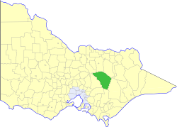
The Shire of Mansfield was a local government area about 185 kilometres (115 mi) northeast of Melbourne, the state capital of Victoria, Australia. The shire covered an area of 3,919.10 square kilometres (1,513.2 sq mi), and existed from 1865 until 1994.
History
Mansfield was incorporated as a road district on 6 January 1865, and became a shire on 31 December 1866. On 30 May 1919, it annexed part of the Shire of Howqua as the Howqua Riding.[2]
On 18 November 1994, the Shire was abolished, and merged with the City and Shire of Benalla and the Warrenbayne district of Shire of Violet Town into the Shire of Delatite.[3] In 2002 the Delatite Shire was abolished, and a new Shire of Mansfield was created with largely the same territory. The remainder of Delatite Shire became the Rural City of Benalla.
Wards
Mansfield was divided into four ridings in 1990, each of which elected three councillors:
- Central Riding
- Alpine Riding
- Delatite Riding
- Midland Riding
Towns and localities
- Mansfield
- Ancona
- Bonnie Doon
- Gaffneys Creek
- Goughs Bay
- Jamieson
- Kevington
- Maindample
- Matlock
- Merrijig
- Merton
- Mount Buller
- Tolmie
- Woodfield
- Woods Point
Population
| Historical population | ||||||||||||||||||||||||||||||||||
|---|---|---|---|---|---|---|---|---|---|---|---|---|---|---|---|---|---|---|---|---|---|---|---|---|---|---|---|---|---|---|---|---|---|---|
|
| |||||||||||||||||||||||||||||||||
| * Estimate in the 1958 Victorian Year Book. | ||||||||||||||||||||||||||||||||||
References
- ↑ Australian Bureau of Statistics, Victoria Office (1994). Victorian Year Book. p. 52. ISSN 0067-1223.
- ↑ Victorian Municipal Directory. Brunswick: Arnall & Jackson. 1992. pp. 753–754. Accessed at State Library of Victoria, La Trobe Reading Room.
- ↑ Australian Bureau of Statistics (1 August 1995). Victorian local government amalgamations 1994-1995: Changes to the Australian Standard Geographical Classification (PDF). Commonwealth of Australia. p. 5. ISBN 0-642-23117-6. Retrieved 2008-01-05.