Shire of Buloke
| Shire of Buloke Victoria | |||||||||||||
|---|---|---|---|---|---|---|---|---|---|---|---|---|---|
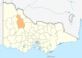 Location in Victoria | |||||||||||||
| Population | 5,952 (2015 est)[1] | ||||||||||||
| • Density | 0.74363/km2 (1.92599/sq mi) | ||||||||||||
| Established | 1995 | ||||||||||||
| Gazetted | 20 January 1995[2] | ||||||||||||
| Area | 8,004 km2 (3,090.4 sq mi) | ||||||||||||
| Mayor | Cr Reid Mather | ||||||||||||
| Council seat | Wycheproof | ||||||||||||
| Region | Northern Victoria | ||||||||||||
| State electorate(s) | Mildura | ||||||||||||
| Federal Division(s) | Mallee | ||||||||||||
|
| |||||||||||||
| Website | Shire of Buloke | ||||||||||||
| |||||||||||||
The Shire of Buloke is a local government area in Victoria, Australia, located in the western part of the state. It covers an area of 8,004 square kilometres (3,090 sq mi) and, at the 2011 Census, had a population of 6,384.[3] It includes the towns of Birchip, Charlton, Donald, Sea Lake and Wycheproof. It was formed in 1995 from the amalgamation of the Shire of Wycheproof, Shire of Birchip, Shire of Charlton, Shire of Donald, and parts of the Shire of Kara Kara.[2]
The Shire is governed and administered by the Buloke Shire Council; its seat of local government and administrative centre is located at the council headquarters in Wycheproof, it also has service centres located in Birchip, Charlton, Donald and Sea Lake. The Shire is named after a major geographical feature in the region, Lake Buloke, which is located in the south of the LGA; the name also comes from the "buloke" or "bulloak" tree Allocasuarina luehmannii, which is common in the region.
Council
Current composition
The council is composed of three wards and seven councillors, with three councillors elected to represent the Mount Jeffcott Ward and two councillors per remaining ward elected to represent each of the other wards.[4]
| Ward | Councillor | Notes | |
|---|---|---|---|
| Lower Avoca | Stuart McLean | ||
| David Pollard | |||
| Mallee | Reid Mather | Mayor (2013–14) | |
| Ellen White | |||
| Mount Jeffcott | Graeme Milne | ||
| Gail Sharp | |||
| Leo Tellefson | |||
Administration and governance
The council meets in the council chambers at the council headquarters in the Wycheproof Municipal Offices, which is also the location of the council's administrative activities. It also provides customer services at its administrative centre in Wycheproof.
See also
References
- ↑ "3218.0 – Regional Population Growth, Australia, 2014–15". Australian Bureau of Statistics. Retrieved 29 September 2016.
- 1 2 Victoria Government Gazette – Online Archive (1837–1997). "S4 of 1995". State Library of Victoria. State Government of Victoria (published 20 January 1995). p. 3. Retrieved 10 January 2014.
|article=ignored (help) - ↑ Census QuickStats (2011). "Buloke (S) – LGA21270". Australian Bureau of Statistics. Government of Australia. Retrieved 10 January 2014.
- ↑ Local Government in Victoria. "Buloke Shire Council". Department of Transport, Planning and Local Infrastructure. State Government of Victoria. Retrieved 10 January 2014.
External links
- Buloke Shire Council official website
- Metlink local public transport map
- Link to Land Victoria interactive maps
Coordinates: 36°00′00″S 142°59′16″E / 36.00000°S 142.98778°E
