Shibata, Miyagi
| Shibata 柴田町 | |||
|---|---|---|---|
| Town | |||
|
Shibata Town Office | |||
| |||
 Location of Shibata in Miyagi Prefecture | |||
 Shibata
| |||
| Coordinates: 38°03′23″N 140°45′57″E / 38.05639°N 140.76583°ECoordinates: 38°03′23″N 140°45′57″E / 38.05639°N 140.76583°E | |||
| Country | Japan | ||
| Region | Tōhoku | ||
| Prefecture | Miyagi | ||
| District | Shibata | ||
| Area | |||
| • Total | 54.03 km2 (20.86 sq mi) | ||
| Population (September 2015) | |||
| • Total | 39,072 | ||
| • Density | 723/km2 (1,870/sq mi) | ||
| Time zone | Japan Standard Time (UTC+9) | ||
| - Tree | Momi Fir | ||
| - Flower | Sakura | ||
| - Bird | Pheasant | ||
| Phone number | 0224-55-2111 | ||
| Address | 2-3-45 Funaoka-chuo, Shibata-machi, Shibata-gun, Miyagi-ken 989-1692 | ||
| Website | Official website | ||


Shibata (柴田町 Shibata-machi) is a town located in Shibata District, Miyagi Prefecture, Japan. As of September 2015, the town had an estimated population of 39,072 and a population density of 723 persons per km². The total area was 54.03 square kilometres (20.86 sq mi).
Geography
Shibata is located in south-central Miyagi Prefecture. The Shiroishi River runs through the town.
Neighboring municipalities
History
The area of present-day Shibata was part of ancient Mutsu Province.The villages of Funaoka and Tsukinoki were established on April 1, 1889 with the establishment of the municipalities system. Tsukioki was promoted to town status on April 1, 1904 and Funaoki on November 3, 1941. The two towns merged to form Shibata on April 1, 1956
Economy
The economy of Shibata is largely based on agriculture.
Education
- Sendai University
- Shibata has six elementary schools, three middle schools, one high school and one special education school.
Transportation
Railway
Highway
Local attractions
- Site of Funaoka Castle
Sister city relations
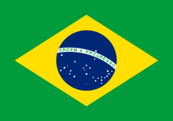 Brazil – Assis Chateaubriand (Paraná), Brazil[1] since April 13, 1981
 China – Danyang, Jiangsu, China,[1] since February 23, 1994
  Japan - Kitakami, Iwate, Japan, since January 25, 1980
- Japan - Date, Hokkaido, Japan, since May 30, 1988 (friendship city)
References
- 1 2 "International Exchange". List of Affiliation Partners within Prefectures. Council of Local Authorities for International Relations (CLAIR). Retrieved 21 November 2015.
External links
![]() Media related to Shibata, Miyagi at Wikimedia Commons
Media related to Shibata, Miyagi at Wikimedia Commons
- Official website (Japanese)
| Wards of Sendai | |
|---|---|
| Cities | |
| Igu District | |
| Kami District | |
| Katta District | |
| Kurokawa District | |
| Miyagi District | |
| Motoyoshi District | |
| Oshika District | |
| Shibata District | |
| Tōda District | |
| Watari District | |
