Taiwa, Miyagi
| Taiwa 大和町 | |||
|---|---|---|---|
| Town | |||
|
Taiwa Town Hall | |||
| |||
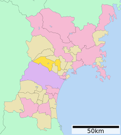 Location of Taiwa in Miyagi Prefecture | |||
 Taiwa
| |||
| Coordinates: 38°26′47″N 141°53′11″E / 38.44639°N 141.88639°ECoordinates: 38°26′47″N 141°53′11″E / 38.44639°N 141.88639°E | |||
| Country | Japan | ||
| Region | Tōhoku | ||
| Prefecture | Miyagi | ||
| District | Kurokawa | ||
| Area | |||
| • Total | 225.59 km2 (87.10 sq mi) | ||
| Population (May 2014) | |||
| • Total | 27,209 | ||
| • Density | 121/km2 (310/sq mi) | ||
| Time zone | Japan Standard Time (UTC+9) | ||
| - Tree | Maple | ||
| - Flower | Azalea | ||
| Phone number | 022-345-1111 | ||
| Address | 1-1 Yoshioka Nishi-Enoki, Taiwa-chō, Kurokawa-gun, Miyagi-ken 981-3680 | ||
| Website | Official website | ||


Taiwa (大和町 Taiwa-chō) is a town located in Kurokawa District, Miyagi Prefecture, Japan. As of May 2014, the town had an estimated population of 27,209 and a population density of 121 persons per km². The total area was 225.59 km².
Geography
Taiwa is located in central Miyagi Prefecture.
Neighboring municipalities
- Miyagi Prefecture
History
The area of present-day Taiwa was part of ancient Mutsu Province, and has been settled since at least the Jomon period by the Emishi people. During later portion of the Heian period, the area was ruled by the Northern Fujiwara. During the Sengoku period, the area was contested by various samurai clans before the area came under the control of the Date clan of Sendai Domain during the Edo period, under the Tokugawa shogunate.
The modern town of Taiwa was created on April 20, 1955, as a result of a merger between the town of Yoshioka, and the villages of Miyatoko, Yoshida, Tsurusu, and Ochiai.
Economy
Taiwa contains a number of industrial parks, and has a strong manufacturing base.
Education
Transportation
Railway
Taiwa is not currently served by any railway lines.
Highway
External links
![]() Media related to Taiwa, Miyagi at Wikimedia Commons
Media related to Taiwa, Miyagi at Wikimedia Commons
| Wards of Sendai | |
|---|---|
| Cities | |
| Igu District | |
| Kami District | |
| Katta District | |
| Kurokawa District | |
| Miyagi District | |
| Motoyoshi District | |
| Oshika District | |
| Shibata District | |
| Tōda District | |
| Watari District | |