Saxonburg, Pennsylvania
| Saxonburg, Pennsylvania | |
|---|---|
| Borough | |
|
Saxonburg Memorial Church | |
 Saxonburg | |
| Coordinates: 40°45′15″N 79°48′56″W / 40.75417°N 79.81556°WCoordinates: 40°45′15″N 79°48′56″W / 40.75417°N 79.81556°W | |
| Country | United States |
| State | Pennsylvania |
| County | Butler |
| Settled | 1832 |
| Incorporated | 1846 |
| Government | |
| • Type | Borough Council |
| Area | |
| • Total | 0.9 sq mi (2.3 km2) |
| Population (2010) | |
| • Total | 1,525 |
| • Density | 1,683/sq mi (649.9/km2) |
| Time zone | Eastern (EST) (UTC-5) |
| • Summer (DST) | EDT (UTC-4) |
| Zip code | 16056 |
| Website |
www |

Saxonburg is a borough in Butler County and part of the Pittsburgh metropolitan area, in the United States. It was founded in 1832 by John A. Roebling. The city was first named "Germania" and "Sachsenburg" before arriving at its present name. The population was 1,525 as of the 2010 census.[1]
History
Founded in 1832 by John A. Roebling, who is known for the design of the Brooklyn Bridge in New York and for innovation in producing wire rope, the community was initially called "Germania", which was soon changed to "Sachsenburg" and eventually anglicized to Saxonburg. Roebling had set out with his brother Karl and a group of pioneers from Germany in 1831 to flee the general unrest and oppression in Europe. The two men, along with a handful of the people who accompanied them on the trans-Atlantic journey secured 1,582 acres (6.40 km2) of land on October 28, 1831, from Mrs. Sarah Collins.[2]
In November 1920, KDKA radio, regarded as the world's first commercial radio station, began broadcasting from East Pittsburgh, but later located its transmitter in neighboring Clinton Township. The Roebling Museum in the borough maintains several artifacts.
Nuclear lab
In 1946, Fred Seitz, then head of the physics department at Carnegie Tech, brought Ed Creutz, Jack Fox, Roger Sutton and Bert Corben to Carnegie Tech to establish an important nuclear physics research program. By June 6, 1946, a leading-edge 450 MeV proton synchrocyclotron was built at the Nuclear Research Center near Saxonburg, just south of the Saxonburg limits. The research program there flourished up to the mid-1970s when the then-obsolete accelerator was dismantled. The site was converted to industrial purposes, and is now occupied by II-VI Corporation. As of 1997, only one or two of the original Nuclear Research Center buildings remained, including the original laboratory building, more or less intact.

Murder of Police Chief Adams
On the afternoon of December 4, 1980, Donald Eugene Webb allegedly killed police officer Gregory Adams in Saxonburg. Webb was on the FBI Most Wanted List longer than any other fugitive since its creation in 1950. He was removed from the list on March 31, 2007, without ever being found.
First woman mayor
In November 2009, Jody Pflueger, Saxonburg's first Democratic and first female mayor, was elected as a write-in candidate, defeating the 12-year incumbent. While in office Mayor Pflueger had the position of Police Chief reinstated. Pflueger was succeeded by the late Pamela Bauman in 2013. William Gillespie held the office to complete her term until 2017.[3]
Geography
Saxonburg is located in southeastern Butler County at 40°45′15″N 79°48′56″W / 40.75417°N 79.81556°W (40.754040, -79.815619).[4] Butler, the county seat, is 9 miles (14 km) to the northwest, and Freeport, on the Allegheny River, is 10 miles (16 km) to the southeast.
According to the United States Census Bureau, Saxonburg has a total area of 0.89 square miles (2.3 km2), all of it land.[1]
Demographics
| Historical population | |||
|---|---|---|---|
| Census | Pop. | %± | |
| 1870 | 295 | — | |
| 1880 | 319 | 8.1% | |
| 1890 | 258 | −19.1% | |
| 1900 | 307 | 19.0% | |
| 1910 | 345 | 12.4% | |
| 1920 | 319 | −7.5% | |
| 1930 | 452 | 41.7% | |
| 1940 | 524 | 15.9% | |
| 1950 | 602 | 14.9% | |
| 1960 | 876 | 45.5% | |
| 1970 | 1,191 | 36.0% | |
| 1980 | 1,336 | 12.2% | |
| 1990 | 1,345 | 0.7% | |
| 2000 | 1,629 | 21.1% | |
| 2010 | 1,525 | −6.4% | |
| Est. 2015 | 1,491 | [5] | −2.2% |
| Sources:[6][7][8] | |||
As of the census[7] of 2000, there were 1,629 people, 655 households, and 391 families residing in the borough. The population density was 1,852.8 people per square mile (714.7/km²). There were 713 housing units at an average density of 811.0 per square mile (312.8/km²). The racial makeup of the borough was 99.32% White, 0.25% African American, 0.31% from other races, and 0.12% from two or more races. Hispanic or Latino of any race were 1.53% of the population.
There were 655 households, out of which 22.7% had children under the age of 18 living with them, 47.8% were married couples living together, 10.4% had a female householder with no husband present, and 40.2% were non-families. 35.3% of all households were made up of individuals, and 17.3% had someone living alone who was 65 years of age or older. The average household size was 2.13 and the average family size was 2.75.
In the borough the population was spread out, with 16.8% under the age of 18, 5.9% from 18 to 24, 21.9% from 25 to 44, 21.0% from 45 to 64, and 34.4% who were 65 years of age or older. The median age was 50 years. For every 100 females there were 72.4 males. For every 100 females age 18 and over, there were 69.0 males.
The median income for a household in the borough was $32,159, and the median income for a family was $41,875. Males had a median income of $37,500 versus $24,135 for females. The per capita income for the borough was $21,931. About 7.8% of families and 9.6% of the population were below the poverty line, including 13.6% of those under age 18 and 8.1% of those age 65 or over.
References
- 1 2 "Geographic Identifiers: 2010 Demographic Profile Data (G001): Saxonburg borough, Pennsylvania". U.S. Census Bureau, American Factfinder. Retrieved March 27, 2014.
- ↑ (Historic Saxonburg and Its Neighbors, Ralph Goldinger, ISBN 1-55856-043-2)
- ↑ https://www.saxonburgpa.com/mayor.html. Missing or empty
|title=(help); External link in|website=(help); - ↑ "US Gazetteer files: 2010, 2000, and 1990". United States Census Bureau. 2011-02-12. Retrieved 2011-04-23.
- ↑ "Annual Estimates of the Resident Population for Incorporated Places: April 1, 2010 to July 1, 2015". Retrieved July 2, 2016.
- ↑ "Census of Population and Housing". U.S. Census Bureau. Retrieved 11 December 2013.
- 1 2 "American FactFinder". United States Census Bureau. Retrieved 2008-01-31.
- ↑ "Incorporated Places and Minor Civil Divisions Datasets: Subcounty Resident Population Estimates: April 1, 2010 to July 1, 2012". Population Estimates. U.S. Census Bureau. Retrieved 11 December 2013.
External links
| Wikimedia Commons has media related to Saxonburg, Pennsylvania. |
- Borough of Saxonburg official website
- Saxonburg Area Business Association
- John Roebling Historic Saxonburg Society
- Everything2 writeup
- CMU nuclear research article on Saxonburg
- Map of historic Saxonburg families
| Counties | 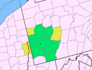 Map of the Pittsburgh Tri-State with green counties in the metropolitan area and yellow counties in the combined area. | |
|---|---|---|
| Major cities | ||
| Cities and towns 15k-50k (in 2010) | ||
| Airports | ||
| Topics | ||
| ||
Municipalities and communities of Butler County, Pennsylvania, United States | ||
|---|---|---|
| City |  | |
| Boroughs | ||
| Townships | ||
| CDPs | ||
| Unincorporated communities | ||
| Footnotes | ‡This populated place also has portions in an adjacent county or counties | |