Saranac, Michigan
| Saranac, Michigan | |
|---|---|
| Village | |
 Location of Saranac, Michigan | |
| Coordinates: 42°55′47″N 85°12′43″W / 42.92972°N 85.21194°W | |
| Country | United States |
| State | Michigan |
| County | Ionia |
| Area[1] | |
| • Total | 1.20 sq mi (3.11 km2) |
| • Land | 1.15 sq mi (2.98 km2) |
| • Water | 0.05 sq mi (0.13 km2) |
| Elevation | 646 ft (197 m) |
| Population (2010)[2] | |
| • Total | 1,325 |
| • Estimate (2012[3]) | 1,327 |
| • Density | 1,152.2/sq mi (444.9/km2) |
| Time zone | Eastern (EST) (UTC-5) |
| • Summer (DST) | EDT (UTC-4) |
| ZIP code | 48881 |
| Area code(s) | 616 |
| FIPS code | 26-71660[4] |
| GNIS feature ID | 0637257[5] |
| Website | http://www.saranac.k12.mi.us/ |
Saranac is a village in Ionia County in the U.S. state of Michigan. The population was 1,325 at the 2010 census.
Saranac is the birthplace of world-renowned geologist J Harlen Bretz.
Geography
According to the United States Census Bureau, the village has a total area of 1.20 square miles (3.11 km2), of which 1.15 square miles (2.98 km2) is land and 0.05 square miles (0.13 km2) is water.[1] The town is located on the Grand River.[6] The river is 262 miles long, which makes it the longest waterway in the state of Michigan.[7]
Demographics
| Historical population | |||
|---|---|---|---|
| Census | Pop. | %± | |
| 1870 | 724 | — | |
| 1880 | 877 | 21.1% | |
| 1890 | 790 | −9.9% | |
| 1900 | 768 | −2.8% | |
| 1910 | 845 | 10.0% | |
| 1920 | 750 | −11.2% | |
| 1930 | 729 | −2.8% | |
| 1940 | 849 | 16.5% | |
| 1950 | 885 | 4.2% | |
| 1960 | 1,081 | 22.1% | |
| 1970 | 1,223 | 13.1% | |
| 1980 | 1,421 | 16.2% | |
| 1990 | 1,461 | 2.8% | |
| 2000 | 1,326 | −9.2% | |
| 2010 | 1,325 | −0.1% | |
| Est. 2015 | 1,333 | [8] | 0.6% |
2010 census
As of the census[2] of 2010, there were 1,325 people, 573 households, and 339 families residing in the village. The population density was 1,152.2 inhabitants per square mile (444.9/km2). There were 616 housing units at an average density of 535.7 per square mile (206.8/km2). The racial makeup of the village was 97.4% White, 0.2% African American, 0.2% Native American, 0.4% Asian, 0.8% from other races, and 1.1% from two or more races. Hispanic or Latino of any race were 2.7% of the population.
There were 573 households of which 33.3% had children under the age of 18 living with them, 42.2% were married couples living together, 12.6% had a female householder with no husband present, 4.4% had a male householder with no wife present, and 40.8% were non-families. 36.5% of all households were made up of individuals and 15.9% had someone living alone who was 65 years of age or older. The average household size was 2.31 and the average family size was 3.01.
The median age in the village was 37.2 years. 28% of residents were under the age of 18; 6.8% were between the ages of 18 and 24; 24.2% were from 25 to 44; 25.8% were from 45 to 64; and 15.1% were 65 years of age or older. The gender makeup of the village was 47.6% male and 52.4% female.
2000 census
As of the census[4] of 2000, there were 1,326 people, 568 households, and 348 families residing in the village. The population density was 1,142.1 per square mile (441.4/km²). There were 589 housing units at an average density of 507.3 per square mile (196.0/km²). The racial makeup of the village was 98.11% White, 0.08% African American, 0.08% Native American, 0.30% Asian, 0.08% Pacific Islander, 0.68% from other races, and 0.68% from two or more races. Hispanic or Latino of any race were 1.36% of the population.
There were 568 households out of which 32.0% had children under the age of 18 living with them, 46.1% were married couples living together, 12.1% had a female householder with no husband present, and 38.6% were non-families. 35.9% of all households were made up of individuals and 20.2% had someone living alone who was 65 years of age or older. The average household size was 2.33 and the average family size was 3.03.
In the village the population was spread out with 27.0% under the age of 18, 8.2% from 18 to 24, 26.3% from 25 to 44, 20.5% from 45 to 64, and 17.9% who were 65 years of age or older. The median age was 37 years. For every 100 females there were 82.4 males. For every 100 females age 18 and over, there were 73.8 males.
The median income for a household in the village was $31,350, and the median income for a family was $41,250. Males had a median income of $35,221 versus $24,750 for females. The per capita income for the village was $15,867. About 5.9% of families and 11.3% of the population were below the poverty line, including 12.5% of those under age 18 and 17.4% of those age 65 or over.
References
- 1 2 "US Gazetteer files 2010". United States Census Bureau. Retrieved 2012-11-25.
- 1 2 "American FactFinder". United States Census Bureau. Retrieved 2012-11-25.
- ↑ "Population Estimates". United States Census Bureau. Retrieved 2013-06-03.
- 1 2 "American FactFinder". United States Census Bureau. Retrieved 2008-01-31.
- ↑ U.S. Geological Survey Geographic Names Information System: Saranac, Michigan
- ↑ https://maps.google.com/
- ↑ http://www.nationalrivers.org/states/mi-view.htm
- ↑ "Annual Estimates of the Resident Population for Incorporated Places: April 1, 2010 to July 1, 2015". Retrieved July 2, 2016.
- ↑ "Census of Population and Housing". Census.gov. Retrieved June 4, 2015.
External links
Municipalities and communities of Ionia County, Michigan, United States | ||
|---|---|---|
| Cities | 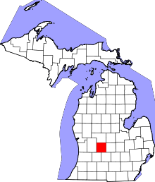 | |
| Villages | ||
| Townships | ||
| Footnotes | ‡This populated place also has portions in an adjacent county or counties | |
Coordinates: 42°55′46″N 85°12′47″W / 42.92944°N 85.21306°W