Hubbardston, Michigan
| Hubbardston, Michigan | |
|---|---|
| Village | |
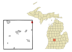 Location of Hubbardston, Michigan | |
| Coordinates: 43°5′36″N 84°50′25″W / 43.09333°N 84.84028°W | |
| Country | United States |
| State | Michigan |
| Counties | Ionia, Clinton |
| Area[1] | |
| • Total | 1.62 sq mi (4.20 km2) |
| • Land | 1.54 sq mi (3.99 km2) |
| • Water | 0.08 sq mi (0.21 km2) |
| Elevation | 682 ft (208 m) |
| Population (2010)[2] | |
| • Total | 395 |
| • Estimate (2012[3]) | 397 |
| • Density | 256.5/sq mi (99.0/km2) |
| Time zone | Eastern (EST) (UTC-5) |
| • Summer (DST) | EDT (UTC-4) |
| ZIP code | 48845 |
| Area code(s) | 989 |
| FIPS code | 26-39660[4] |
| GNIS feature ID | 0628745[5] |
Hubbardston is a village located in the U.S. state of Michigan. The village is on the boundary between Ionia County and Clinton County, and is partially in both. The village is mostly within North Plains Township in Ionia County and partially within Lebanon Township in Clinton County. The population was 395 at the 2010 census.
Geography
According to the United States Census Bureau, the village has a total area of 1.62 square miles (4.20 km2), of which 1.54 square miles (3.99 km2) is land and 0.08 square miles (0.21 km2) is water.[1]
Demographics
| Historical population | |||
|---|---|---|---|
| Census | Pop. | %± | |
| 1900 | 450 | — | |
| 1910 | 450 | 0.0% | |
| 1920 | 368 | −18.2% | |
| 1930 | 344 | −6.5% | |
| 1940 | 391 | 13.7% | |
| 1950 | 335 | −14.3% | |
| 1960 | 381 | 13.7% | |
| 1970 | 403 | 5.8% | |
| 1980 | 421 | 4.5% | |
| 1990 | 404 | −4.0% | |
| 2000 | 394 | −2.5% | |
| 2010 | 395 | 0.3% | |
| Est. 2015 | 400 | [6] | 1.3% |
2010 census
As of the census[2] of 2010, there were 395 people, 136 households, and 107 families residing in the village. The population density was 256.5 inhabitants per square mile (99.0/km2). There were 148 housing units at an average density of 96.1 per square mile (37.1/km2). The racial makeup of the village was 97.2% White, 0.3% African American, 0.3% Asian, 1.5% from other races, and 0.8% from two or more races. Hispanic or Latino of any race were 4.3% of the population.
There were 136 households of which 33.1% had children under the age of 18 living with them, 55.9% were married couples living together, 14.7% had a female householder with no husband present, 8.1% had a male householder with no wife present, and 21.3% were non-families. 19.9% of all households were made up of individuals and 5.9% had someone living alone who was 65 years of age or older. The average household size was 2.69 and the average family size was 2.87.
The median age in the village was 41.8 years. 23% of residents were under the age of 18; 8.9% were between the ages of 18 and 24; 24.1% were from 25 to 44; 29.1% were from 45 to 64; and 14.9% were 65 years of age or older. The gender makeup of the village was 50.9% male and 49.1% female.
2000 census
As of the census[4] of 2000, there were 394 people, 130 households, and 99 families residing in the village. The population density was 250.2 per square mile (96.9/km²). There were 139 housing units at an average density of 88.3 per square mile (34.2/km²). The racial makeup of the village was 98.22% White, 1.02% Native American, and 0.76% from two or more races. Hispanic or Latino of any race were 0.76% of the population.
There were 130 households out of which 36.9% had children under the age of 18 living with them, 58.5% were married couples living together, 10.8% had a female householder with no husband present, and 23.8% were non-families. 13.8% of all households were made up of individuals and 4.6% had someone living alone who was 65 years of age or older. The average household size was 2.84 and the average family size was 3.15.
In the village the population was spread out with 26.6% under the age of 18, 7.4% from 18 to 24, 28.4% from 25 to 44, 24.6% from 45 to 64, and 12.9% who were 65 years of age or older. The median age was 36 years. For every 100 females there were 96.0 males. For every 100 females age 18 and over, there were 97.9 males.
The median income for a household in the village was $36,458, and the median income for a family was $38,750. Males had a median income of $34,688 versus $21,500 for females. The per capita income for the village was $12,690. About 8.8% of families and 11.5% of the population were below the poverty line, including 13.2% of those under age 18 and 5.8% of those age 65 or over.
References
- 1 2 "US Gazetteer files 2010". United States Census Bureau. Retrieved 2012-11-25.
- 1 2 "American FactFinder". United States Census Bureau. Retrieved 2012-11-25.
- ↑ "Population Estimates". United States Census Bureau. Retrieved 2013-06-03.
- 1 2 "American FactFinder". United States Census Bureau. Retrieved 2008-01-31.
- ↑ "US Board on Geographic Names". United States Geological Survey. 2007-10-25. Retrieved 2008-01-31.
- ↑ "Annual Estimates of the Resident Population for Incorporated Places: April 1, 2010 to July 1, 2015". Retrieved July 2, 2016.
- ↑ "Census of Population and Housing". Census.gov. Retrieved June 4, 2015.
External links
Municipalities and communities of Clinton County, Michigan, United States | ||
|---|---|---|
| Cities | 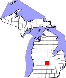 | |
| Villages | ||
| Charter townships | ||
| General law townships | ||
| CDPs | ||
| Footnotes | ‡This populated place also has portions in an adjacent county or counties | |
Municipalities and communities of Ionia County, Michigan, United States | ||
|---|---|---|
| Cities |  | |
| Villages | ||
| Townships | ||
| Footnotes | ‡This populated place also has portions in an adjacent county or counties | |
Coordinates: 43°05′32″N 84°50′32″W / 43.09222°N 84.84222°W