Sainte-Marguerite, Chaudière-Appalaches, Quebec
This article is about the town in Chaudière-Appalaches. For the former Sainte-Marguerite in Gaspésie, see Sainte-Marguerite-Marie, Quebec.
| Sainte-Marguerite | |
|---|---|
| Parish municipality | |
_Quebec_location_diagram.png) Location within La Nouvelle-Beauce RCM. | |
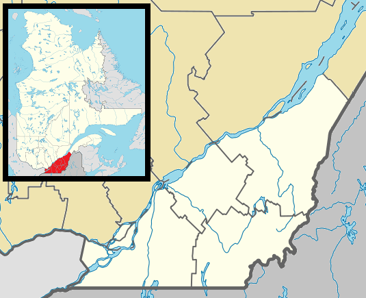 Sainte-Marguerite Location in southern Quebec. | |
| Coordinates: 46°31′N 70°56′W / 46.517°N 70.933°WCoordinates: 46°31′N 70°56′W / 46.517°N 70.933°W[1] | |
| Country |
|
| Province |
|
| Region | Chaudière-Appalaches |
| RCM | La Nouvelle-Beauce |
| Constituted | July 1, 1855 |
| Government[2] | |
| • Mayor | Adrienne Gagné |
| • Federal riding | Beauce |
| • Prov. riding | Beauce-Nord |
| Area[2][3] | |
| • Total | 83.10 km2 (32.09 sq mi) |
| • Land | 83.30 km2 (32.16 sq mi) |
|
There is an apparent contradiction between two authoritative sources | |
| Population (2011)[3] | |
| • Total | 1,073 |
| • Density | 12.9/km2 (33/sq mi) |
| • Pop 2006-2011 |
|
| • Dwellings | 495 |
| Time zone | EST (UTC−5) |
| • Summer (DST) | EDT (UTC−4) |
| Postal code(s) | G0S 2X0 |
| Area code(s) | 418 and 581 |
| Highways |
|
Sainte-Marguerite is a parish municipality in La Nouvelle-Beauce Regional County Municipality in the Chaudière-Appalaches region of Quebec, Canada. Its population is 1,073 as of the Canada 2011 Census. It is named after Marguerite Marcoux, who gave part of the land she owned in 1830 for the construction of a church.
References
- Commission de toponymie du Québec
- Ministère des Affaires municipales, des Régions et de l'Occupation du territoire
 |
Sainte-Hénédine | Sainte-Claire | | |
| |
||||
| ||||
| | ||||
| Sainte-Marie | Saints-Anges | Frampton |
| Cities & Towns | |
|---|---|
| Municipalities | |
| Parishes | |
| |
This article is issued from Wikipedia - version of the 2/28/2014. The text is available under the Creative Commons Attribution/Share Alike but additional terms may apply for the media files.