Sainte-Catherine-de-Hatley, Quebec
| Sainte-Catherine-de-Hatley (Katevale) | |
|---|---|
| Municipality | |
|
Sainte-Catherine-de-Hatley town hall. | |
 Location within Memphrémagog RCM. | |
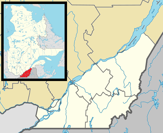 Ste-Catherine-de-Hatley Location in southern Quebec. | |
| Coordinates: 45°15′N 72°03′W / 45.250°N 72.050°WCoordinates: 45°15′N 72°03′W / 45.250°N 72.050°W[1] | |
| Country |
|
| Province |
|
| Region | Estrie |
| RCM | Memphrémagog |
| Constituted | March 28, 1901 |
| Government[2][3] | |
| • Mayor | Jacques Demers |
| • Federal riding | Compton—Stanstead |
| • Prov. riding | Orford |
| Area[2][4] | |
| • Total | 99.20 km2 (38.30 sq mi) |
| • Land | 86.55 km2 (33.42 sq mi) |
| Population (2011)[4] | |
| • Total | 2,464 |
| • Density | 28.5/km2 (74/sq mi) |
| • Pop 2006-2011 |
|
| • Dwellings | 1,312 |
| Time zone | EST (UTC−5) |
| • Summer (DST) | EDT (UTC−4) |
| Postal code(s) | J0B 1W0 |
| Area code(s) | 819 |
| Highways |
|
| Website |
www |

Sainte-Catherine-de-Hatley is a municipality on Quebec Route 108 along Little Lake Magog. It is part of the Memphrémagog Regional County Municipality in the Eastern Townships region of Quebec. It is the home of the "Marais" birdwatching sanctuary, the Eglise Sainte Catherine de Hatley, as well as the Dominique Savio primary School. Sainte-Catherine-de-Hatley is also known (and formerly known) as "Katevale". As the hometown of producer Franklin Raff, pastoral Sainte-Catherine-de-Hatley is frequently depicted on G. Gordon Liddy's syndicated talk radio show as an otherworldly, Franco-Catholic redoubt in a predominantly Anglo-Loyalist region of Quebec.
See also
References
- ↑ Reference number 56087 of the Commission de toponymie du Québec (French)
- 1 2 Ministère des Affaires municipales, des Régions et de l'Occupation du territoire: Sainte-Catherine-de-Hatley
- ↑ Parliament of Canada Federal Riding History: COMPTON--STANSTEAD (Quebec)
- 1 2 2011 Statistics Canada Census Profile: Sainte-Catherine-de-Hatley, Quebec
 |
Rock Forest–Saint-Élie–Deauville (Sherbrooke) Lake Magog |
Hatley (township) / North Hatley | | |
| Magog | |
Lake Massawippi | ||
| ||||
| | ||||
| Stanstead-Est | Lake Massawippi / Hatley / Ayer's Cliff |
| Cities & Towns | |
|---|---|
| Municipalities | |
| Townships | |
| Villages | |
| |
This article is issued from Wikipedia - version of the 2/28/2014. The text is available under the Creative Commons Attribution/Share Alike but additional terms may apply for the media files.