Sainte-Angèle-de-Prémont, Quebec
| Sainte-Angèle-de-Prémont | |
|---|---|
| Municipality | |
 Location within Maskinongé RCM. | |
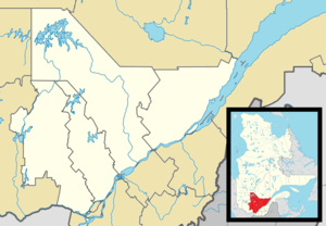 Sainte-Angèle-de-Prémont Location in central Quebec. | |
| Coordinates: 46°22′N 73°03′W / 46.367°N 73.050°WCoordinates: 46°22′N 73°03′W / 46.367°N 73.050°W[1] | |
| Country |
|
| Province |
|
| Region | Mauricie |
| RCM | Maskinongé |
| Constituted | August 28, 1917 |
| Government[2] | |
| • Mayor | Barbara Paillé |
| • Federal riding | Berthier—Maskinongé |
| • Prov. riding | Maskinongé |
| Area[2][3] | |
| • Total | 37.80 km2 (14.59 sq mi) |
| • Land | 37.89 km2 (14.63 sq mi) |
|
There is an apparent contradiction between two authoritative sources | |
| Population (2011)[3] | |
| • Total | 647 |
| • Density | 17.1/km2 (44/sq mi) |
| • Pop 2006-2011 |
|
| • Dwellings | 338 |
| Time zone | EST (UTC−5) |
| • Summer (DST) | EDT (UTC−4) |
| Postal code(s) | J0K 1R0 |
| Area code(s) | 819 |
| Highways |
|
| Website |
www |
Sainte-Angèle-de-Prémont is a municipality in the Mauricie region of the province of Quebec in Canada.
References
 |
Saint-Alexis-des-Monts | Saint-Paulin | | |
| |
||||
| ||||
| | ||||
| Sainte-Ursule | Saint-Léon-le-Grand |
| Cities & towns | |
|---|---|
| Municipalities | |
| Parishes | |
This article is issued from Wikipedia - version of the 4/21/2013. The text is available under the Creative Commons Attribution/Share Alike but additional terms may apply for the media files.